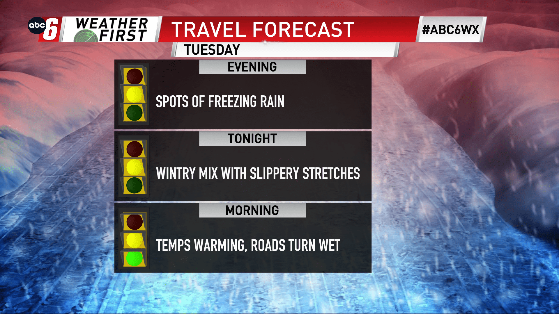
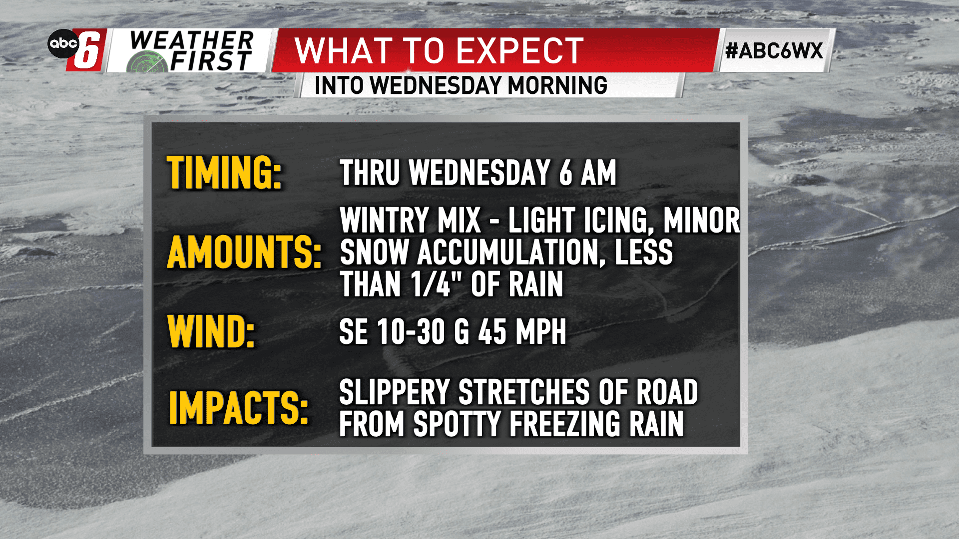
Slippery overnight from rain/wintry mix
We’re lucky the temperatures are just warm enough. We’re mainly above freezing but there will be spots that do take that dip down. Some spotty icing will materialize as a result. Bridges, culverts, untreated side streets will be the most susceptible to see icing first. Use some caution on the roads overnight and you’ll be fine.
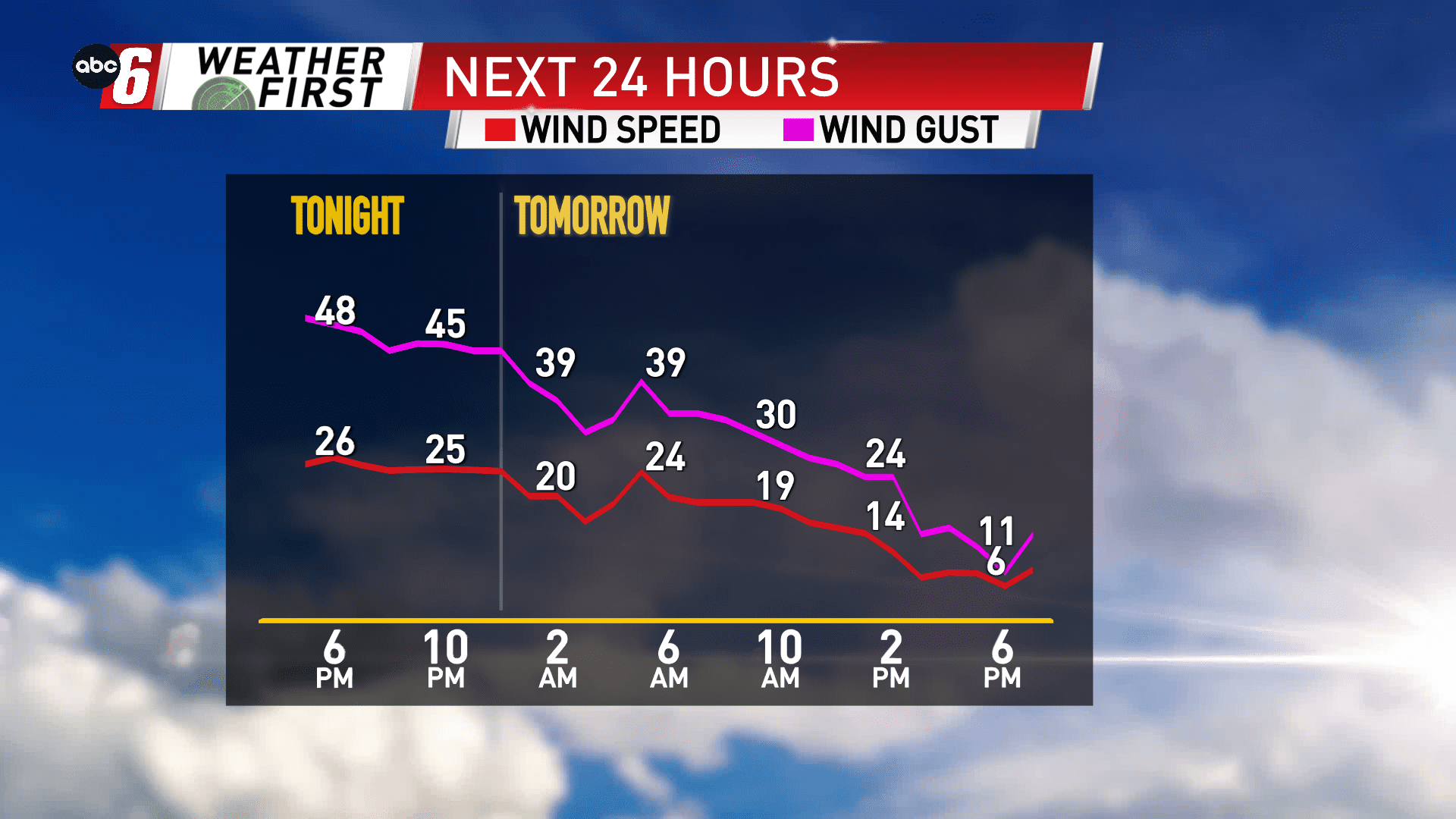
Thankfully our temperatures are just warm enough. With the wind as strong as it is overnight into Wednesday morning, we’d have a major situation on our hands with downed trees and powerlines. Gusts will reach 45 mph overnight from the E/SE.
Primarily rain, we will see a pop of wintry mix at times overnight, especially into early Wednesday morning. Precip will fall overnight before ending closer to sunrise on our NE edge. Accumulations of rain will be around 1/4″ to 1/2″. A minor coating of ice is possible, less than 1/10″ in isolated spots. A few sloppy snowflakes with minor accumulation is possible on our NE edge early Wednesday.