Blizzard conditions leave widespread impacts into holiday weekend
(ABC 6 News) – A major winter storm will continue to bring widespread impacts to the region heading into the Christmas weekend.
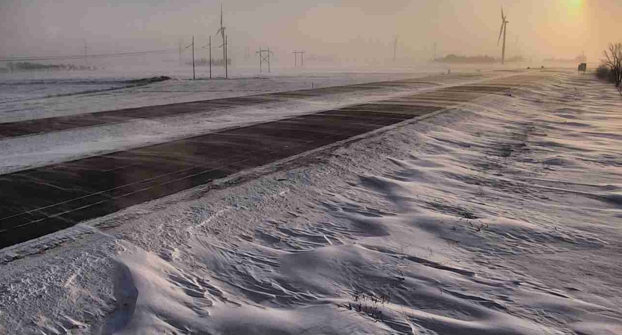
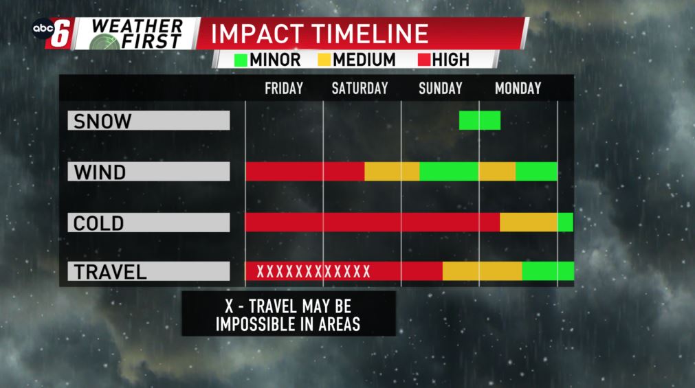
Wind will commonly gust 40-55 mph through 3 AM on Saturday. At these strengths, we’ve seen blizzard conditions take over the area.
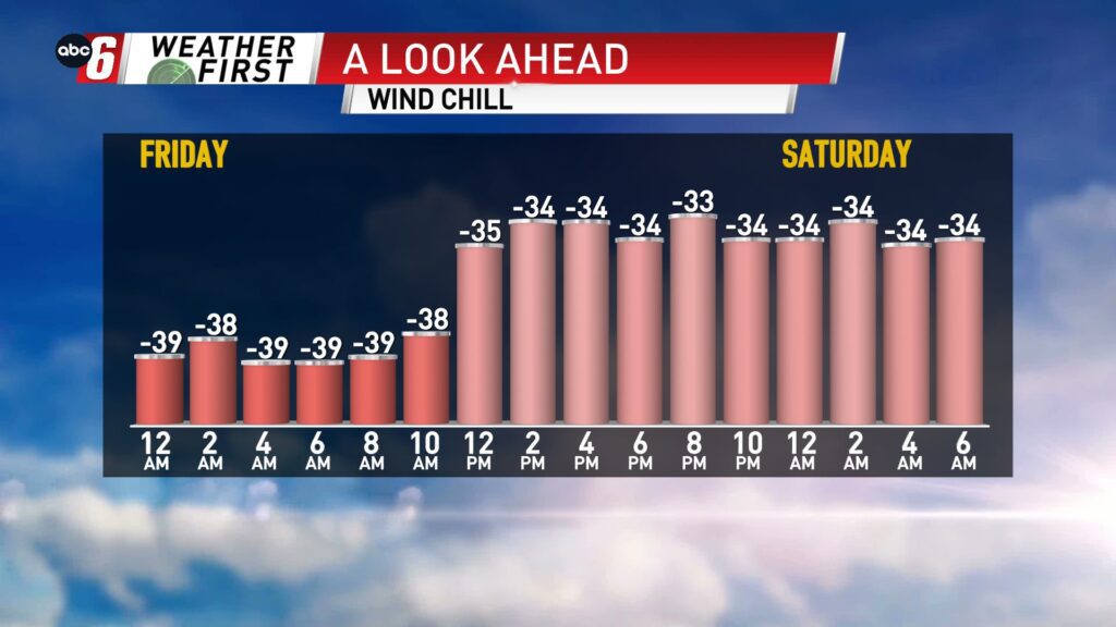
Emergency travel only outside of city limits. The danger being, we still have wind chills down around -35° headed into Saturday morning. To be stranded in the elements not prepared for them is a dangerous proposition.
[anvplayer feed=”ASJWMB2EQZ2SXAAJAA” station=”998128″]
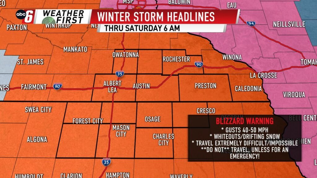
The National Weather Service has **Blizzard Warnings** in effect for the entire ABC 6 News viewing area until early Saturday morning.
Wind will ease through the day on Saturday, but we’ll likely still need some time to get things back to normal.
Breezy winds could still gust as high as 40 mph, especially early on in the day.
Temperatures remain below zero until Christmas Day.
But late in the evening, a pop of snow is expected. Accumulations are expected and some travel slow-downs may be possible.
Thankfully the wind looks manageable with this bump of snow.
For all weather information, and to stay updated with the forecast, CLICK HERE.
To view closings and delays, CLICK HERE.
For the latest road conditions, CLICK HERE.
To view road cameras provided by the Minnesota & Iowa D.O.T., CLICK HERE.
To submit a weather photo, CLICK HERE.