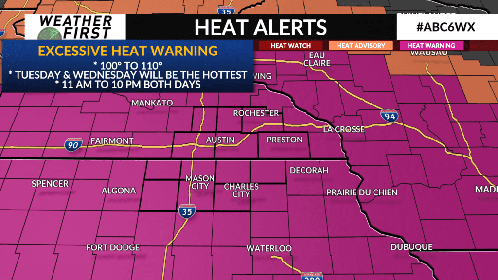
Tuesday: One of The Hottest Days of The Last Decade

We’re still under an ALERT DAY as extreme heat hits a new peak Tuesday. Without any real cloud cover (unlike Monday afternoon and evening) and winds shifting out of the south and southwest, we will be surpassing the heat we experienced Monday. Air temperatures will top off in the mid to upper-90s and the heat index could top off anywhere between 100-110°F.
We won’t get as hot as Kansas City or Omaha due to them having a longer period of clearer skies (and being immersed in the hot air mass) but we will still be feeling the hottest we have felt in about a decade.
If you have to do outdoor chores or work today, you will need sunscreen. Depending on what activities or the length of time you plan to be outdoors, you may need to reapply (maybe even multiple times).