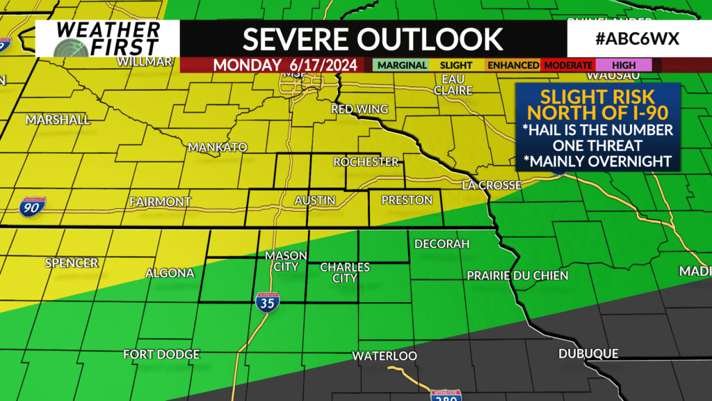
ALERT DAY: Severe potential getting lower, but not out of the woods just yet

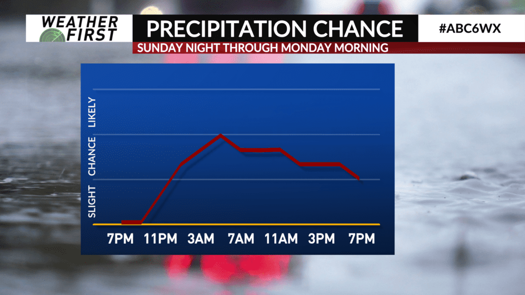
The storms that are moving in from the west do not have the same strength as the storms that passed between 4-7 AM. Although, a strong storm featuring hail or gusty winds does remain possible. The severe thunderstorm watch continues until 10 AM.
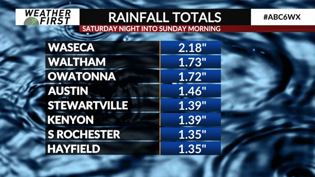
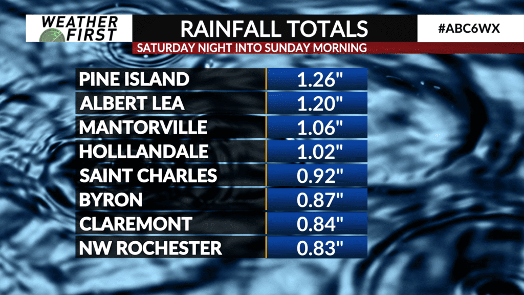
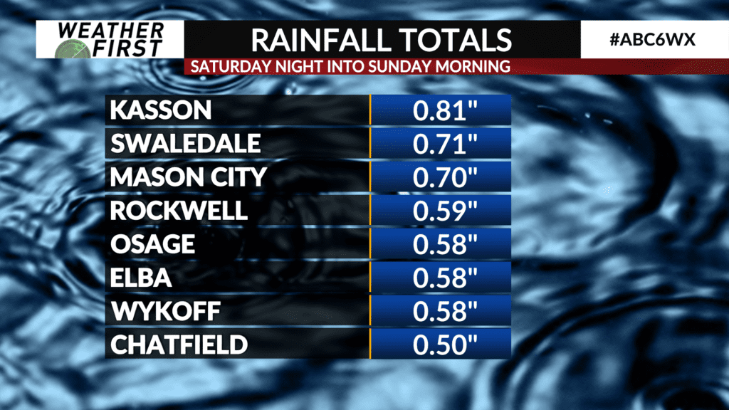
Any storms the rest of the morning still have the potential to drop heavy rain, which could result in flash flooding depending on where the rainfall occurs. The highest rainfall totals have been out by I-35 and north of I-90 (which also had the highest rainfall totals Saturday night into Sunday).
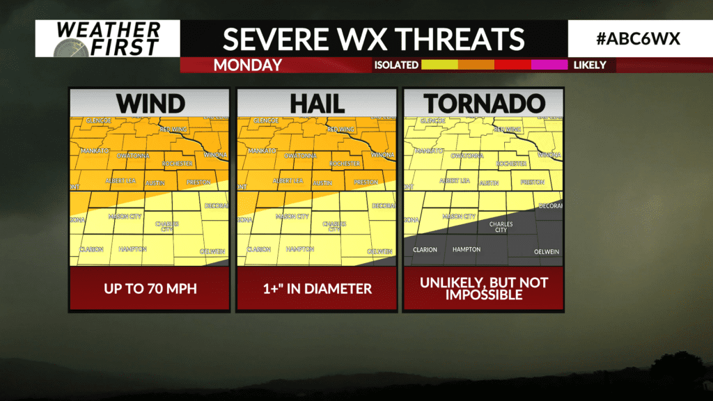
There is some variability as to how much storms we will have in our area from about 1-5 PM Monday afternoon. These storms will have less of a risk of being severe due to all the energy being used up during overnight storms, but some gusty winds and large hail will still be possible.