Summer to sizzle this weekend with chances for thunderstorms
Summer is set to sizzle this weekend as warm and humid air is set to grip the area leading to some of the warmest temperatures of the season so far.
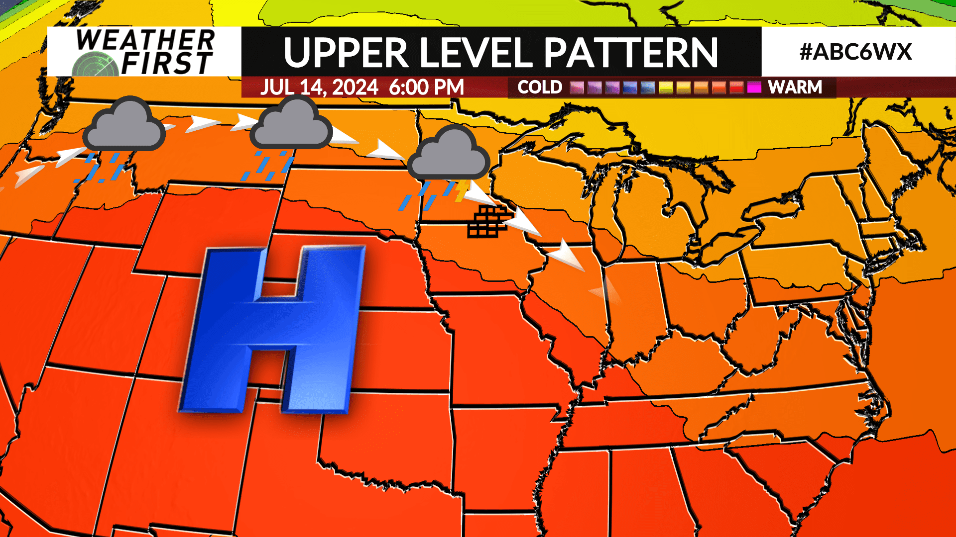
High pressure setup over the western United States where significant heat and record-breaking temperatures have been plaguing that part of the country the last several days will push further east leading the weekend warmup.
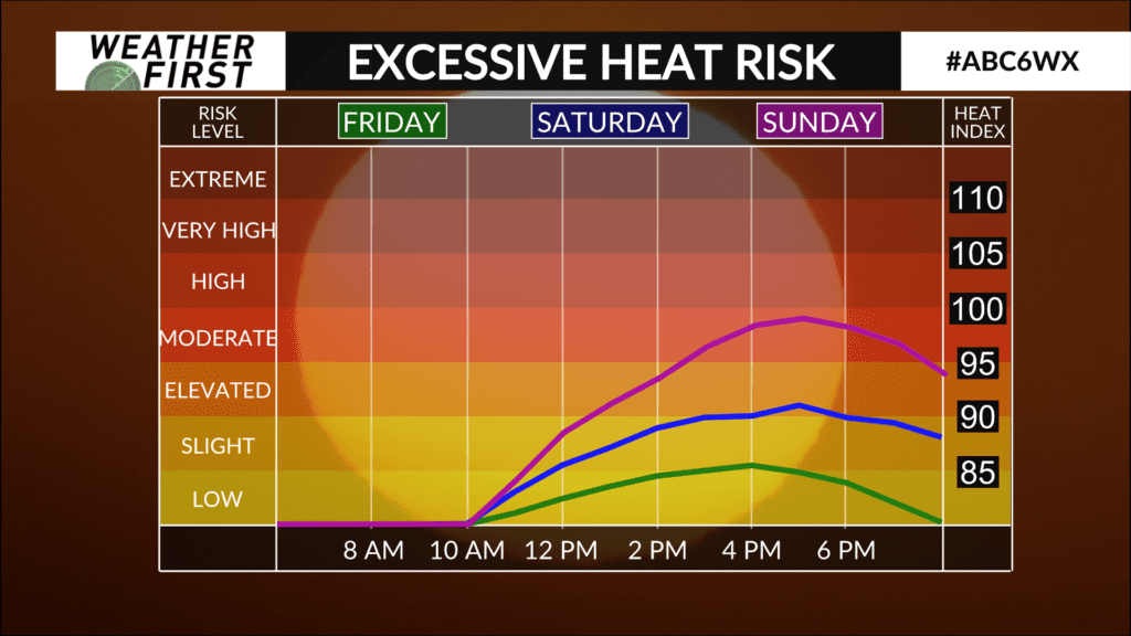
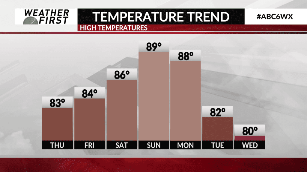
High temperatures are expected to push into the mid-to-upper 80s on Saturday and with dew point temperatures in the 60s, the heat index (feels-like temperature) will likely be in the low-to-mid 90s making for a hot and humid day.
Temperatures will get a bump on Sunday as highs push into the upper 80s to lower 90s. Dew point temperatures are again expected to be in the 60s and 70s leading to heat indices in the upper 90s to near 100°.
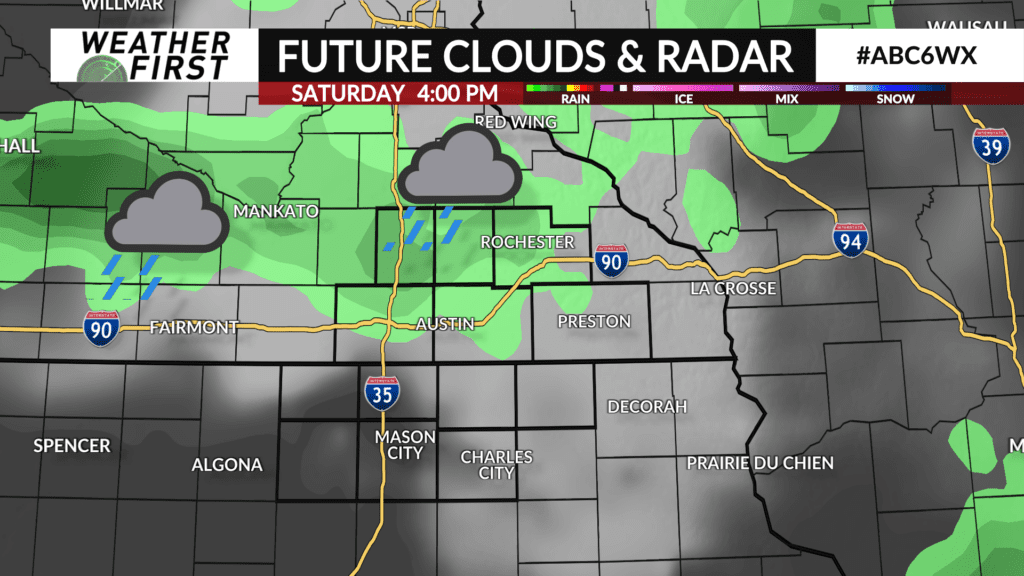
A thunderstorm complex will develop near the U.S. and Canada border on Friday night and track southeast through the night along the eastern fringe of the high pressure. It’s expected to weaken in time, but still could sneak into the area on Saturday. A few more showers and thunderstorms are possible during the afternoon and evening with some potentially strong.
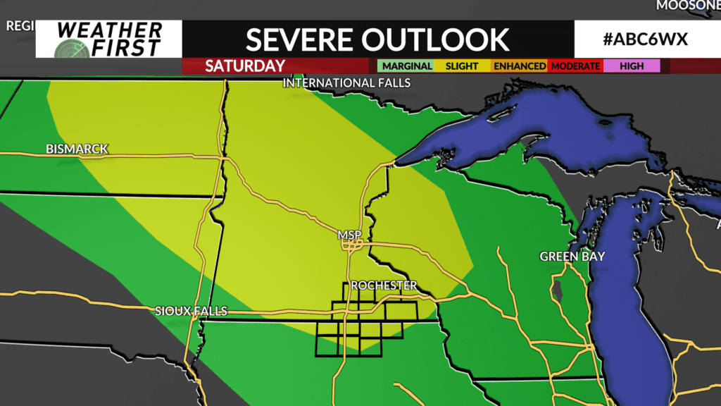
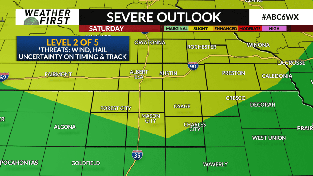
The Storm Prediction Center has a Level 2 out of 5 risk for the potential of severe thunderstorms for most of the Weather First area on Saturday. The main threats would be strong wind and hail.
Another thunderstorm complex may develop near the area on Sunday although several uncertainties remain due to how thunderstorms evolve from Saturday.