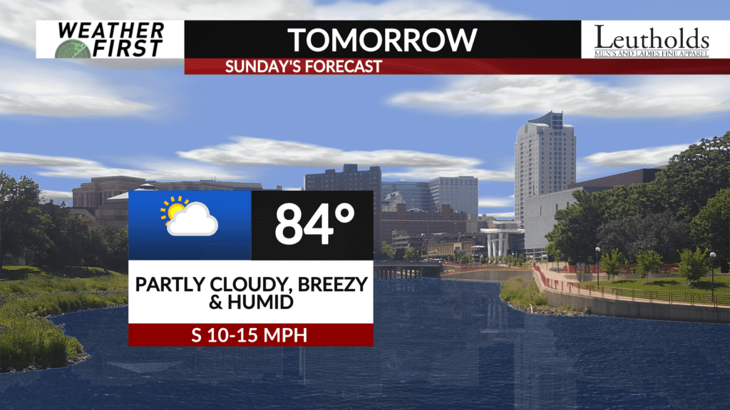
Sunday forecast: not as warm, but humid

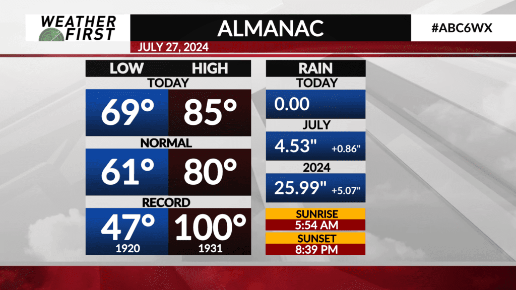
Today was warmer and more humid, with highs in the mid 80F’s across the region and dew points reaching into the low 70F’s. Rochester reached 85F, which is 5F above the average high for this time of year. Nowhere near the record high of 100F set back in 1931, but toasty non the less.
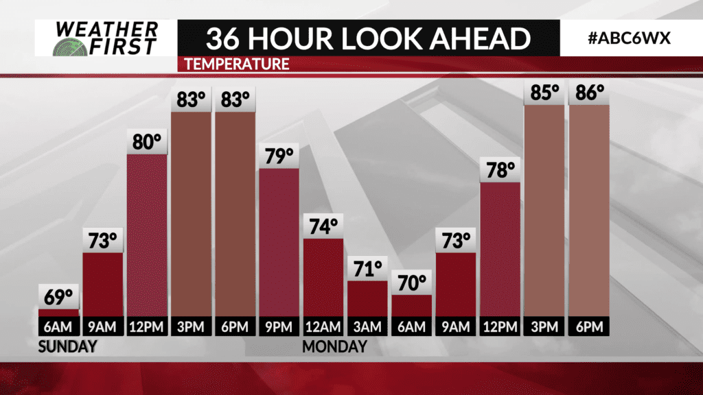
Sunday will be slightly cooler, with highs in the low to perhaps mid 80F’s. The potential for more cloud cover, courtesy of a low pressure system passing to our southeast, may hinder high temperatures slightly.
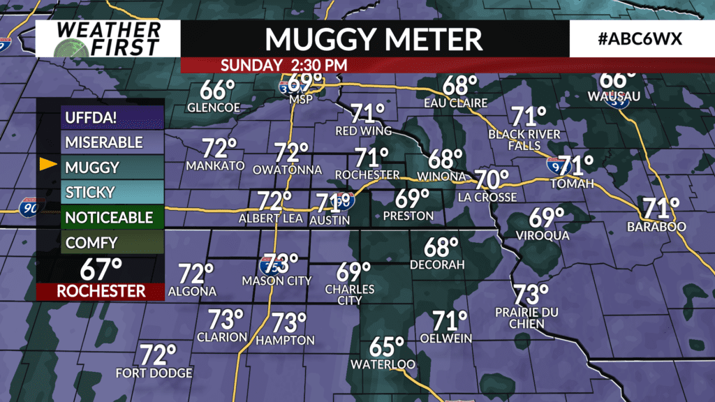
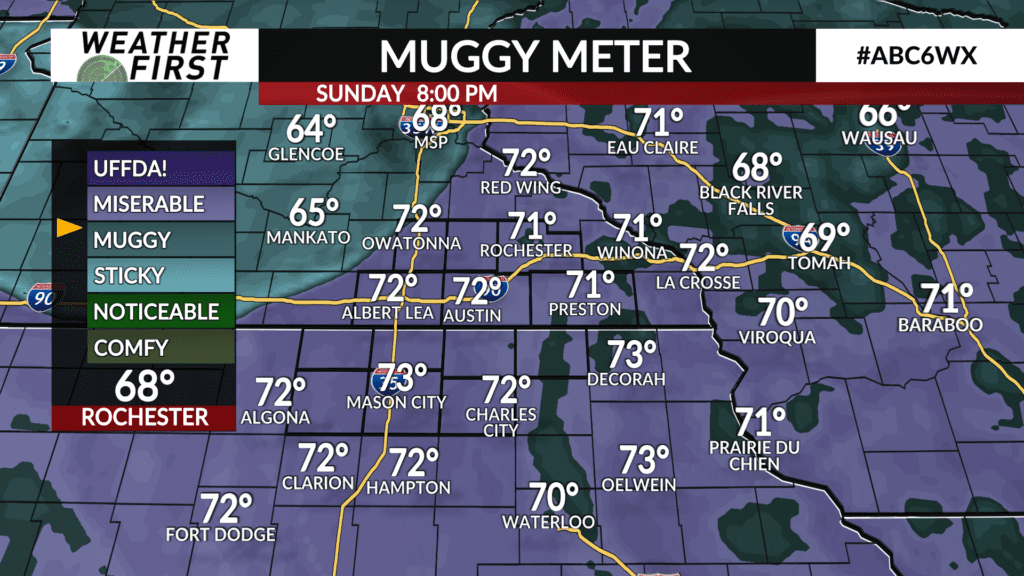
Dew points, on the other hand, will still make things feel soupy out there. We will continue to have a southerly wind tonight and into Sunday. This will continue to transport warm, moist air northward across the viewing area. As a result, dew points will be in the upper 60F’s to lower 70F’s.
Heat index values will be slightly higher than the actual temperature, thanks to the soupy dew points, but will be just below the caution range. Regardless, if outside and in the sun, taking shade breaks and drinking water will be especially important for those more prone to heat related illnesses.
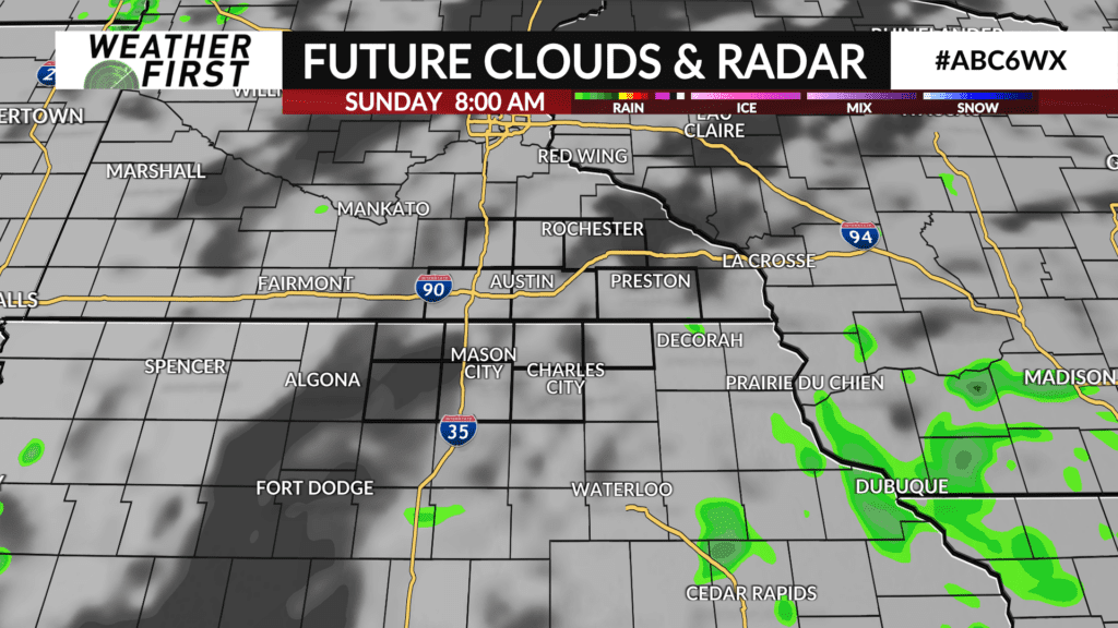
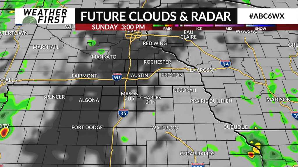
Rain chances will be on the very low end during the day time. The low pressure passing to the southeast should be far enough away that it won’t bring any rain into the area. The approaching unsettled weather from the west should hold off as well until late Sunday night.
That being said, a dry Sunday is in store, but it is going to on the warmer side and very humid. Rather typical for this time of year overall!