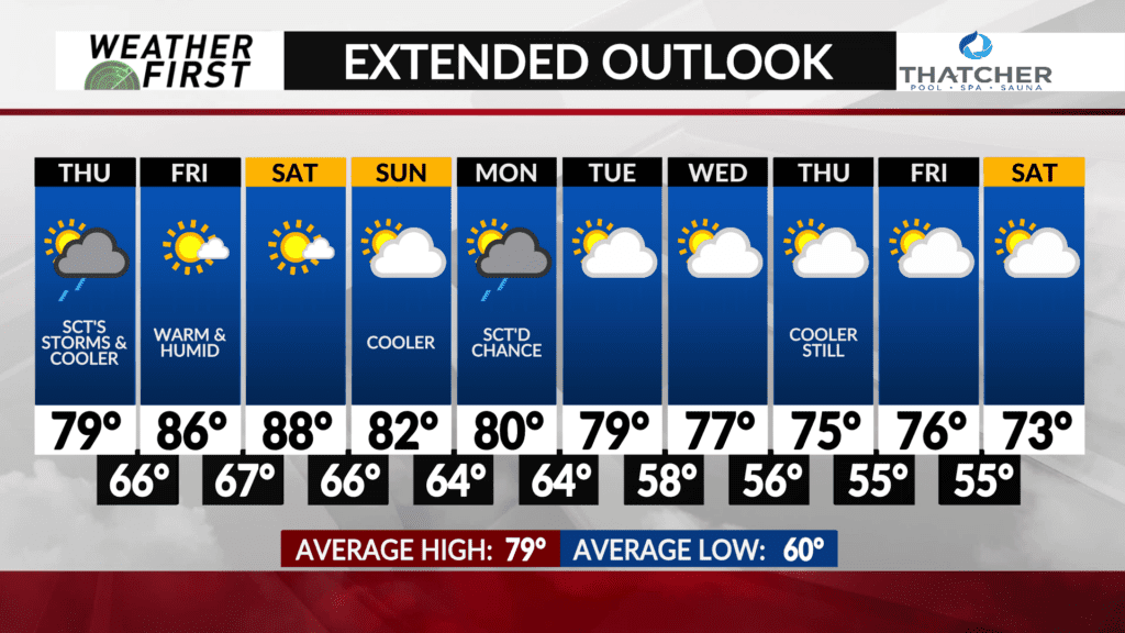
Warm and muggy this weekend, then a transition to cooler weather next week

Heat and humidity have been the theme over the last several days across the Weather First area. Temperatures have routinely climbed into the mid 80F’s, and dew points have been relaxing in the upper 60F’s to mid 70F’s.
While we will get a small break from at least the warmer temperature tomorrow, the dew points will still make it feel thick out there. Once we head into Friday, sunshine returns, and with it, the heat and humidity.
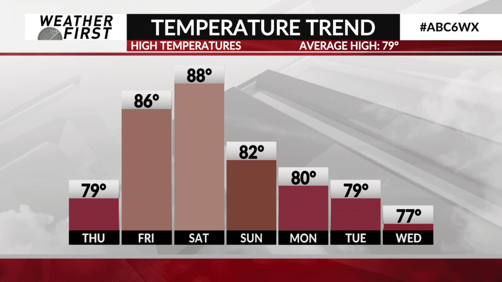
Highs are expected to climb into the mid to upper 80F’s for Friday under all that sunshine. Dew points are expected to be in the upper 60F’s to lower 70F’s as well. This will continue to be the case through the weekend. A positive is that there will be plenty of sunshine, so a great weekend to get out on the lake or go to the pool!
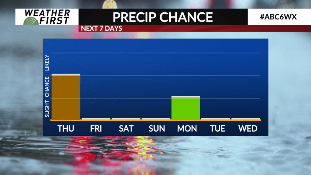
A cold front is expected to swing through Sunday night into Monday. Much cooler and less humid air from Canada is expected to make its way into our area by Monday. As we head through next week, our daily highs get cooler and cooler, potentially not even reaching the mid 70F’s by the week. Brrr.
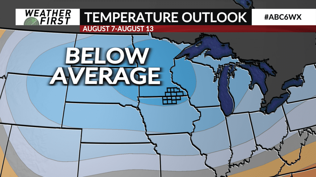
Long range tidbit…the Climate Prediction Center has Minnesota in the dead center of a below average temperature forecast that goes until the middle of August. After all the heat and humidity though, this will likely be a welcome change for many.