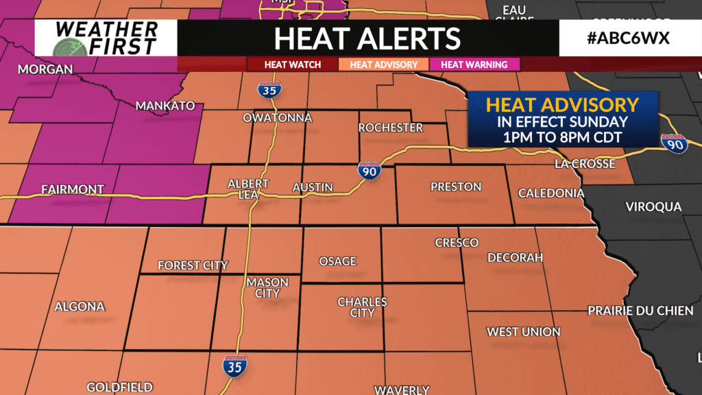
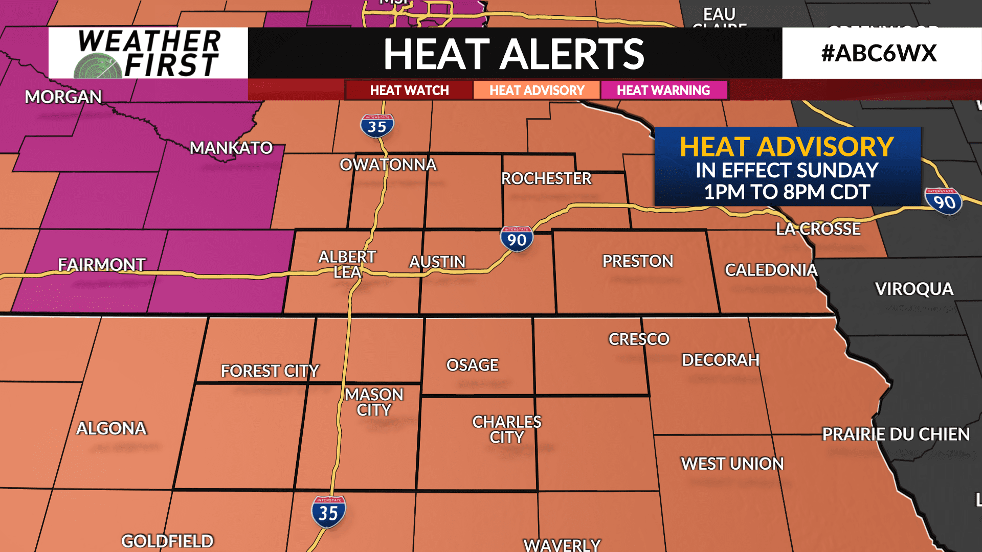
Heat Advisory set to take effect Sunday
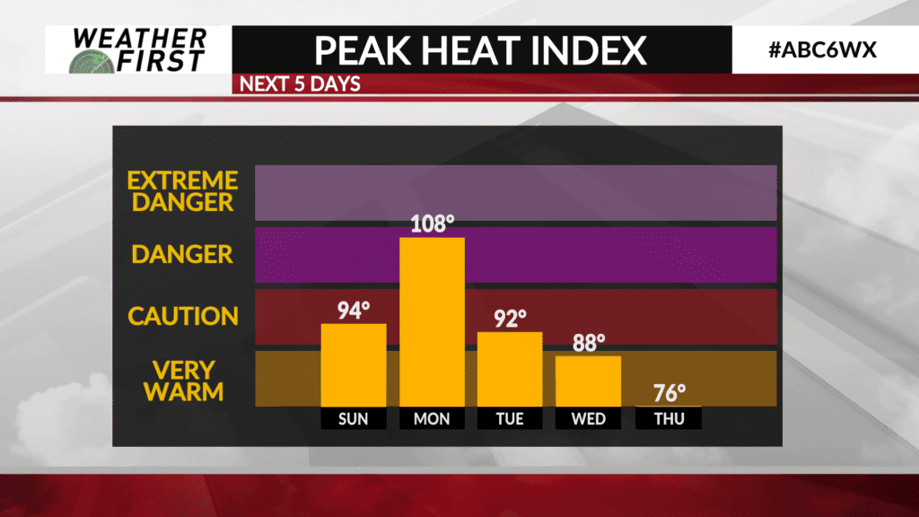
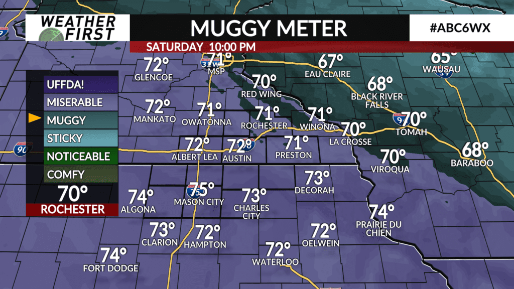
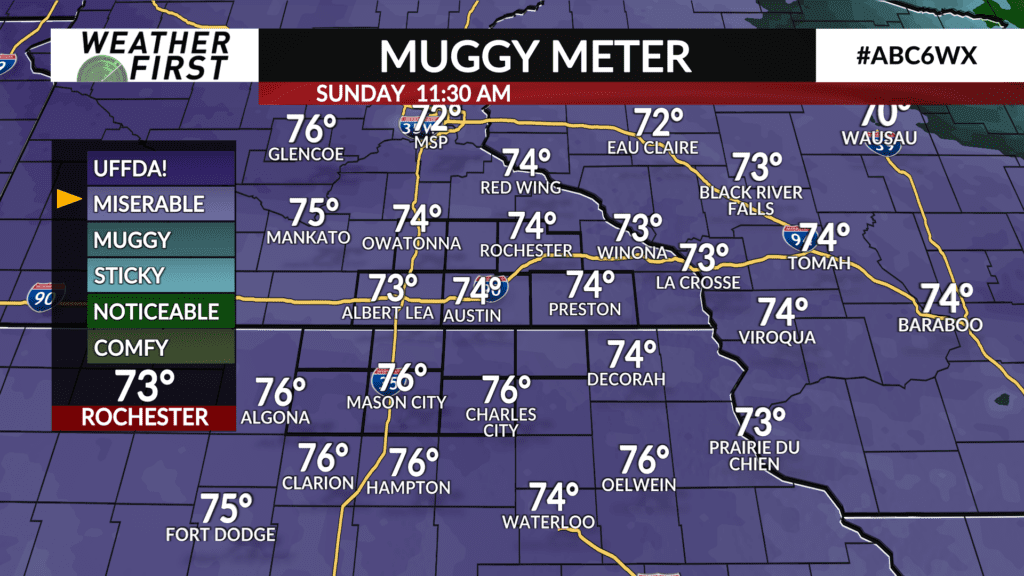
While today hasn’t been terrible in regards to the heat and humidity, it certainly has felt heavier out there across the Weather First area. This is a trend that is going to come to a peak Sunday and into early next week.
The National Weather Service offices of La Crosse, the Twin Cities and Des Moines have decided to issue a Heat Advisory for the entire viewing area, starting Sunday at 1PM CDT and lasting until Sunday 8PM CDT.
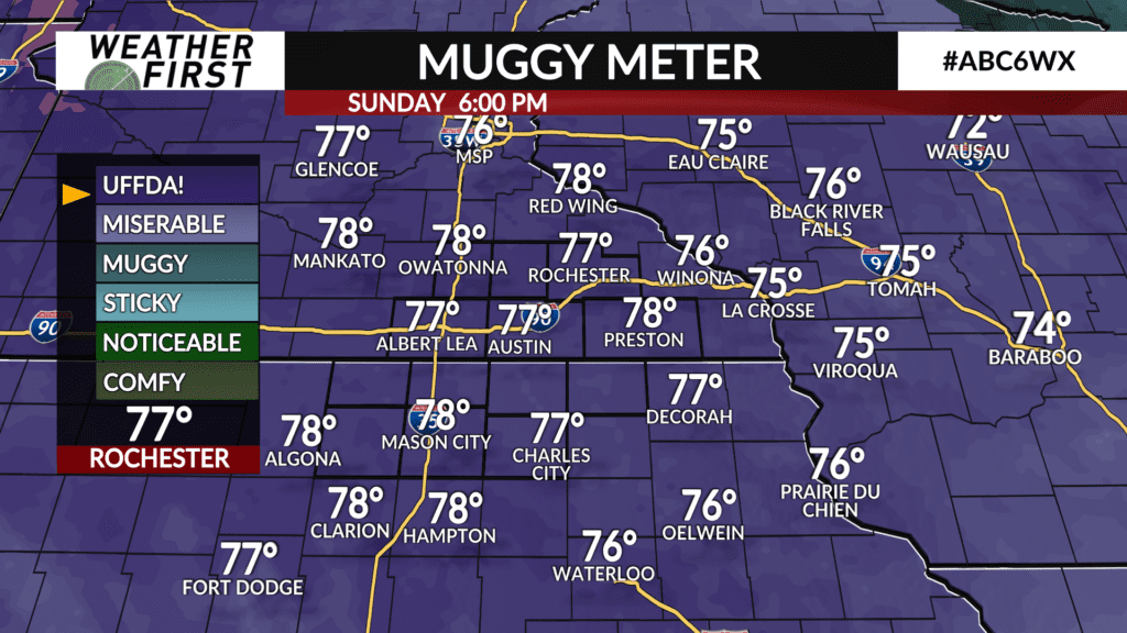
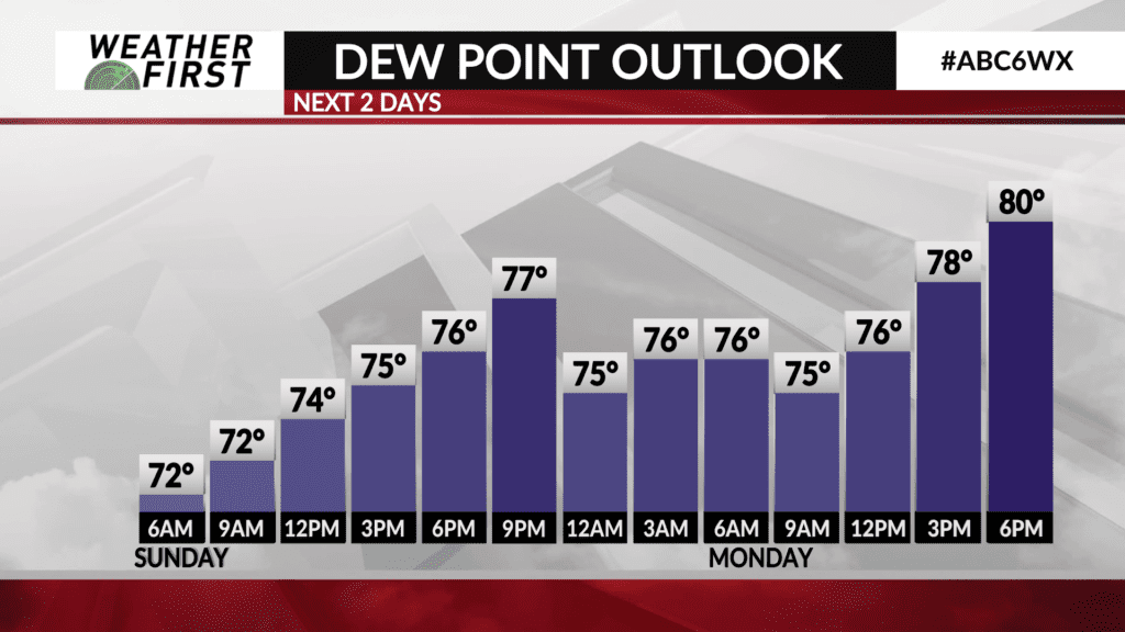
Temperatures tomorrow will climb into the mid to upper 80F’s across southeastern Minnesota and northern Iowa. Dew points will be working their way into the mid to upper 70F’s alongside those warmer temperatures. Combining the effects of the warm temperatures and high dew points, our heat index values will easily exceed 90F.
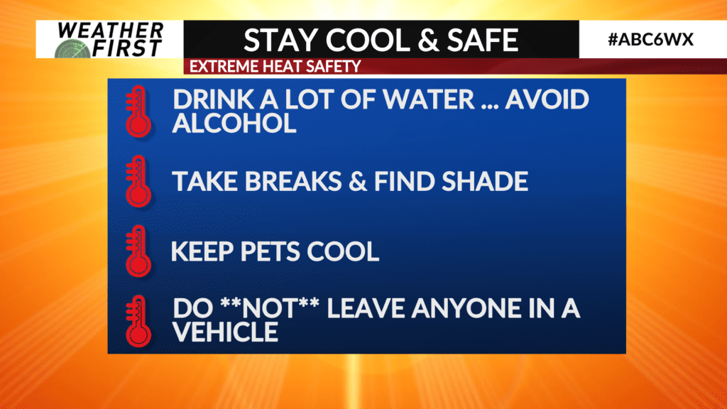
With this in mind, staying cool and safe in the heat will be very important to prevent any heat related illnesses. Precautions include drinking plenty of water, taking shade breaks, keeping your furry friends cool, and NOT leaving anyone or any pet alone in a vehicle. Car temperatures in the sun on a hot day like tomorrow can easily exceed 120F, which can be deadly when exposed to for too long.
Heat advisories may be extended into Monday, which looks even hotter and more humid than Sunday, so these precautions will certainly apply then as well.
Stay cool, and stay safe out there folks!