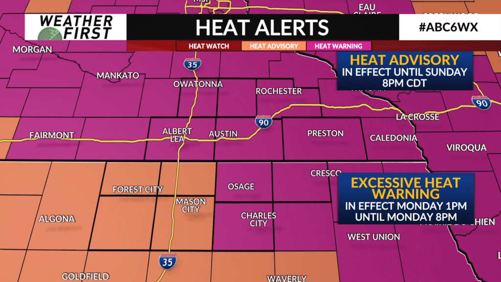
Hot and humid temperatures through midweek
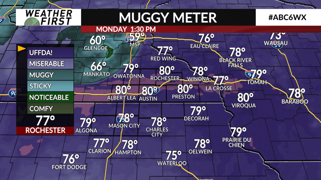
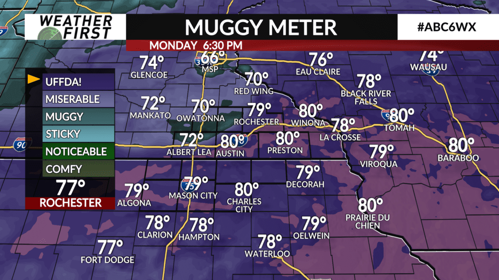
It has been a very warm and humid day out there across southeastern Minnesota and northern Iowa! Temperatures have reached into the upper 80F’s to low 90F’s across the area, dew points are in the mid to upper 70F’s, and heat index values are exceeding 100F across most of the viewing area.
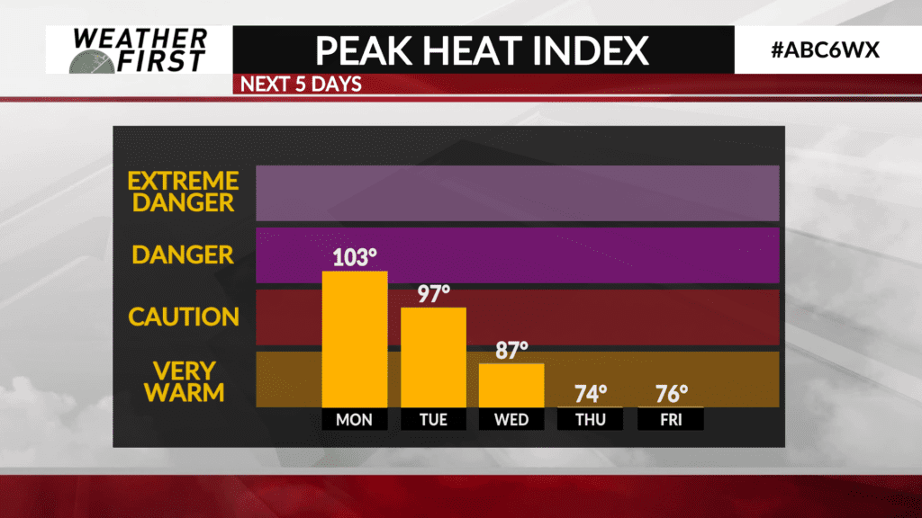
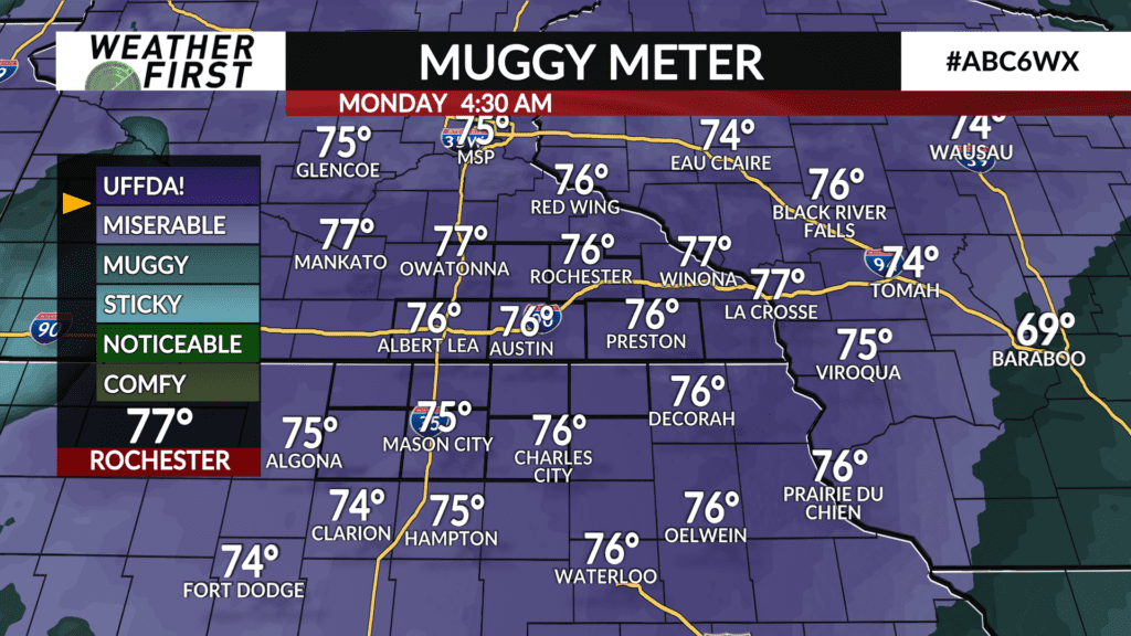
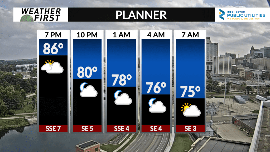
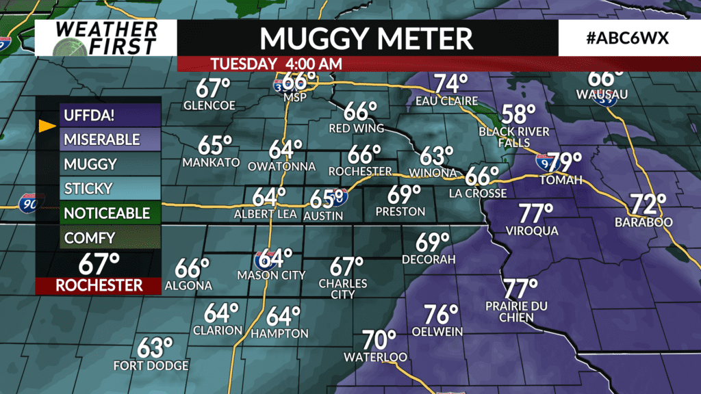
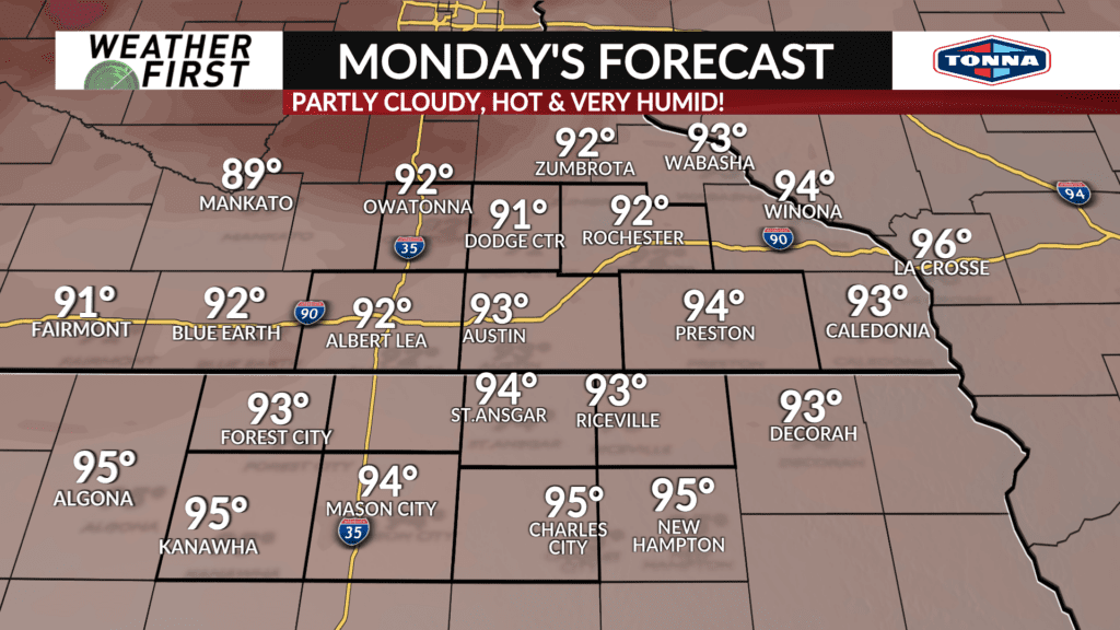
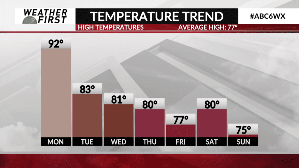
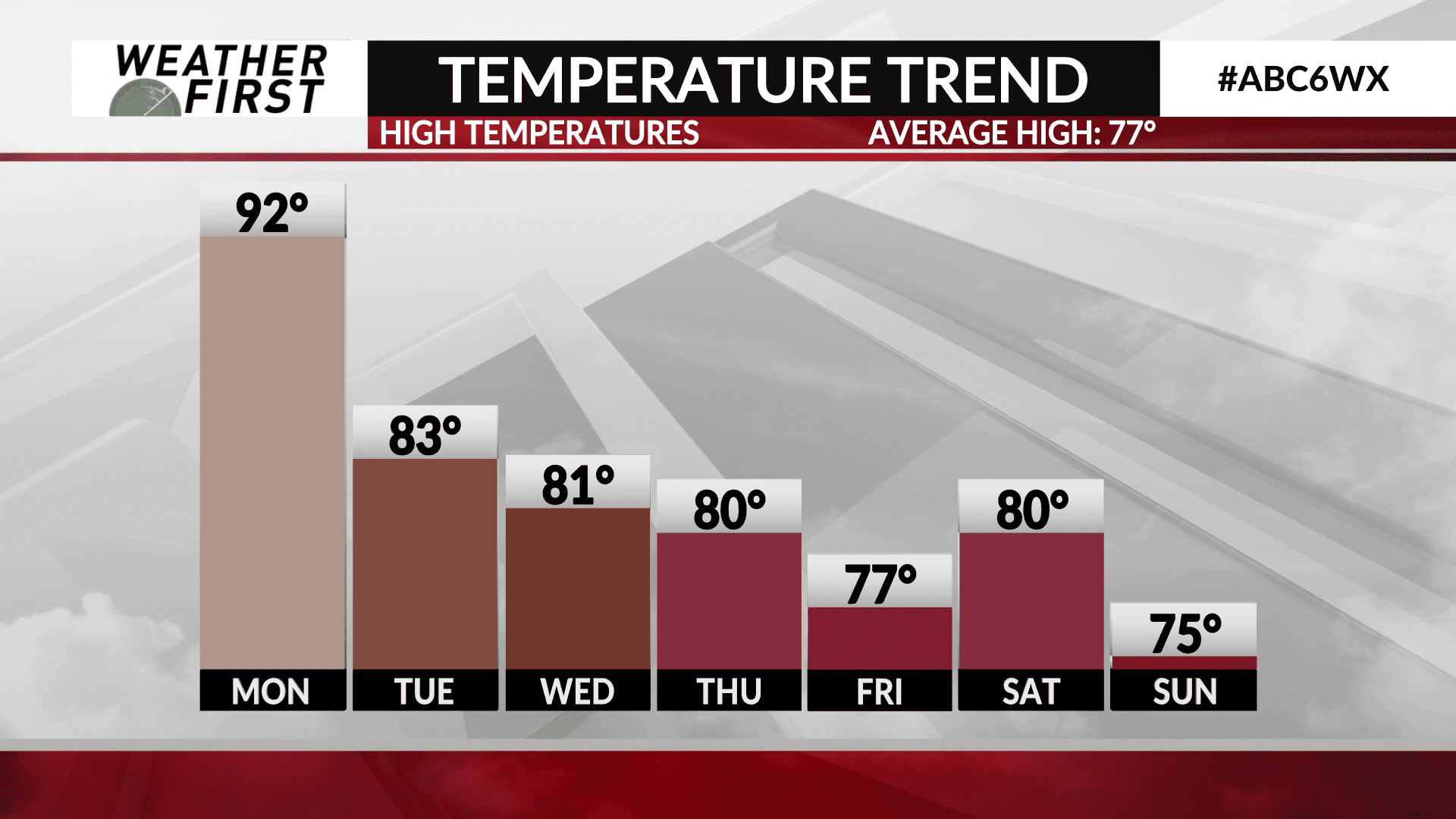
We don’t cool down too much tonight thanks to the soupy dew points in the mid 70F’s. Some of the area may also see some patchy fog thanks to how thick it will be out there. Because we don’t cool down much and recover from today’s heat overnight tonight, tomorrow will be even warmer. Highs are expected to be in the low 90F’s across all of the weather first area, with dew points in the upper 70F’s. Some sneaky cloud cover may cap out temperatures just a little, especially north of I-90, but either way it is still going to very warm and humid tomorrow.
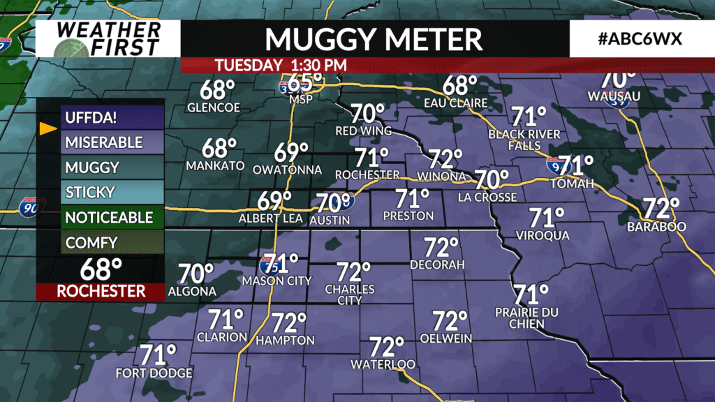
Tuesday highs will in the low to mid 80F’s under generally partly sunny skies, and dew points in the upper 60F’s to around 70F. This will yield a heat index value well in the 90F’s for most of the area, especially if we see more sunshine. Highs will be around 80F on Wednesday, with dew points still making it feel tropical out there. Heat index values will at least be lower, perhaps not making it to 90F.
Thursday a cold front tracks through the area, bringing with it much cooler and drier Canadian air. Highs will likely not make it to 80F by the end of the week!
We warm things up a little for next weekend, but cool down once again just in time for the start of September and meteorological fall.