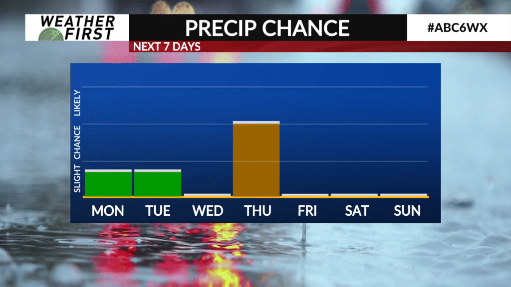
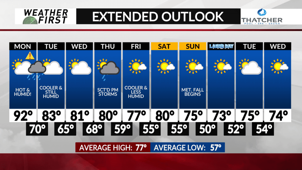
Storm chances arrive to start the week
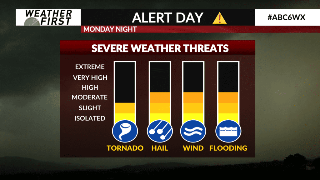
The second piece of tomorrow’s Alert Day will be the severe weather potential. While the best chance for widespread rain holds off until Thursday, Monday night will be the night to watch.
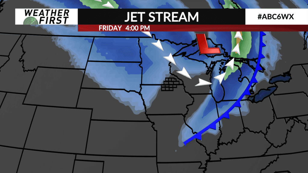
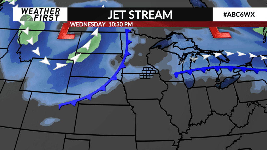
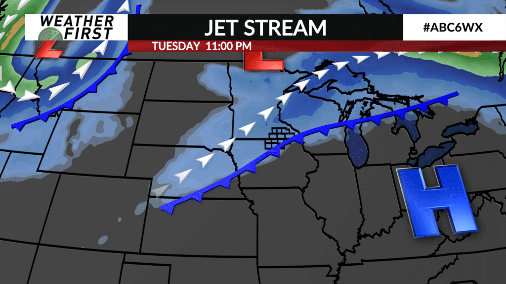
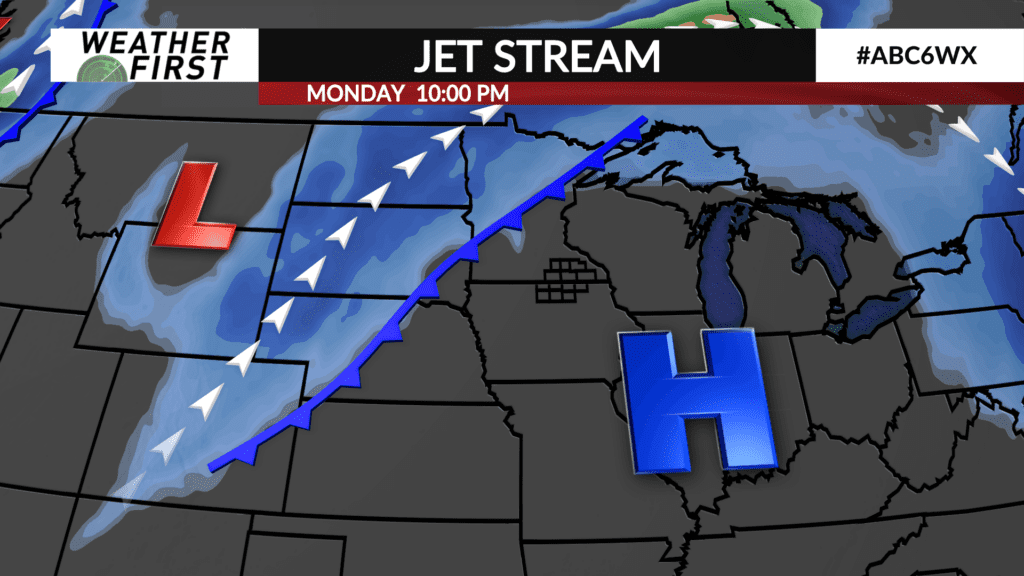
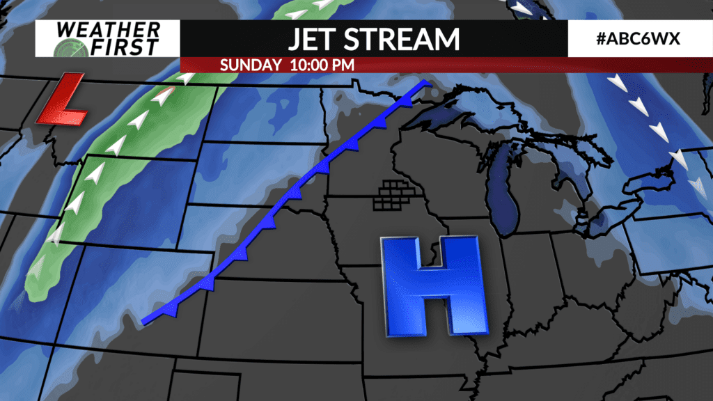
A cold front currently draped across the central Dakota’s ahead of a trough of low pressure will gradually work its way eastward tonight and tomorrow. The cold front itself arrives in Minnesota later tomorrow evening and into the overnight hours.
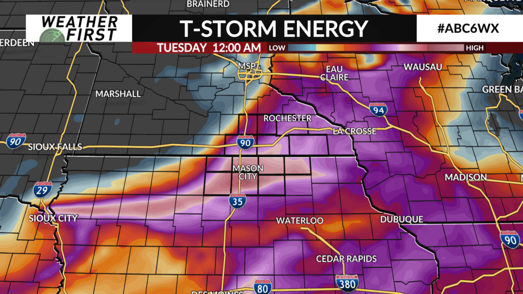
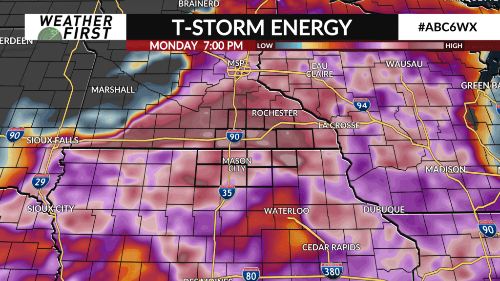
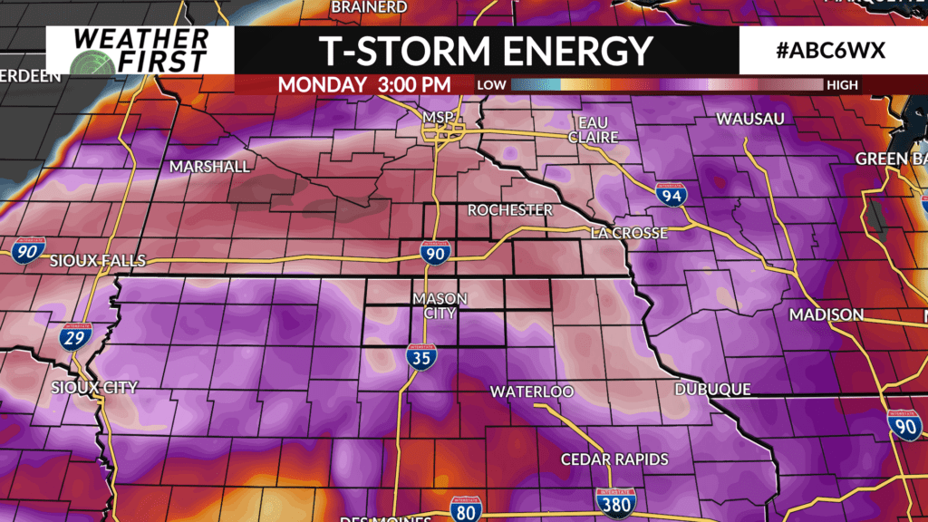
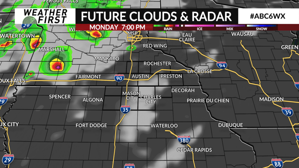
With the hot and humid conditions around for tomorrow afternoon into the evening, there will be plenty of energy for thunderstorms to work with through Monday night. No storms are expected on Monday during the day, however, due to a warm cap aloft that is expected to hold through at least the early evening hours across southeastern Minnesota and northern Iowa.
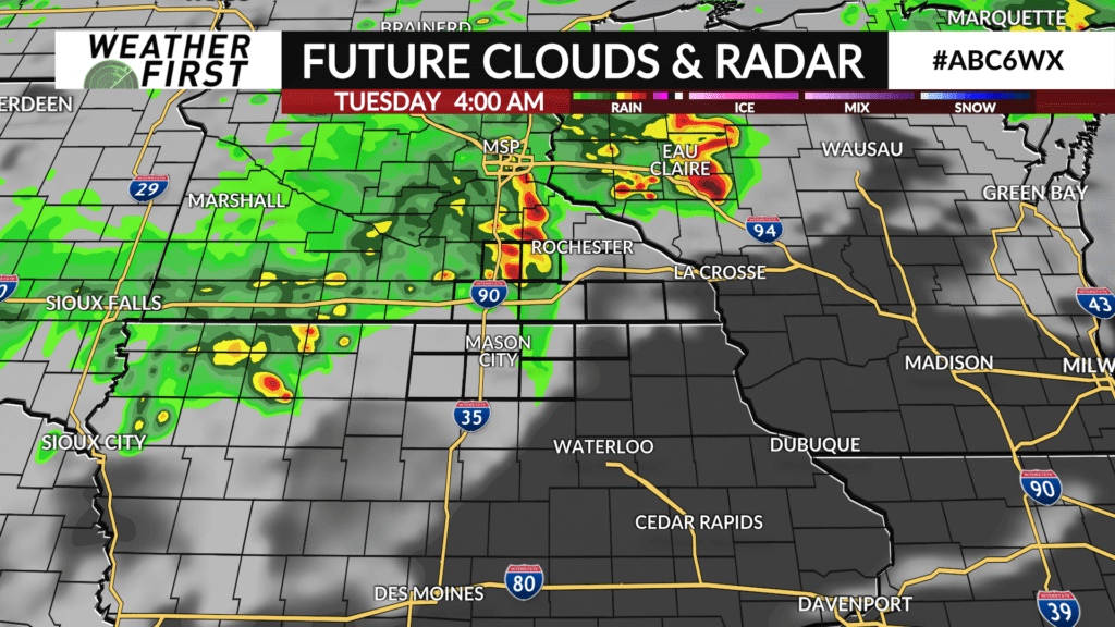
By late evening and overnight Monday night, the cold front will be approaching from the west. Winds just above the surface will also ramp up, helping to weaken the cap. Odds are at some point Monday night the cap will break, and thunderstorm activity will quickly develop to our west/northwest and work its way in our direction.
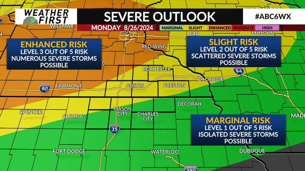
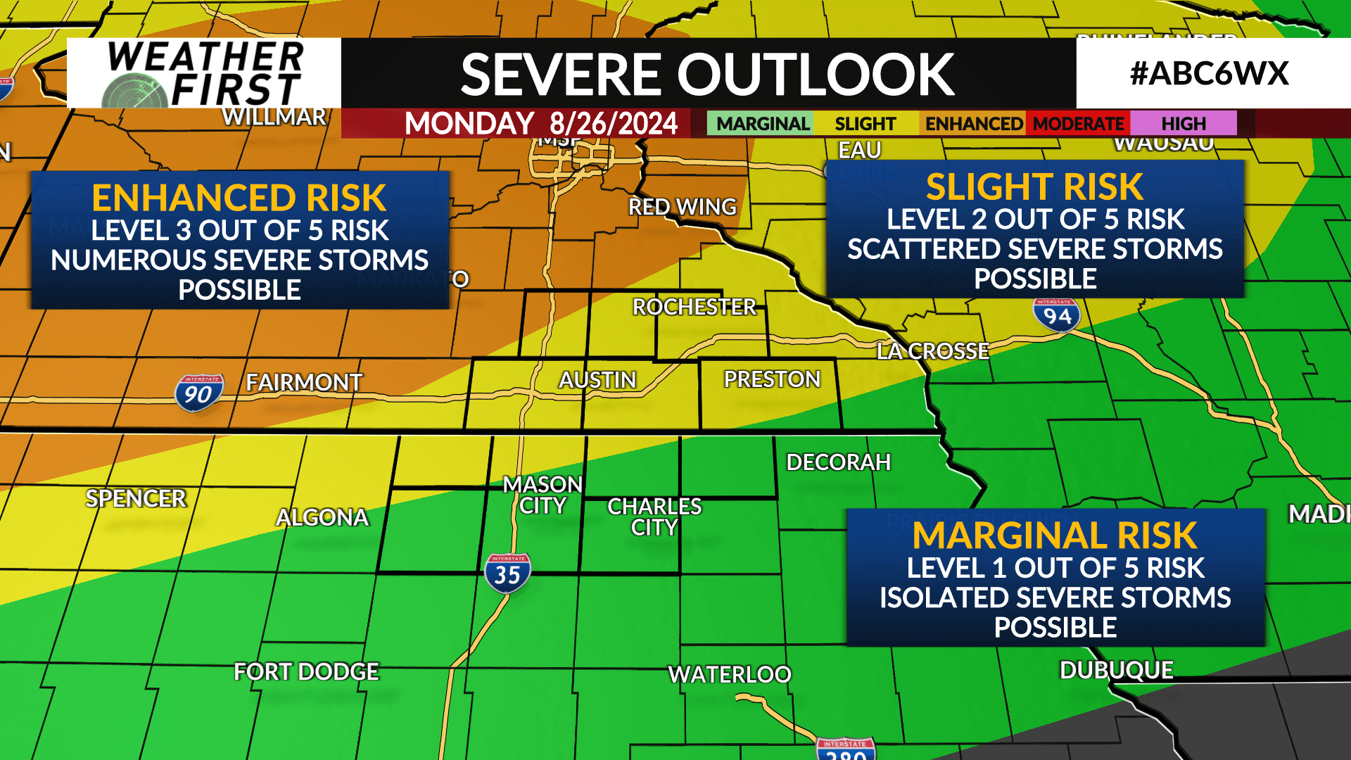
Given the amount of energy in the atmosphere, severe t-storms are possible tomorrow night. All severe hazards will be possible, including damaging winds, large hail, tornadoes, and flooding. The greatest threat will be across central and western Minnesota, where an enhanced risk of severe weather is in place. A slight risk of severe weather is in place for most of the Minnesotan portions of the Weather First area and down into portions of northern Iowa. The remainder of our area is in a marginal risk of severe weather.
The bottom line, odds of severe weather increase the further north you are, with our Minnesotan counties at the greatest risk for seeing severe weather Monday night.
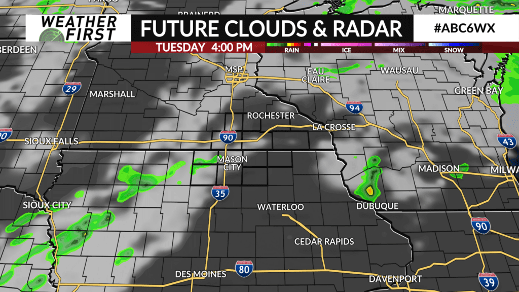
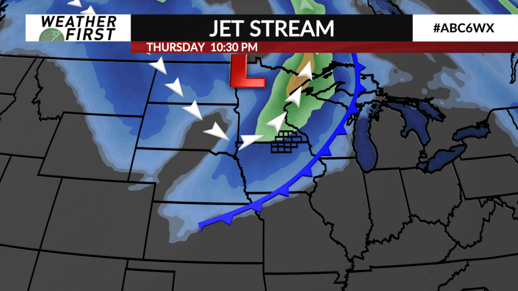
Can’t rule out a couple of lingering showers and storms on Tuesday, especially during the morning. The next best chance of rain arrives Thursday as another cold front makes its way through the area. This appears to be a more widespread event, meaning our entire viewing area has a much greater chance at seeing rain than on Monday night. No severe weather is expected on Thursday at this time.