No signs of fall as summertime warmth continues into next week
The summer season looks like it is going to hang on to the very end as there are no signs of any fall-like weather in the days ahead.
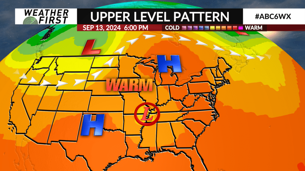
The remnants of Hurricane Francine will move northward into the south-central part of the country by this weekend which will reinforce and amplify a high pressure ridge over the Upper Midwest keeping the warm air locked into place.
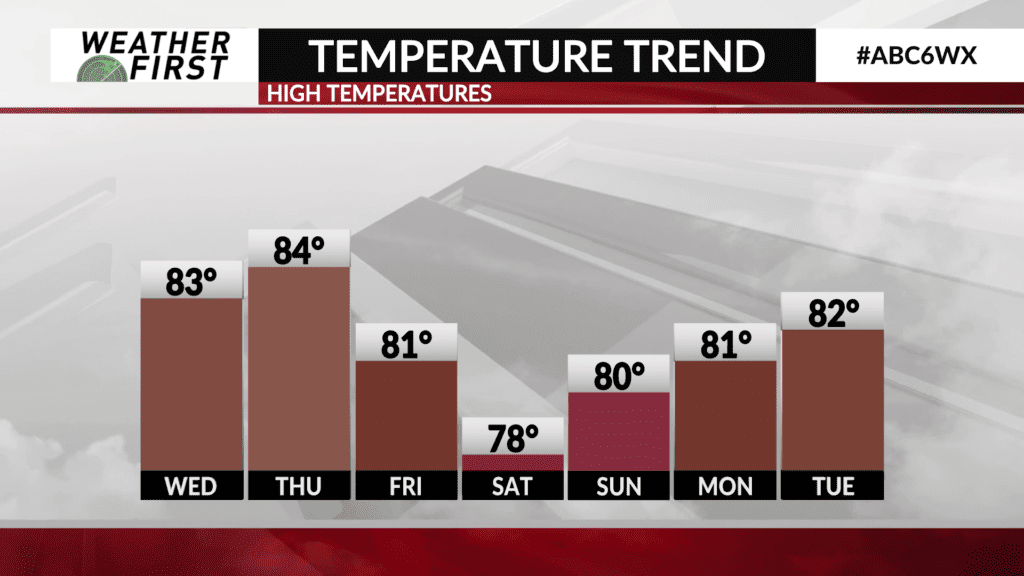
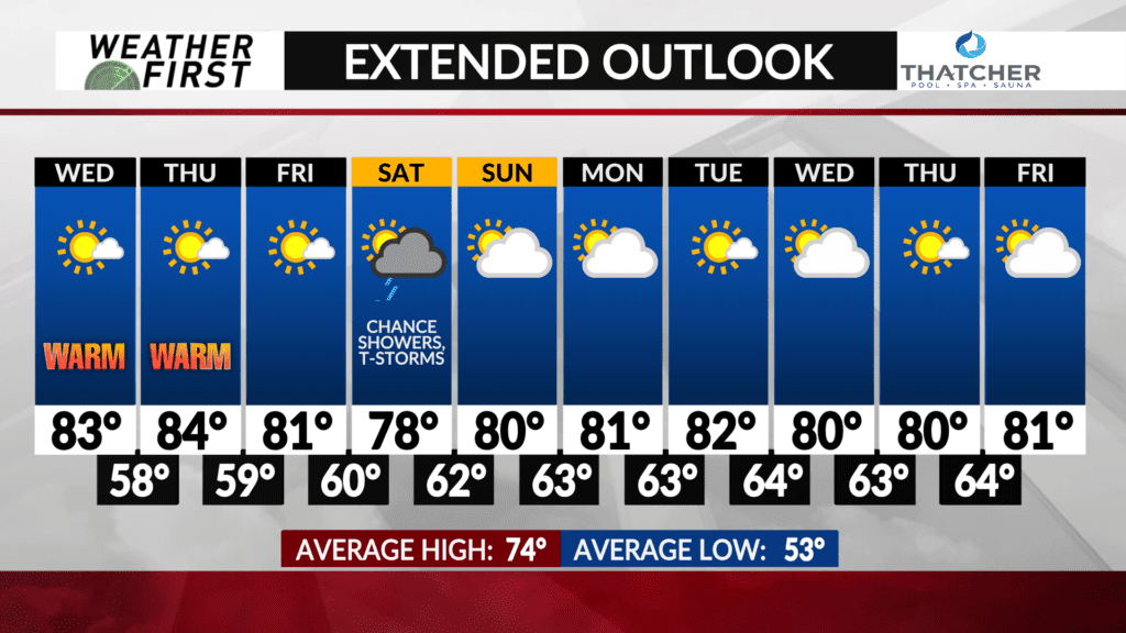
Temperatures are expected to remain well above average through at least the middle of September. The average high temperature during this period is in the middle 70s and lows are in the low 50s.
The upper air pattern into next week will generally be out of the southwest which will help keep temperatures warmer than average.
There won’t be much range in temperatures as highs will be near or in the lower 80s from the weekend through much of next week and night lows will hover around or in the lower 60s.
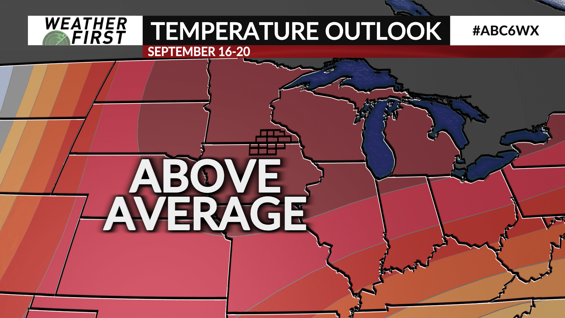
The Climate Prediction Center’s latest 6 to 10 day temperature outlook has a high likelihood of above average temperatures in the September 16th through 20th period.