Taking a look back at a warm and dry September

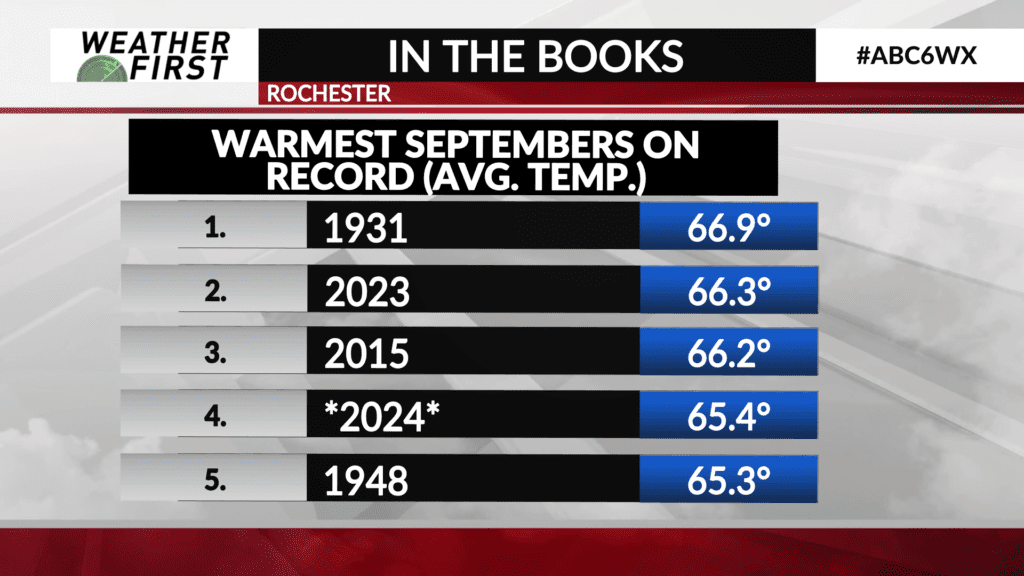
If you think it was a warm September across the Weather First area, you certainly are on to something. September of 2024 was one of the warmest Septembers on record…and was also one of the driest.
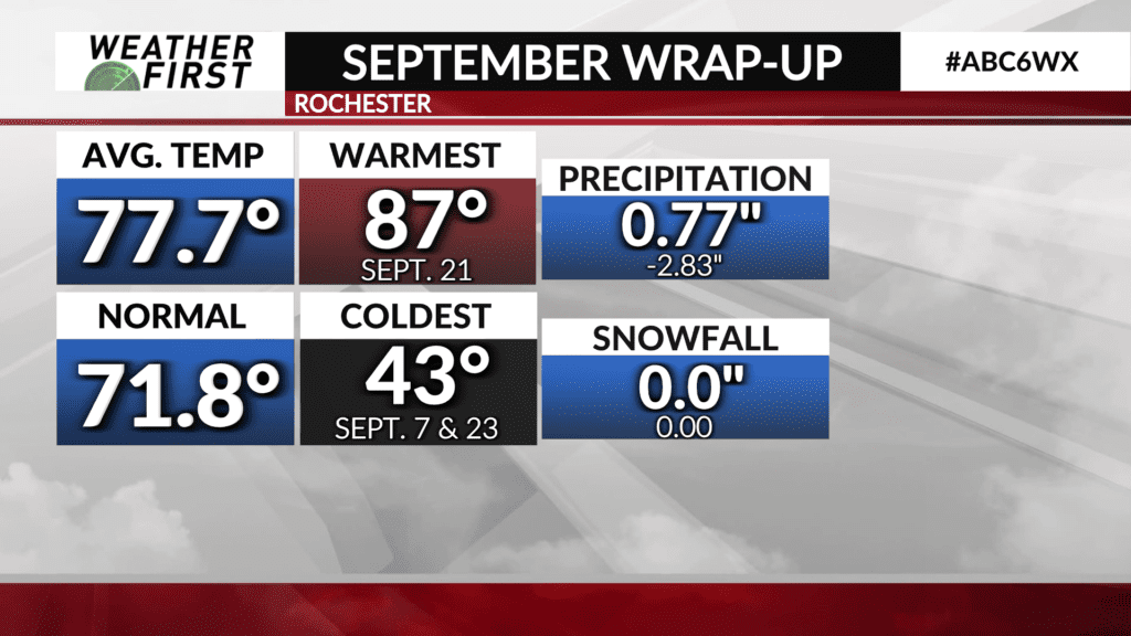
Temperatures were above the long term average daily high temperature for most of the month of September. All of these warm days contributed to September 2024 having an average high of 77.7F, while the normal average high for the entire month of September is 71.8F. We were above that average by quite a bit!
The warmest temperature we saw was 87F on September 21st, with temperatures tying the record high of 83F in Rochester on September 28th. The coldest temperature we saw was 43F on September 7th and 23rd. The average low by the end of the month is around 44F, so we certainly did not deviate to far into the “chilly” territory by average temperature standards during the month of September.
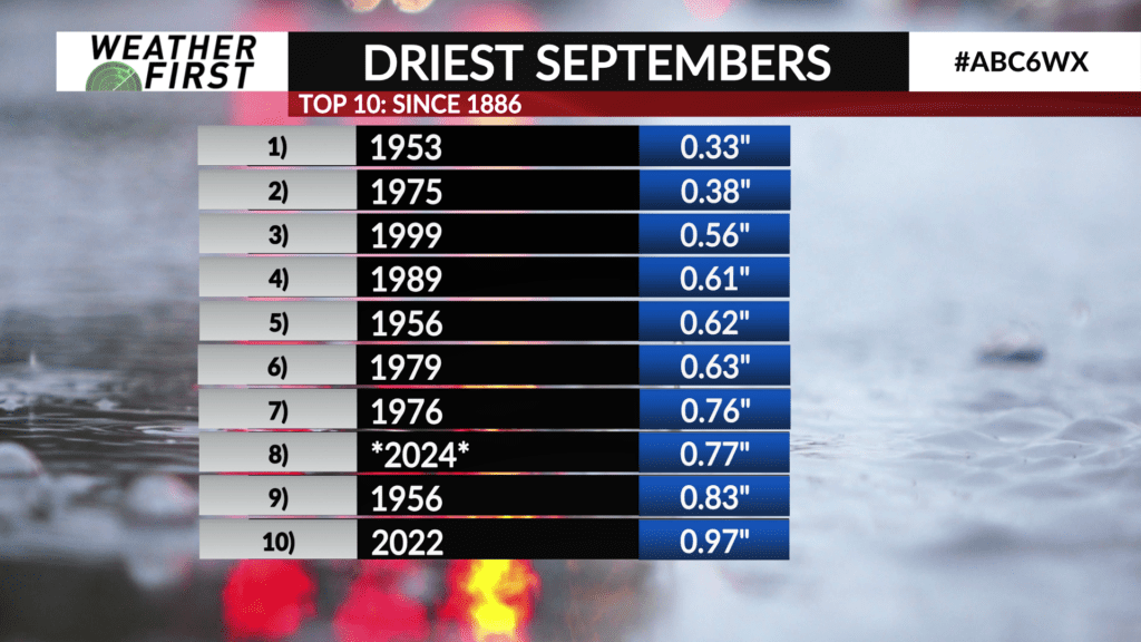
Precipitation this month across the Weather First area was not easy to come by. Rochester only received 0.77″ of rain for the entire of month of September, which is 2.83″ of rain below average. Dry Septembers have become a normal for Minnesota as of the last few years, but this September made it on the top 10 driest Septembers board, coming in at number 8. This is not as detrimental as it would be in June or July, as the growing season is coming to an end, and farmers need drier weather to get into the fields and harvest. The fact still remains…it was a dry September!
What will October hold? Current longer range forecasts call for the warm and dry weather to continue, but only time will tell. We will revisit this on November 1st!