Same weather pattern, different week
Temperatures are going to follow a rather familiar style this next week, with a cool start, followed by warmer temperatures by the end of the week.
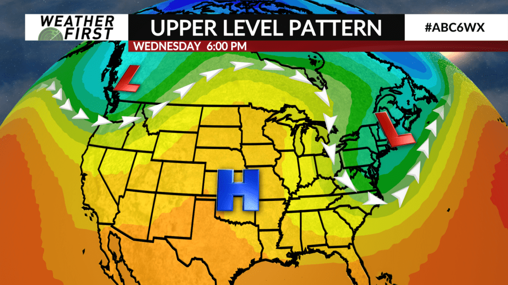
An area of upper level low pressure will be slowly making it’s way southward and eastward through the beginning of next week. This upper level low will usher in much cooler, more fall like air across southeastern Minnesota and northern Iowa on its backside.
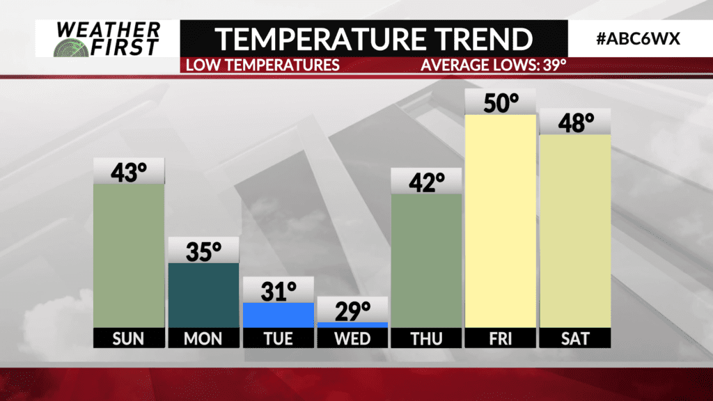
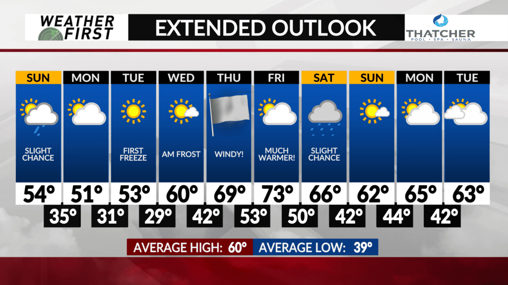
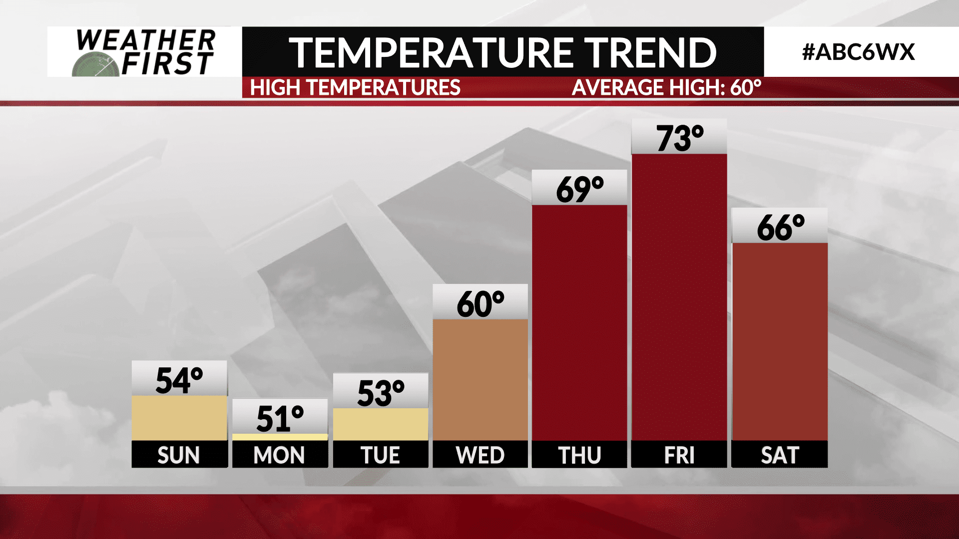
High temperatures on Sunday aren’t going to be able to climb too much thanks to cloud cover, into the low to mid 50F’s. Monday will be even cooler, with highs temperatures only getting to around 50F under a partly cloudy sky.
The seasons first freeze is currently expected Monday night, into Tuesday morning. Temperatures could very well dip below 32F Monday night, with generally light winds and clear skies. Tuesday night into Wednesday morning another freeze is likely, with low temperatures dropping into the upper 20F’s!
By Wednesday, most folks will see the return of 60F on the thermometer, with skies remaining generally sunny as an upper level ridge passes overhead. Thursday, temperatures will be quite warmer, with highs in the upper 60F’s. Winds will be strong out of the southwest, helping to bring this warm air northward. Friday will be the warmest day of the week, with highs in the low to mid 70F’s! Things look to stay dry through the end of the workweek.
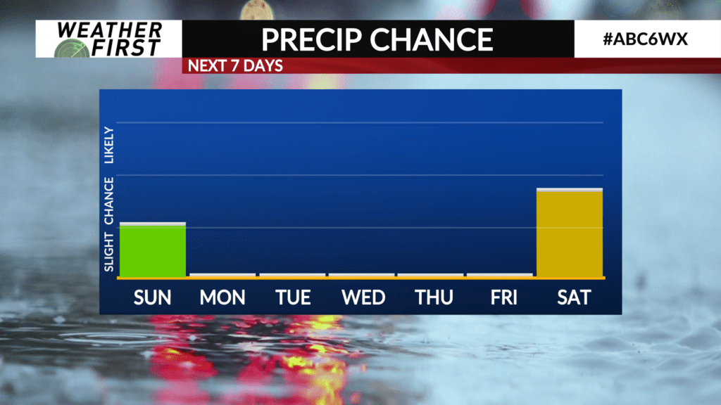
By next Saturday, a cold front will be approaching the area, bringing a slight chance of showers and a drop in temperatures with it. Too soon to specify on too many details, but things look very reminiscent of this past week in terms of temperatures as we head into next week.