Saturday’s Almanac (10/26/24)

Saturday was next to perfect across the Weather First area for this time of year!
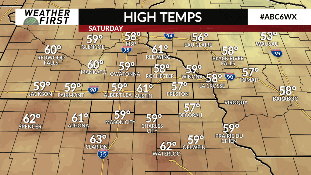
Temperatures across southeastern Minnesota and northern Minnesota were generally in the upper 50F’s, with even a few 60F’s showing up in Mason City and Austin. There was plenty of sunshine with light winds…really can’t get any better than that in late October.
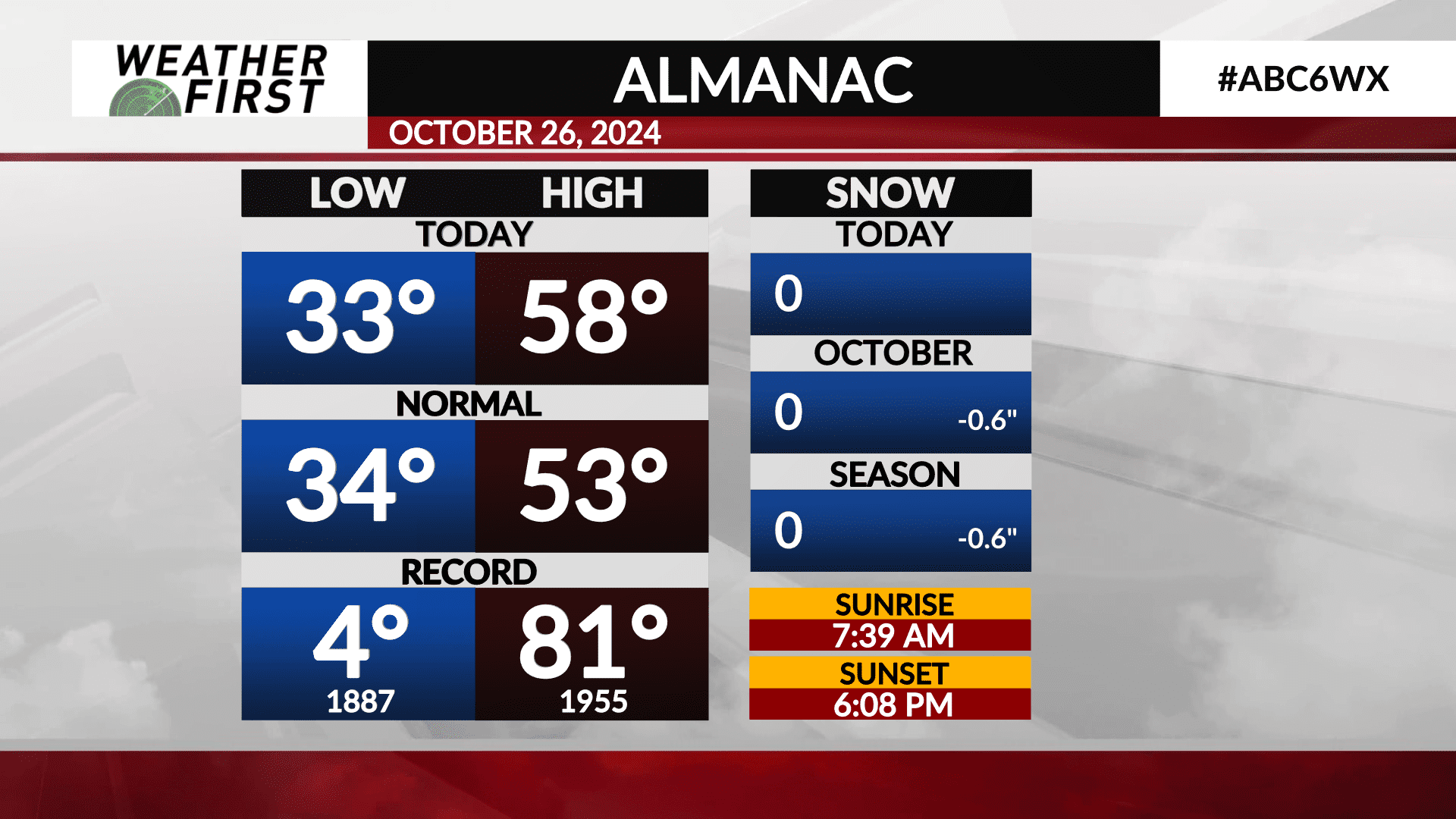
For Rochester, the high temperature was 58F, which is 5F above the average high temperature for October 26th, which is 53F.
We came nowhere near close to any record today, high or low, as the record high is 81F, set back in 1955, and the record low is a bone chilling 4F, set back in 1887.
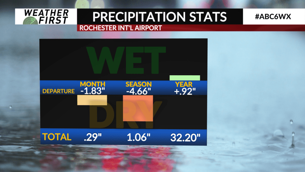
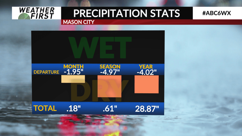
Precipitation wise, Rochester’s monthly precipitation stands at a meager 0.29″, while Mason City stands at 0.18″. Despite the rain that our area received last Thursday, our monthly rainfall is well below normal. Both Rochester and Mason City are nearly 2″ behind the average for this time of year. The bottom line is we are still hurting for some rain, and it remains highly unlikely that we will end October near or above average in terms of precipitation.
Well above normal temperatures will arrive for early next week, as well as highly beneficial rain. We will likely see some interesting statistics because of this in the coming days!


