Record warm temperatures ahead, turning cold
Everyone who lives in Minnesota knows that temperatures can change wildly on the dime. This week is certainly going to be a classic example of going from one season to another in a matter of 24 short hours!
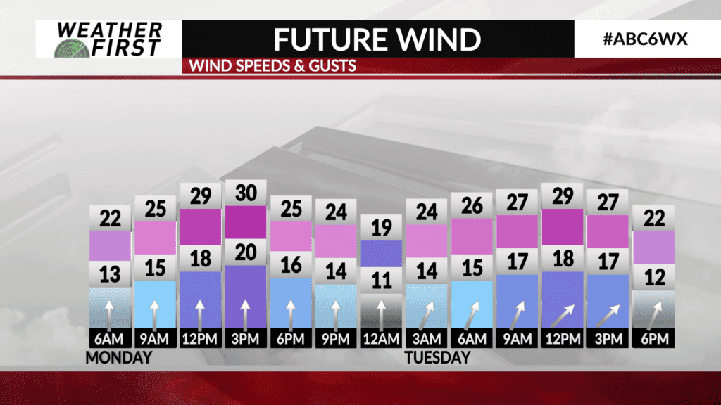
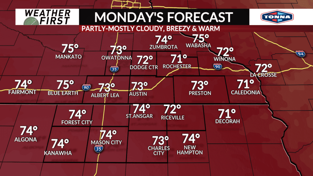
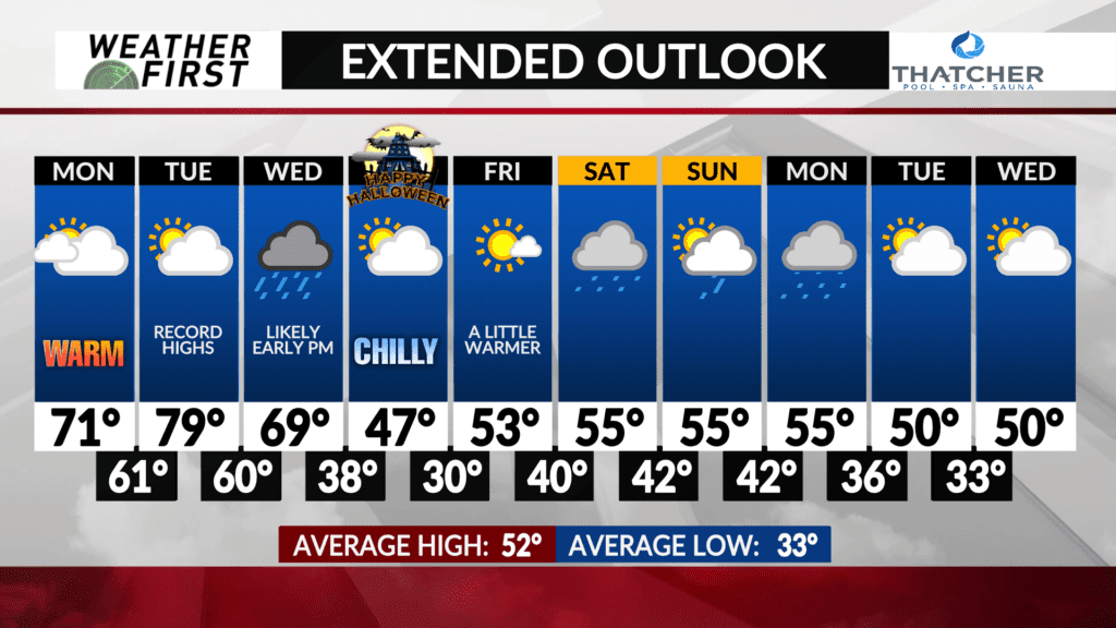
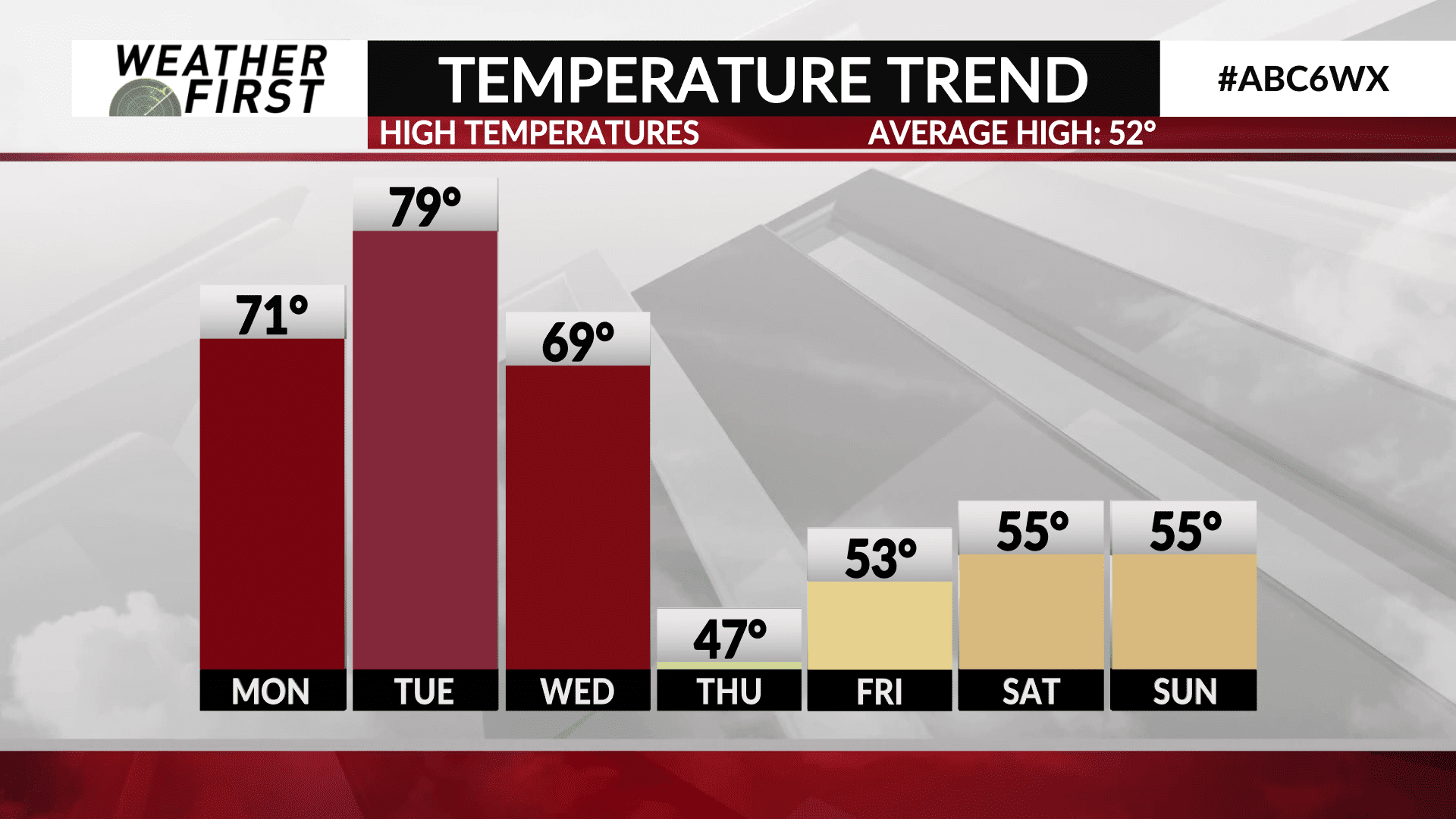
We start the workweek off a good 10F warmer than Sunday, with highs in the low 70F’s for most across southeastern Minnesota and northern Iowa. Winds will remain breezy out of the south at around 10 to 20 mph, gusting up to 30 to 35 mph at times during Monday afternoon.
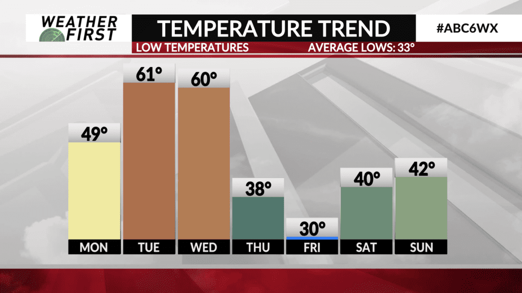
Low temperatures Monday night won’t drop much at all thanks to cloud cover, southerly winds, and higher dew points. Lows will only be in the low 60F’s, which would break the record warmest low for October 29th, which stands at 58F set back in 1946!
Tuesday will be a VERY warm day by late October standards across the Weather First area! Strong southerly winds will continue in the 15 to 20 mph range, gusting up to 30 mph at times once again in the afternoon. These strong southerly winds will continue to bring warmer air northward into the area, resulting in high temperatures reaching the upper 70F’s to lower 80F’s for all of us Tuesday afternoon.
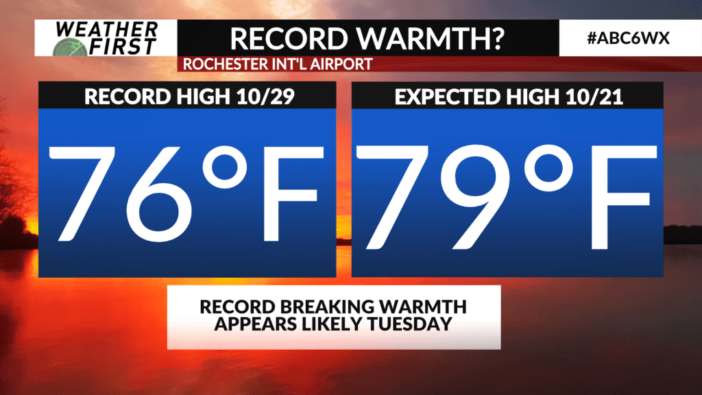
The previous record high for Rochester, MN for October 29th is 76F set back in 1896. The expected high for Tuesday, October 29th, is 79F for Rochester, and 80F elsewhere! Rochester still has a chance of reaching 80F certainly, but even if temperatures don’t quite get there, we still are set to break a record!
Lows Tuesday night will be right around 60F once again, falling short of the warmest record low for October 30th, with is 63F. Still looking at highs in the upper 60F’s to lower 70F’s on Wednesday before a powerful cold front arrives to send our temperatures crashing Wednesday night into Thursday.
Highs for Halloween will only reach into the mid to upper 40F’s across the area. Lows Thursday night into Friday morning will likely dip below freezing, and into the upper 20F’s for some. We warm up a bit for Friday and the weekend, but for now, it looks like a more fall like pattern holds on after this Wednesday for the foreseeable future.
