Chilly end to the week, warmer next week

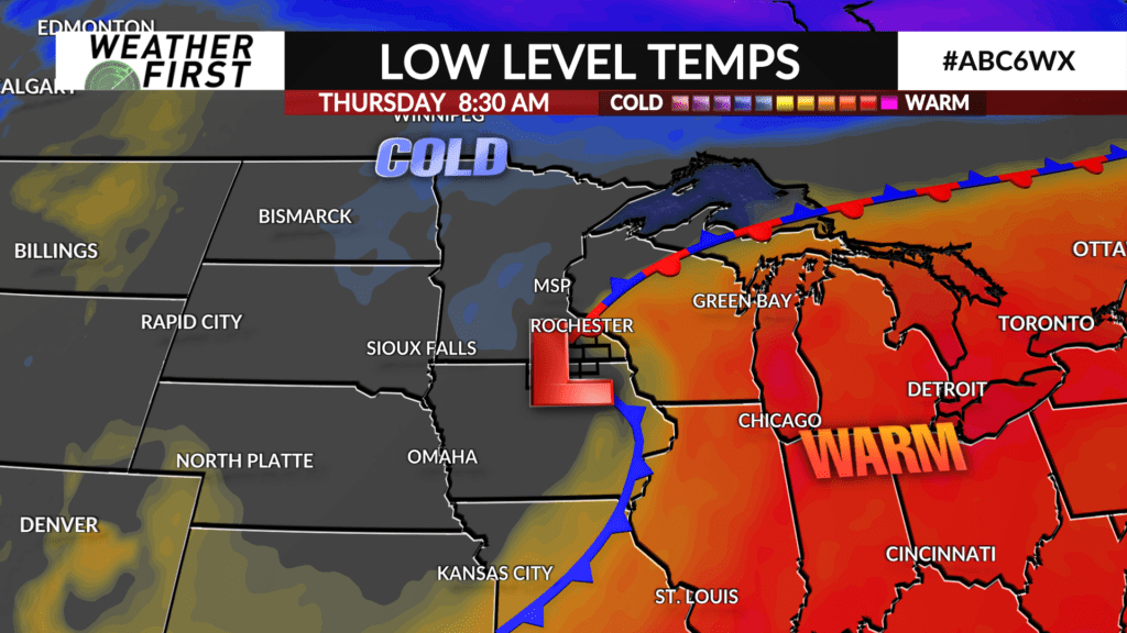
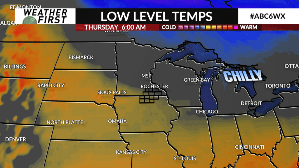
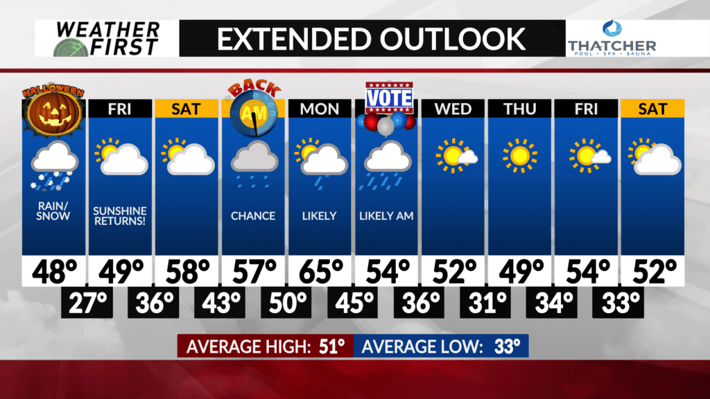
Temperatures are going to take quite a tumble this afternoon once an area of low pressure passes through the area! Temperatures by this evening will be in the mid to upper 30F’s for most, along with gusty northwest winds around 15-25 mph, gusting up to 35 mph at times. Feels like temperatures will be in the mid to upper 20F’s for trick-or-treating…BRRRR!
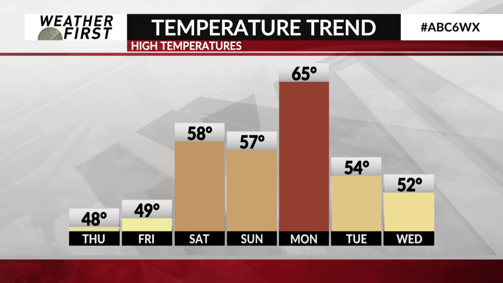
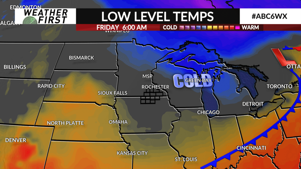
Friday the sun finally returns, but temperatures are going to struggle to recover much, with highs in the upper 40F’s for a majority of the Weather First area.
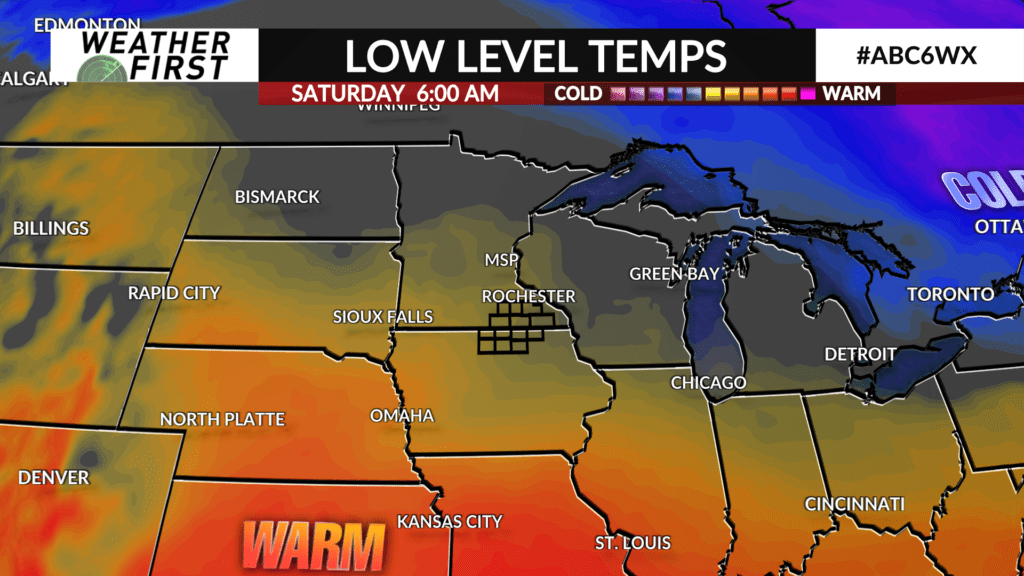
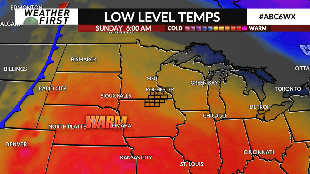
Saturday we see high temperatures rebound nicely, into the mid to upper 50F’s across southeastern Minnesota and northern Iowa. Even thinking we may see a few 60F’s, especially across our Iowa counties! These warmers temperatures stick around through the weekend thanks to southerly winds bringing warmer air northward from down south.
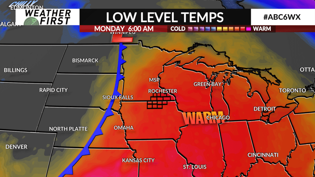
Monday is the warmest day in the extended forecast, with high temperatures in the mid 60F’s! Well above normal for this time of year!
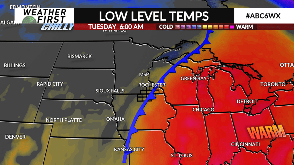
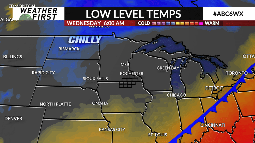
Heading into the middle of next week, another cold front tracks through the area, sending our temperatures back into the upper 40F’s to around 50F by next Wednesday, which is right around where we should be this time of year. Luckily with the cooler weather next week, the sun also returns!
For a majority of the extended forecast, temperatures are looking to be above average for this time of year despite the colder days here and there. With that said, the trend of warmer than average temperatures looks to continue for the foreseeable future!
