Rain chances return Sunday through early next week

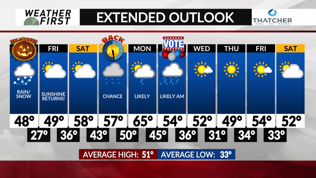
After the rain/snow makes its way out of our area this afternoon and into the evening, another rain chance will have our attention heading into the weekend.
An area of low pressure is expected to develop in a fairly similar position as this last area of low pressure did, in the foothills of the Colorado Rocky Mountains. It will gradually track northeast across the Great Plains and into the Upper Midwest through early next week.
There are still some uncertainty in timing and extent of any rain this weekend. Saturday will be dry across the area, with a good deal of sunshine throughout the day. Increasing clouds will certainly be possible later in the afternoon as energy in the upper levels of the atmosphere begins to track overhead.
Sunday the rain chances begin to increase, but again, there is uncertainty. Model guidance is split between the first round of rain making it’s way through Sunday morning, and the first round of rain not tracking into the area until at least Monday. With that said, going with odds that at least something will be in the area Sunday, so have a moderate chance of rain for now.
Monday and Tuesday will feature much higher chances of rain across the area, with an area of low pressure passing overhead. No snow is expected at this time thanks to well above normal temperatures through the weekend and early next week.
Pinning down rain totals is difficult at this time, but a steady, soaking rain is exactly what we need as of right now, especially with how dry we have been as of late.


