Thanksgiving Almanac 11/28/24

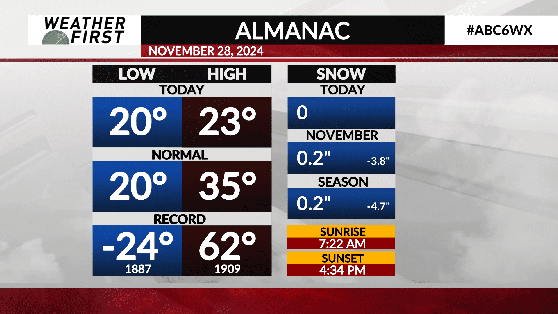
It was a fairly chilly day out there across southeastern Minnesota and northern Iowa, with even a few flakes falling here and there!
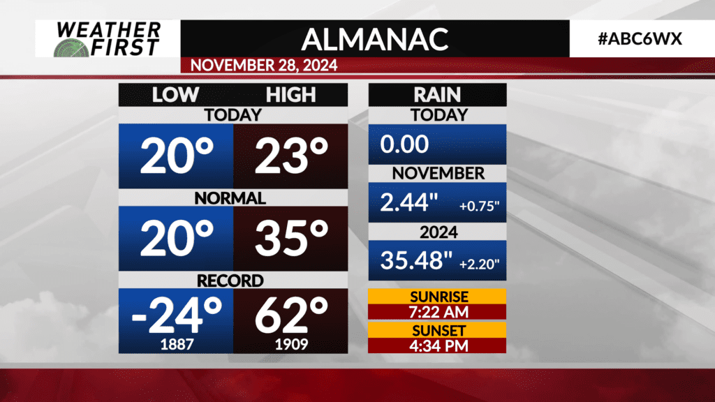
Highs only made it into the low 20F’s for most of the Weather First area, which is over 10F below the average high temperature for this time of year! The low this morning, however, was right where the average low is, at 20F.
We were far away from any records today, records that are quite impressive! The record high for November 28th is 62F, set back in 1909. The record low…yuck…was -24F set back in 1887. Thank goodness we were nowhere near THAT!
So far during the month of November, Rochester has only seen 0.2″ of snow, which is 3.8″ behind the monthly average at this time. A majority of Minnesota has seen more snow than here locally.
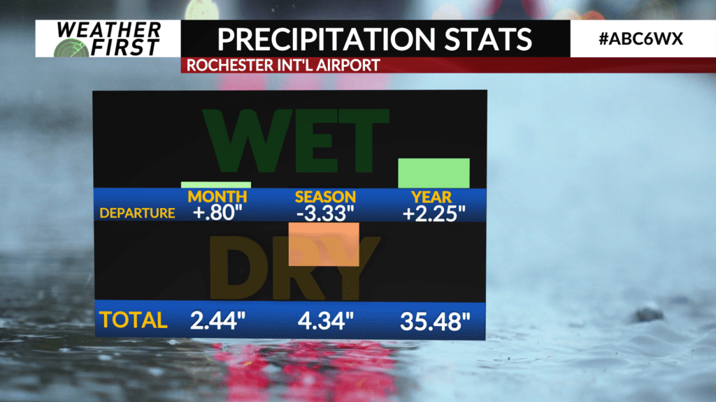
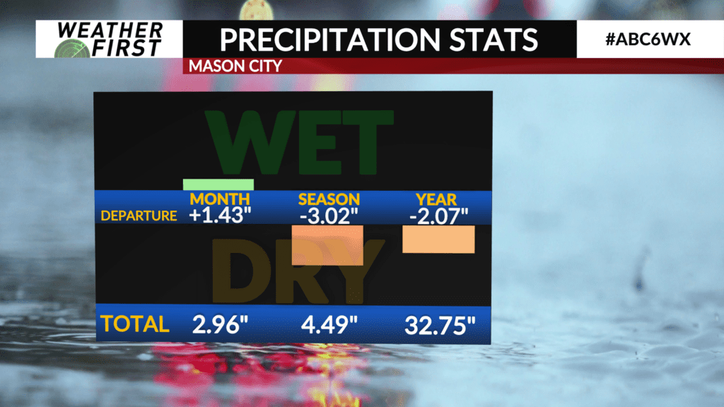
In terms of liquid equivalent precipitation, Rochester and Mason City are ahead of the game, Rochester by 0.8″ and Mason City by 1.43″. Both locations are still below average, however, when it comes to seasonal precipitation. Hard to make up for the lack of any precipitation during the months of September and October around here!
We are now in the final days of meteorological fall, with winter beginning this Sunday! With temperatures already behaving like it is the end of January/early February, it will be interesting to see what December brings!


