Warmer early next week, cold by weeks end

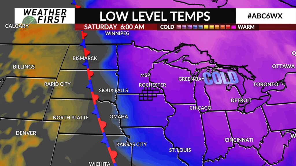
After plenty of cold weather this upcoming weekend, there will be a little bit of relief before the next round of cold moves in!
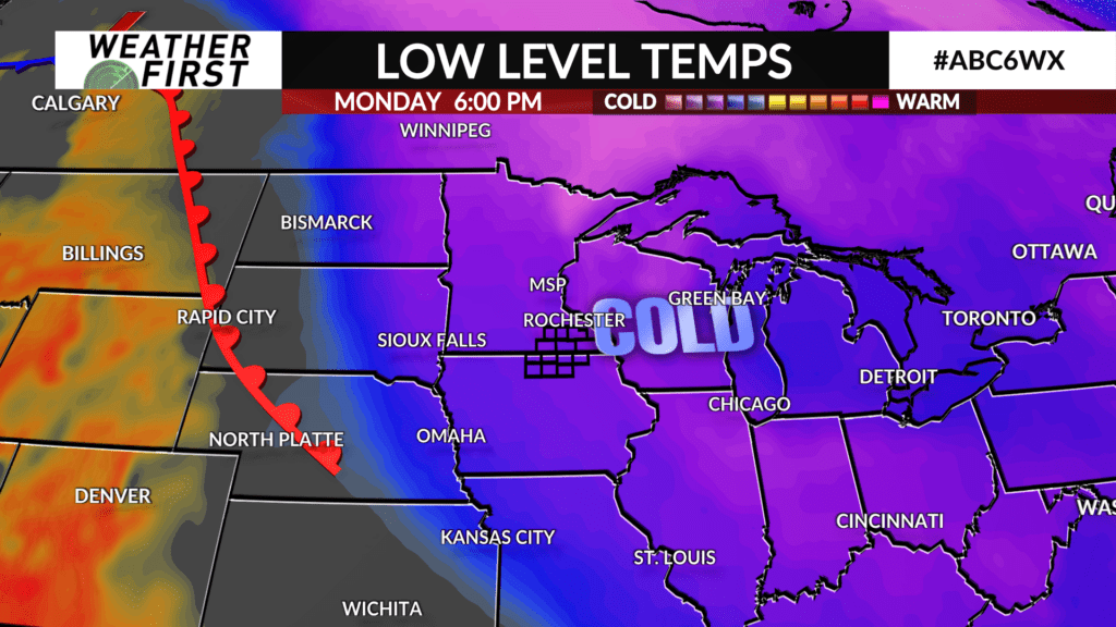
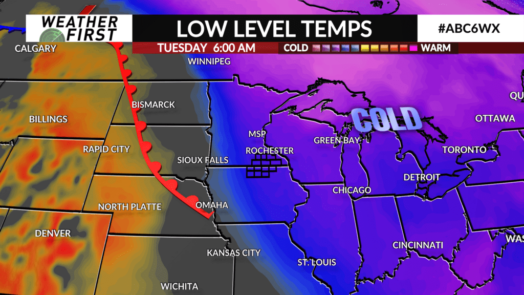
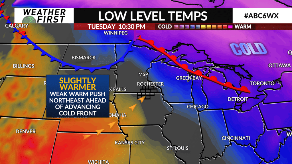
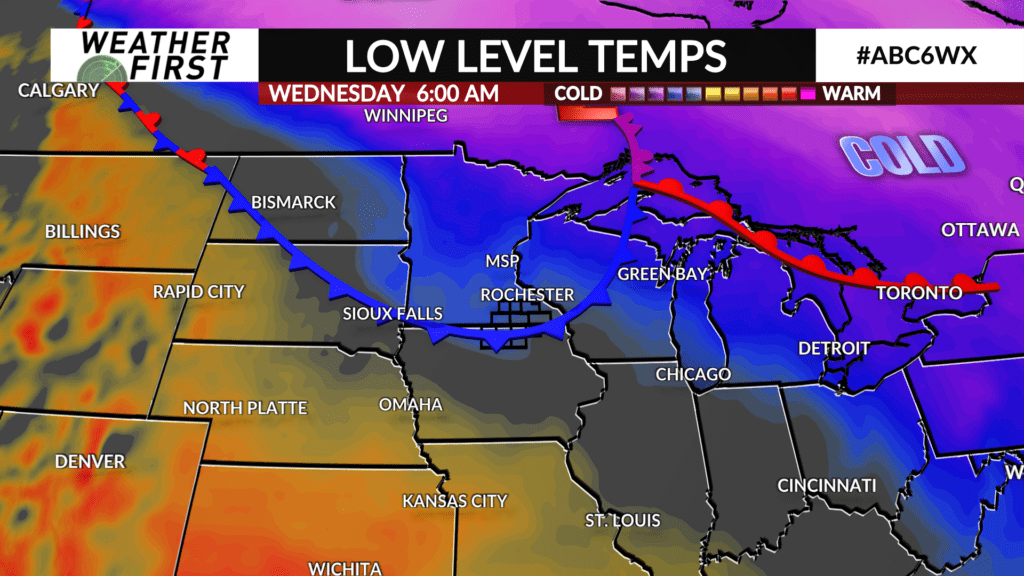
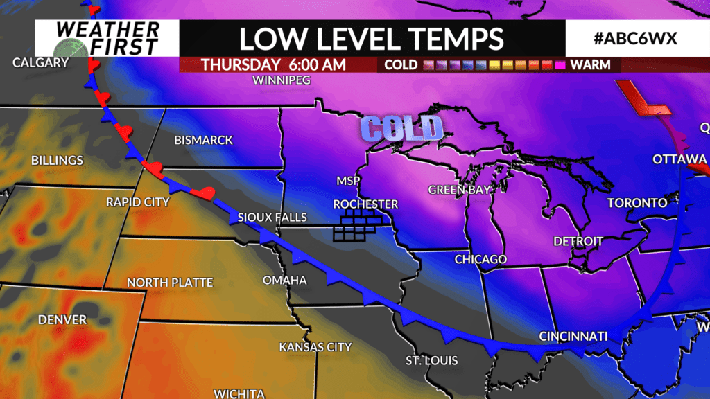
A warm front will develop well to our west Monday, and will gradually make its way in our direction Tuesday and into Wednesday. Temperatures gradually warm up across southeastern Minnesota and northern Iowa as a result, before cooling down sharply once again toward the end of next week.
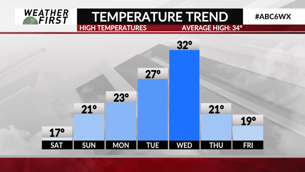
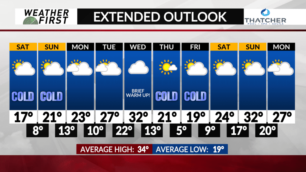
Highs Monday will reach into the low to mid 20F’s, which is still a good 10F below the long term average for this time of year. We warm up a little bit more on Tuesday, with highs temperatures in the mid to upper 20F’s. Still below average, but much better than highs in the teens!
Wednesday could well be the warmest day of the extended forecast, with highs in the low 30F’s across the Weather First area! This will depend on timing of the cold front, however. If the cold front passes through Wednesday morning, temperatures will likely not make it out of the 20F’s. If the cold front doesn’t pass through till later on Wednesday, then highs in the 30F’s are a good possibility.
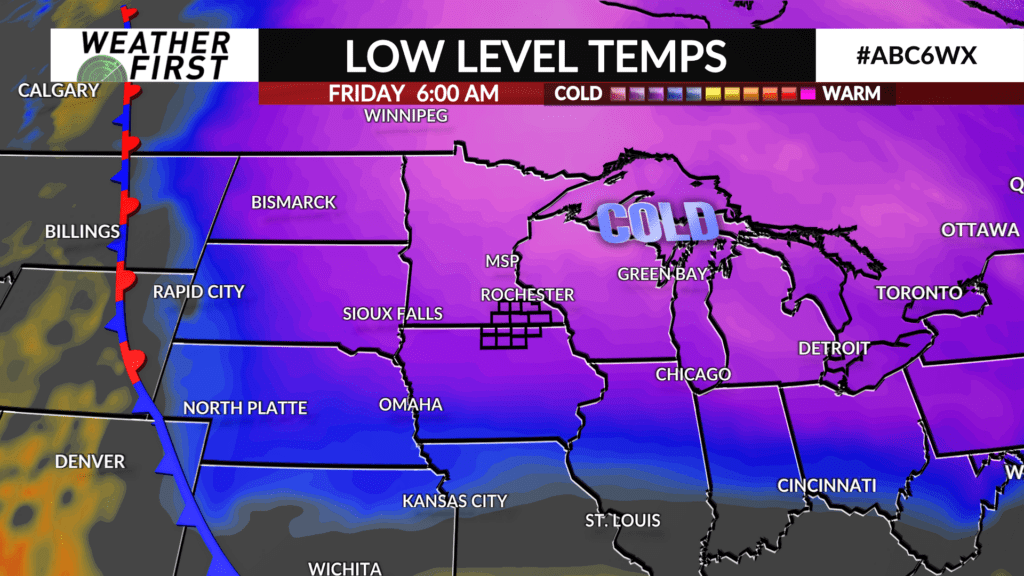
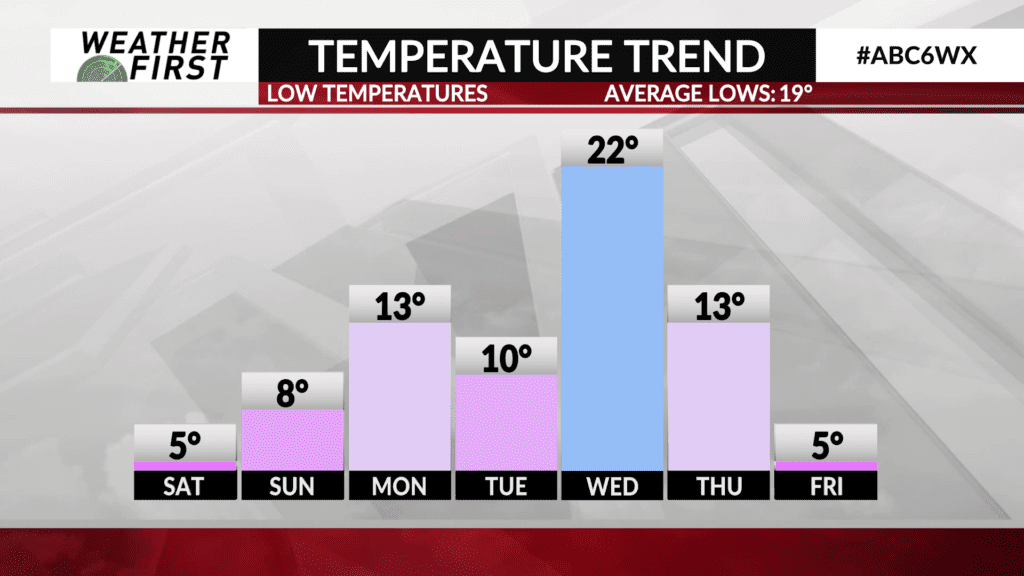
Once the cold front passes through, temperatures drop once again into the low 20F’s for highs on Thursday and upper teens to lower 20F’s for Friday. Overnight lows will once again bottom out in the single digits Thursday and Friday night.
There are signs temperatures begin to warm up again next weekend, but with such a long time until then, it’s hard to pin-point exactly what things will look like across the Upper Midwest, so we’ll hold our breathes on the warm up for now!
