An arctic blast is on the way with a side of Wednesday morning snow
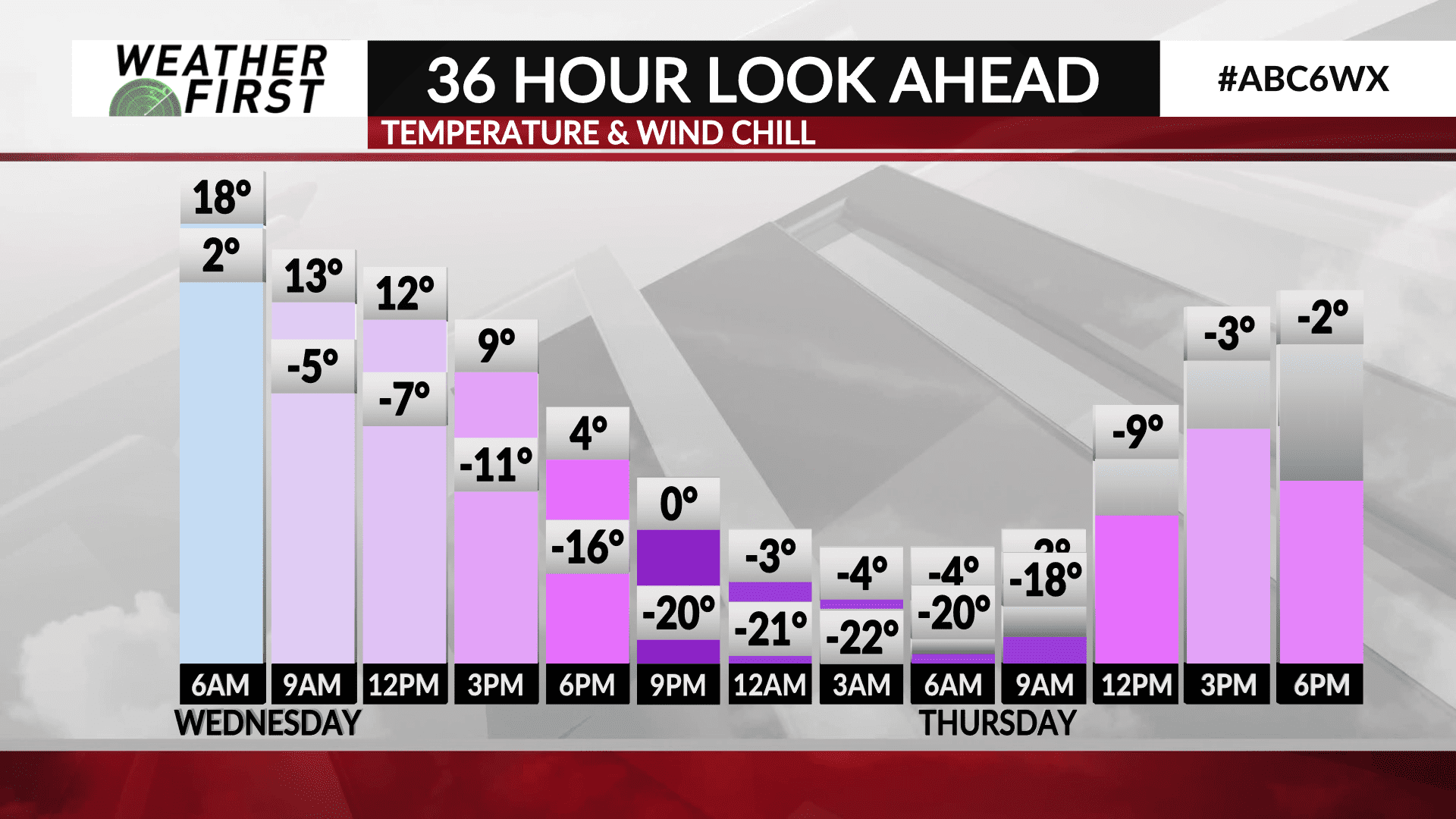
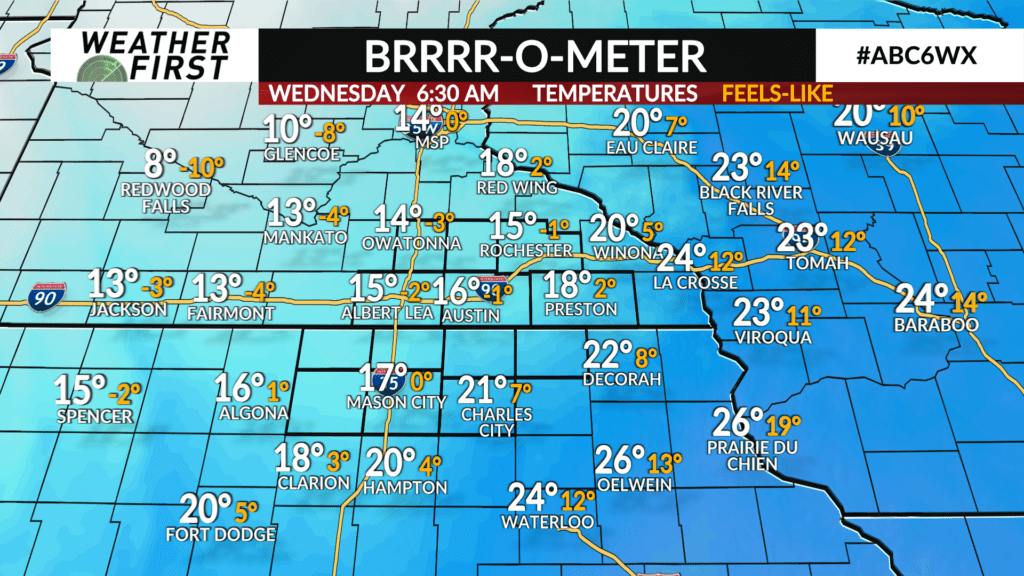
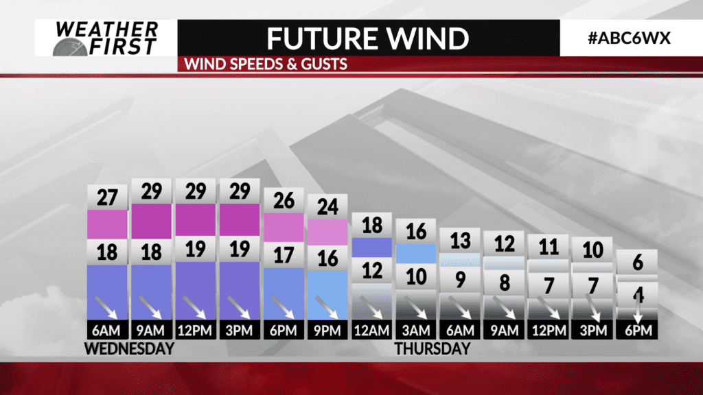
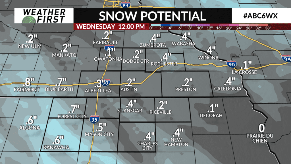
Some big changes are ahead for the middle to the end of the week. Snow will be developing in spots overnight into Wednesday morning. Amounts will be minimal, mainly around or less than a half inch. However, combined with wind and more cold air, there will likely be some impact on roads across northern Iowa and southern Minnesota.
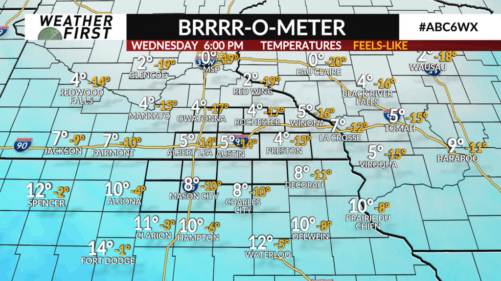
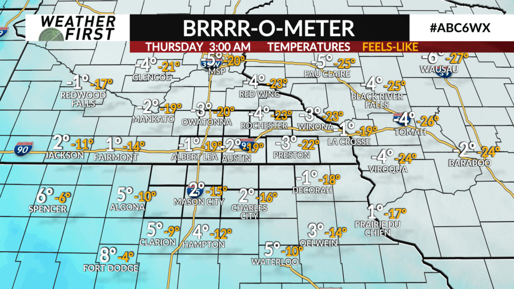
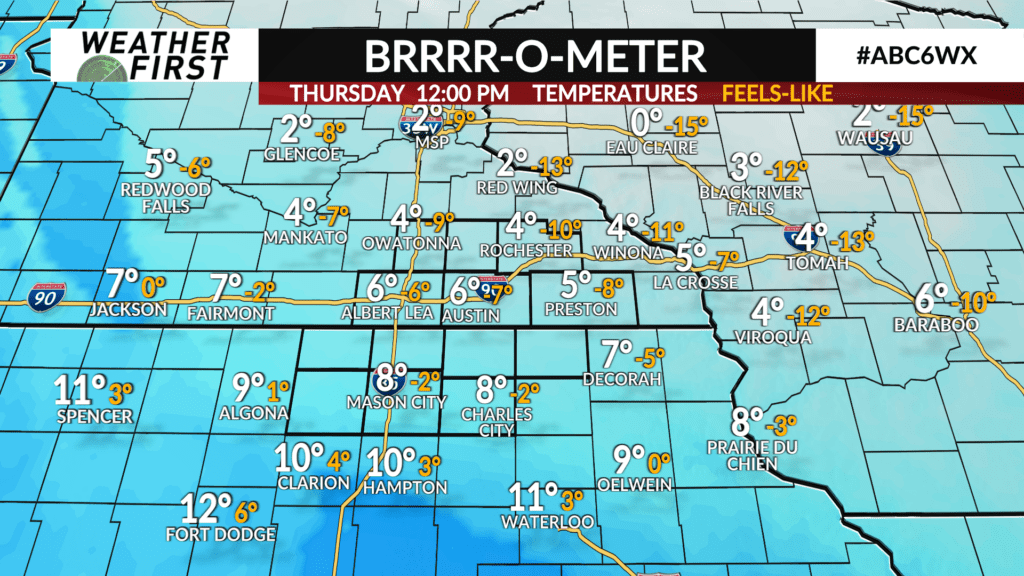
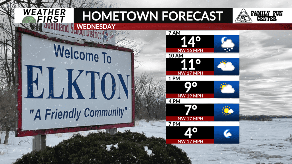
Temperatures will be dropping tonight, and will continue to drop through Wednesday into Thursday morning. By Wednesday afternoon, temperatures will be in the single digits, and by Wednesday evening, wind chills will be as cold as -20°.
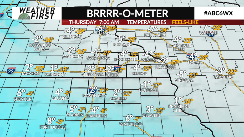
This will be followed by a frigid Thursday with sub-zero low temperatures and highs in the single digits.
