Colder by weeks end

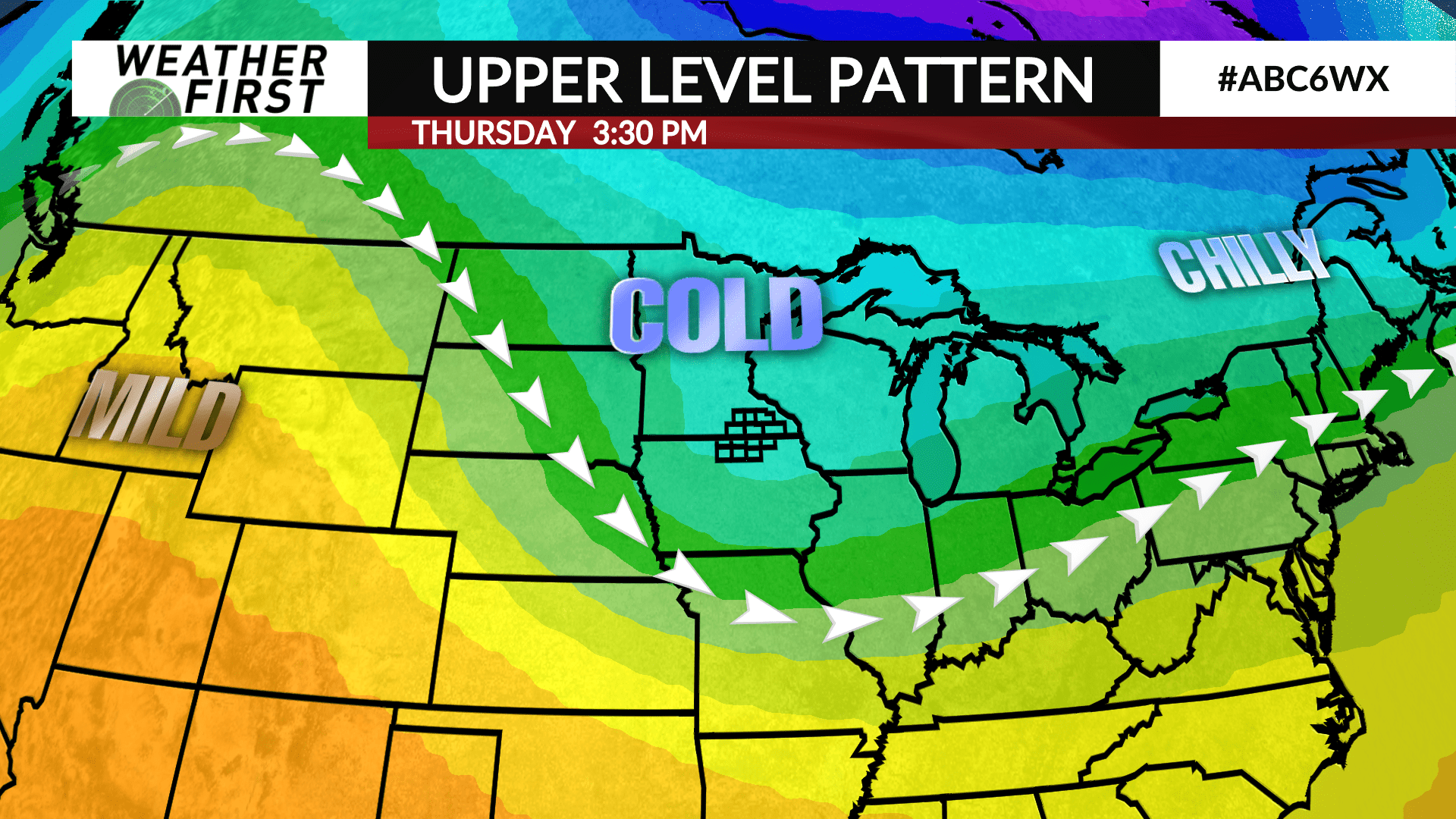
We have been pretty spoiled, with more mild temperatures across our area the last 2 days. This mild stretch is going to come to a gradual end throughout the week, with much colder air arriving for the weekend.
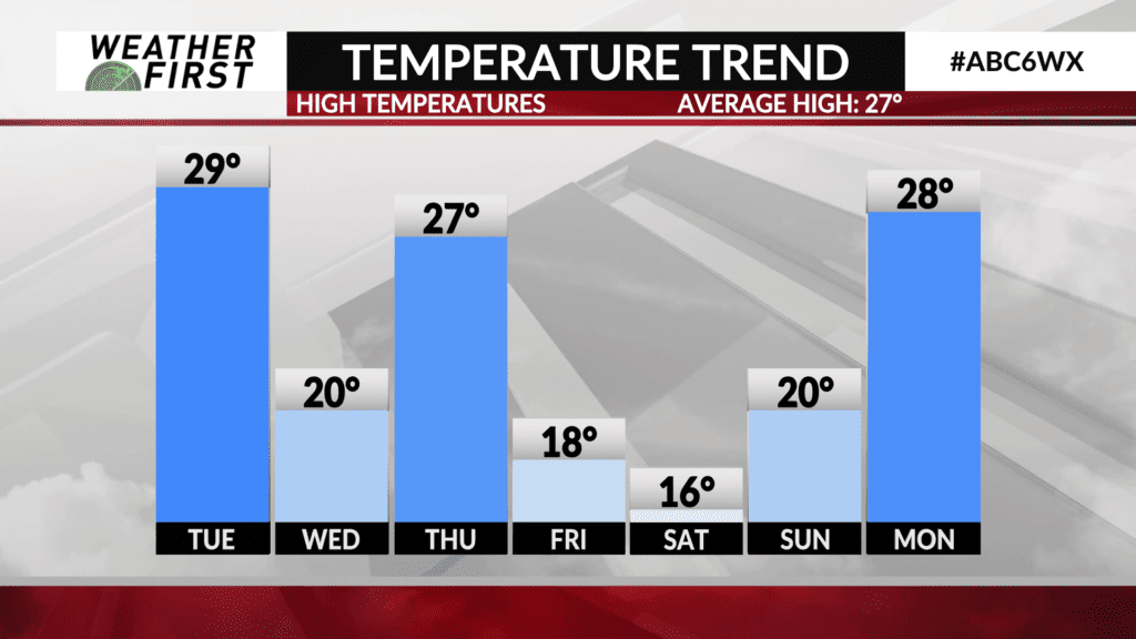
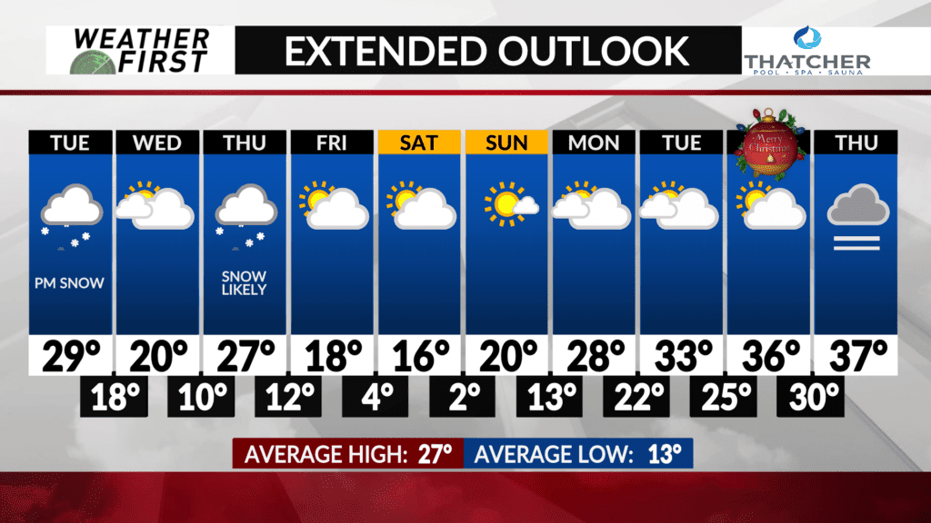
High temperatures Tuesday will be about 10F colder than they were today, in the upper 20F’s to lower 30F’s across the area. Still above average for this time of year, but cooler than the last few days.
An Alberta Clipper swipes through Tuesday afternoon into Tuesday evening, with colder air on its heels. Highs will struggle to reach 20F for some Wednesday afternoon with the fresh blanket of snow and air streaming down from the northwest.
We warm up slightly on Thursday as another Alberta Clipper swings through, but with added snow on the ground and northwest winds behind the system, much colder air is expected to stream southeastward Thursday night into Friday.
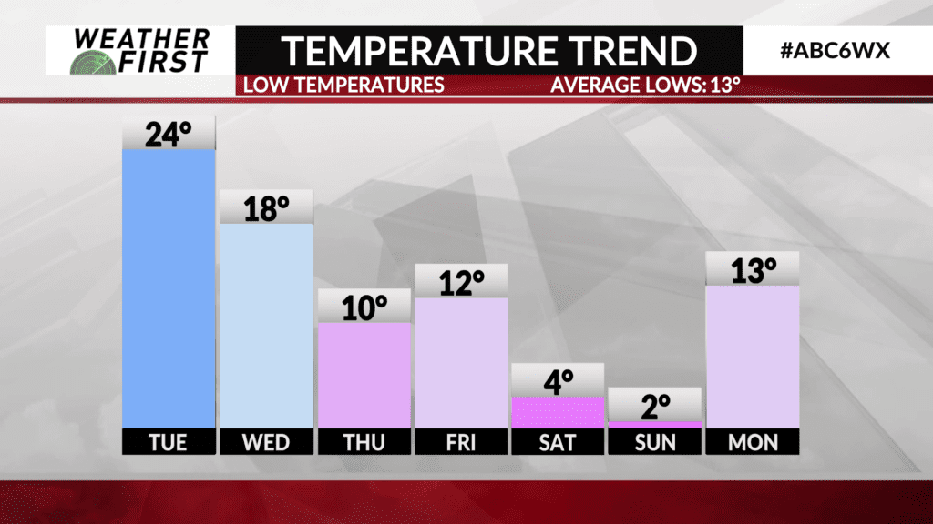
Highs will struggle to reach 20F Friday, with some locations not making 20F at all. Overnight lows Friday night into Saturday morning will be in the single digits. High temperatures on Saturday only make it into the mid teens for most of the area, with Saturday night lows in the low single digits to near 0F. BRRRRR
Temperatures begin to rebound on Sunday, with a high near 20F and lows in the low teens Sunday night into Monday morning. A more mild airmass may enter the Upper Midwest for the beginning of next week, bringing the eventually return of highs in the 30F’s across southeastern Minnesota and northern Iowa. High temperatures may even be into the mid to upper 30F’s by Christmas!
Hopefully the more mild temperatures early next week do not spoil our chances at a white Christmas after a few rounds of snow later this week!


