Accumulating snow likely Thursday, colder air to follow

Chief Meteorologist Randy Brock
The next storm system to affect the region will be moving in late Wednesday night to early Thursday morning. Snow will begin to fall between 3 AM-6 AM Thursday morning and mainly light snow will continue through the afternoon into the early evening.
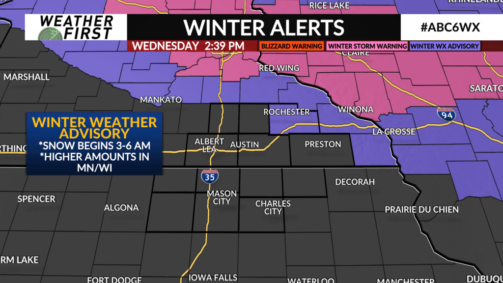
Snowfall totals will vary from southeast Minnesota to northern Iowa. While some parts of southeast Minnesota will receive around 3 inches to isolated 4 inch totals, amounts in north-central Iowa look to remain around a trace up to an inch. Just to our north, around the Twin Cities and west-central Wisconsin, snowfall totals will be closer to 6 to 7 inches.
Here is a look at headlines issued by the National Weather Service.

Snow will taper off late Thursday afternoon, coming to an end Thursday evening.
Colder, arctic air will move in behind this clipper, keeping highs in the upper teens to lower 20s from Friday through Saturday.
Temperatures start to moderate Sunday, and highs return to the 30s through next week. By Christmas Day, highs will be back above the freezing mark.
If we can get a decent accumulation of around 3 inches, there is hope that it will linger through Christmas Day before gradually melting away later next week.