Snow likely this weekend with a shot of Arctic air early next week
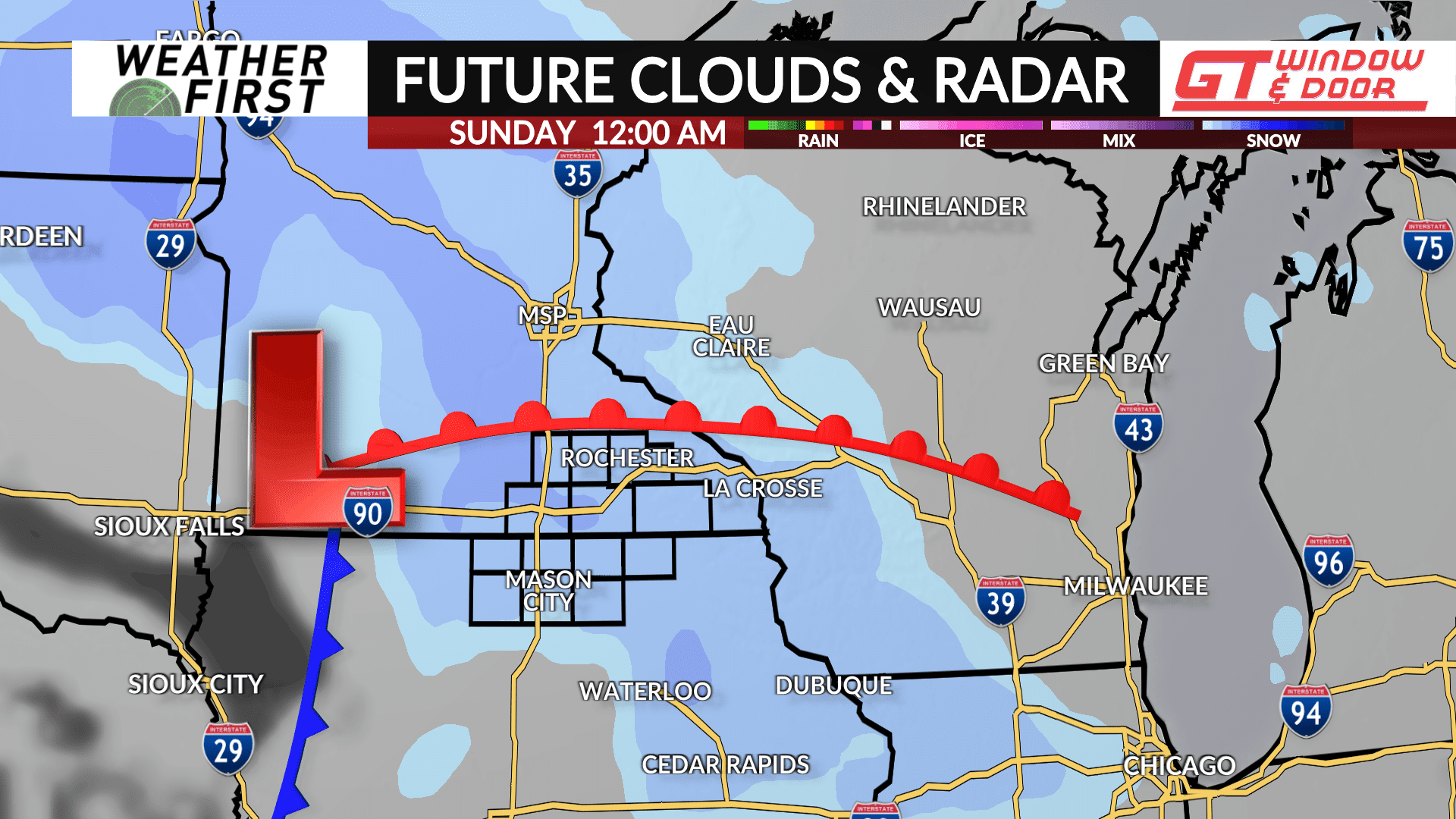
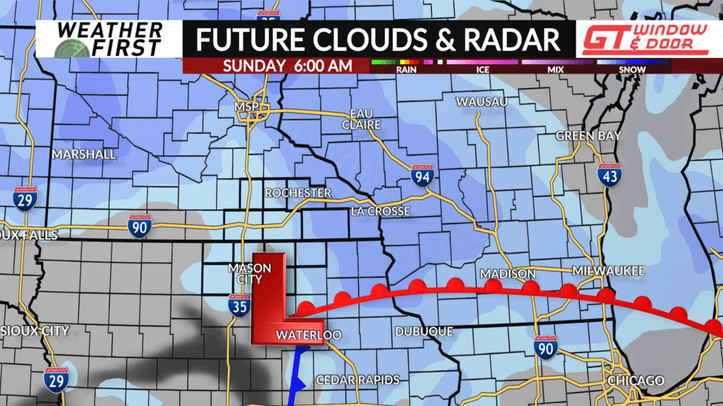
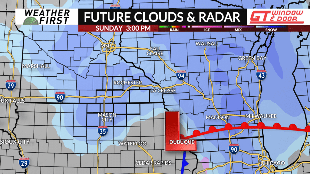
A clipper system will dive south from Canada and pass through the region this weekend with snow likely across the Weather First area followed by a brief blast of Arctic cold.
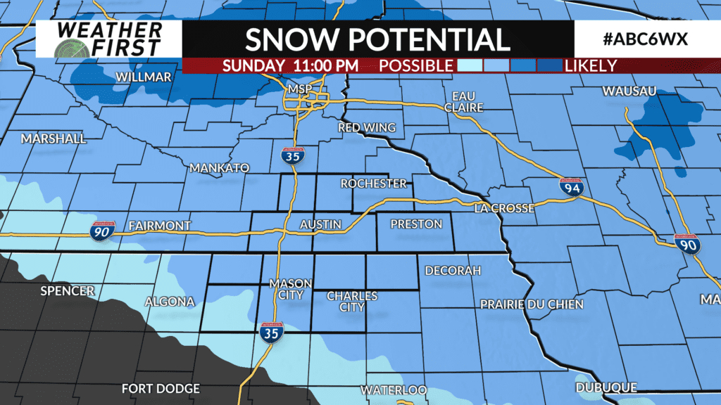
The track and overall timing of the system is still uncertain, but snow will be possible sometime late Saturday night with snow showers likely continuing into Sunday.
This system will have some moisture to work with and will be a bit more potent with snow accumulations looking likely as it passes through. Much of the area may pick up 1″ with some places likely seeing around 2″ or more. The amounts and where will become clearer in the days ahead once the track of the system gets narrowed down.
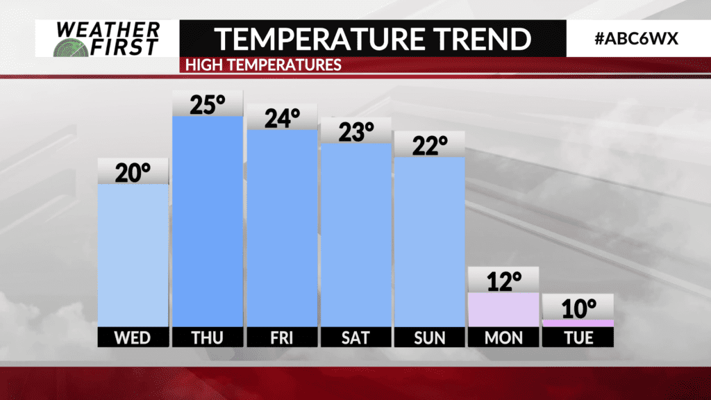
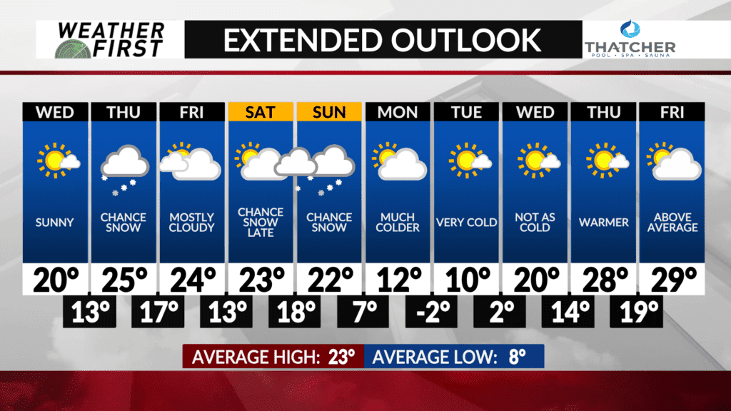
Temperatures will be hovering near-average for early January with highs in the lower-to-middle 20s both Saturday and Sunday.
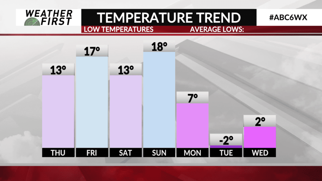
Behind the system, some Arctic air arrives heading into next week with highs in the single digits and teens and night lows may dip below-zero by Tuesday morning.
