Why the roads were so icy Sunday morning
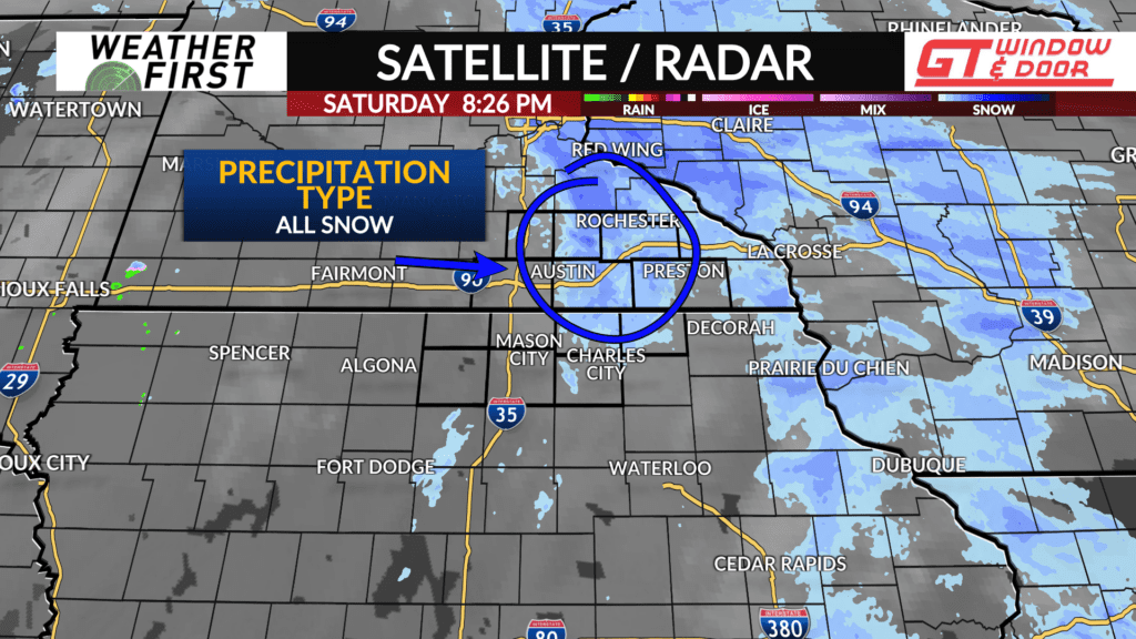
Sunday morning brought a highly unpleasant surprise to portions of our area, ice. A coating of ice was on the roads, sidewalks, cars, and trees. The only culprit for such a coating would be freezing rain/mist, but with the colder temperatures and falling snow Saturday night, how could this be?
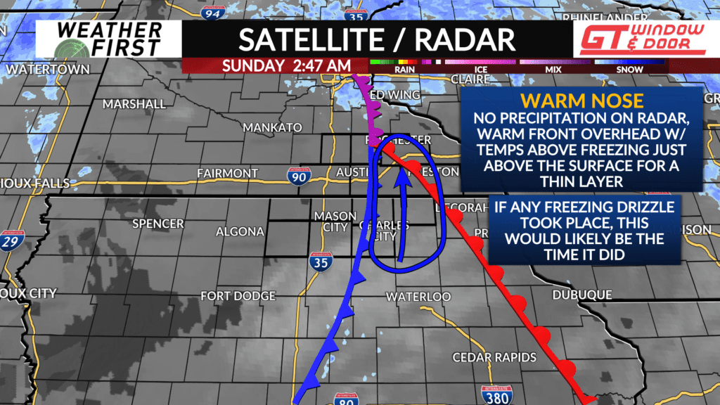
There are multiple factors that came into play late Saturday night into early Sunday morning that lead to the unexpected freezing fog/mist. The first factor was the placing of the warm front. Uncertainty remained on just how far north the warm front would track, thus having an impact on how far north warmer air could reach.
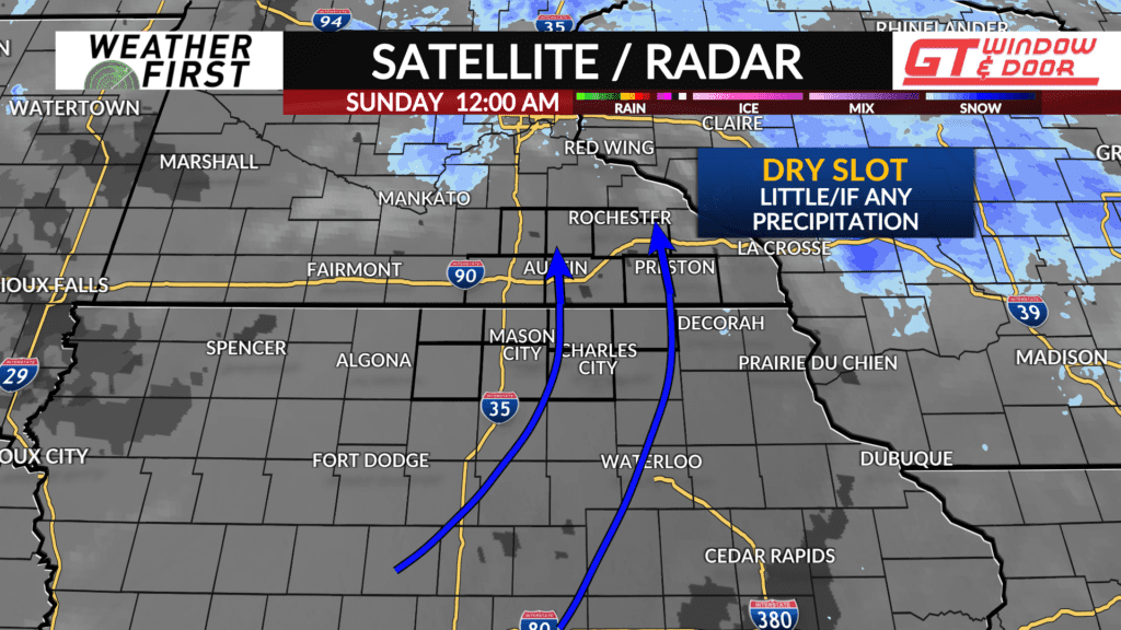
Another factor included the amount of dry air in the area. While widespread significant precipitation was not able to manifest thanks to dry air, there was enough moisture closer to the ground for fog/mist to form.
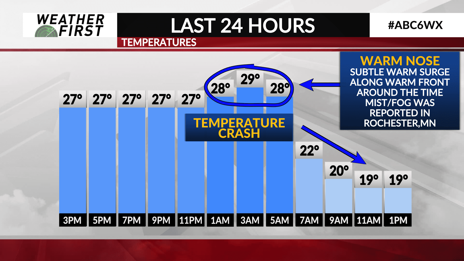
Last night, the warm front passed near/over Rochester, MN around 1AM, sending temperatures a few degrees higher, to around 29F by 3AM. Along the warm front, temperatures typically increase slightly above the surface. This would place temperatures last night just above the surface around the freezing mark.
These temperatures allowed light mist to fall in the form of liquid between 2AM and 5AM, which then froze thanks to those below freezing surface temperatures.
The thermometer then tanked around 6AM-7AM once the cold front passed through the area, leading any unfrozen precipitation to freeze quickly. This resulted in a flash freeze on many surfaces, and very icy conditions on roads.
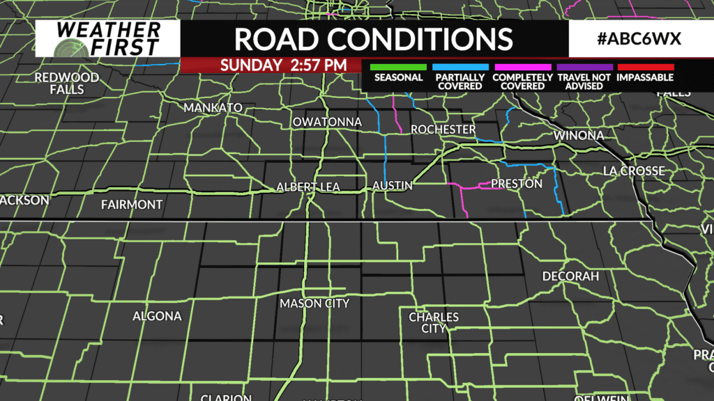
The good news is, road conditions have improved across southeastern Minnesota today, with only a few roads being reported as partially covered in snow/ice by MnDOT.
However, neighborhood roads and parking lots could well continue to be icy through tonight. Make sure to be extra cautious of any slick spots to prevent your car from sliding!
