Active, cold pattern leading to below average temperatures and another shot of snow Wednesday
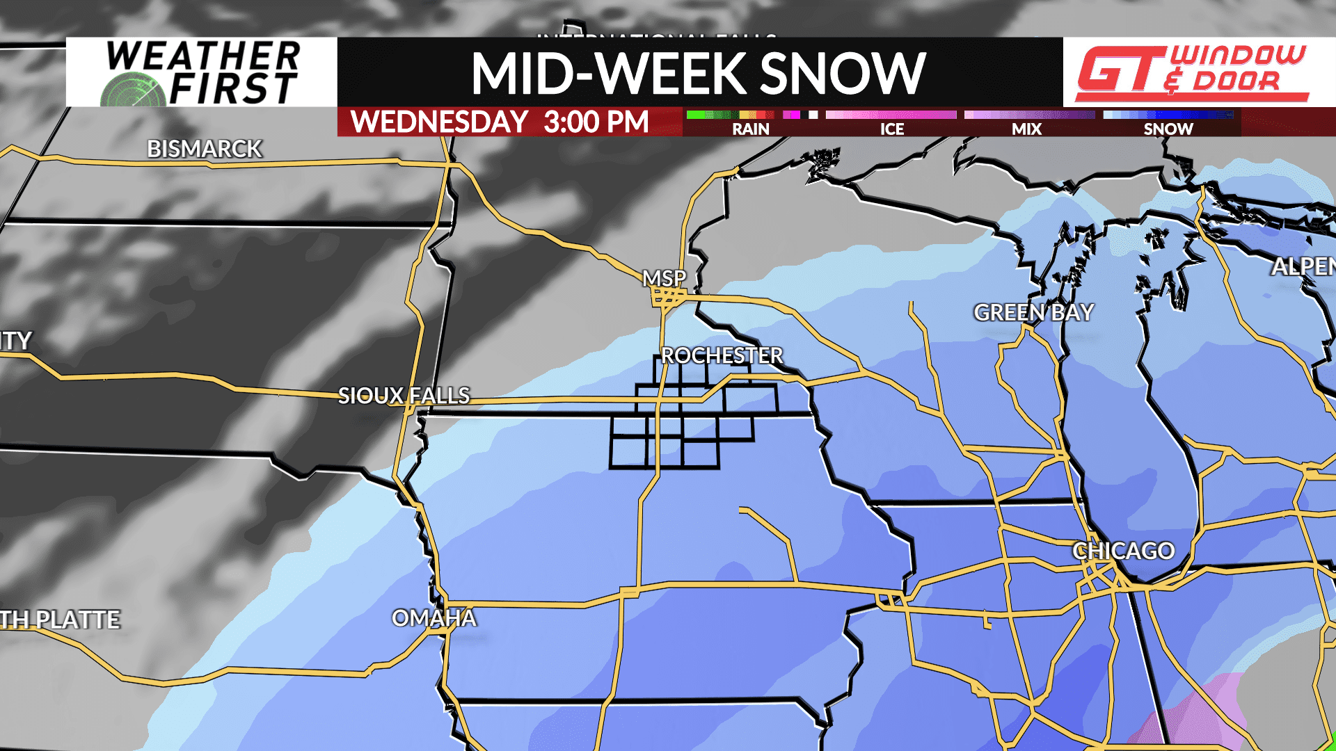
Cold air staying put all week long is a certainty. The storm track is a bit more uncertain, but from Sunday night’s perspective, there are two more opportunities at accumulating snow this week. The first arrives Monday afternoon to evening. The second arrives Wednesday.
Snowfall totals from both systems, assuming everything remains on track, will be relatively minor, at least in southern Minnesota and northern Iowa. However, both waves look to bring enough snow to keep snow removal crews busy and our landscape remaining snowy. Wednesday’s storm system should deliver higher accumulations to southern Iowa, much of Illinois, and southern Wisconsin.
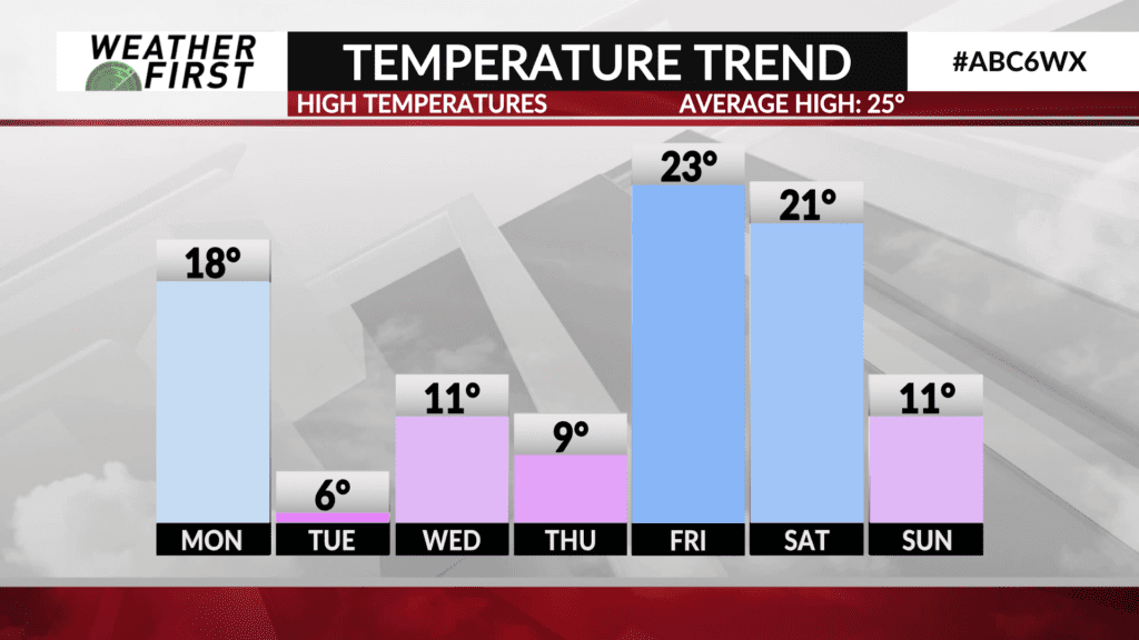
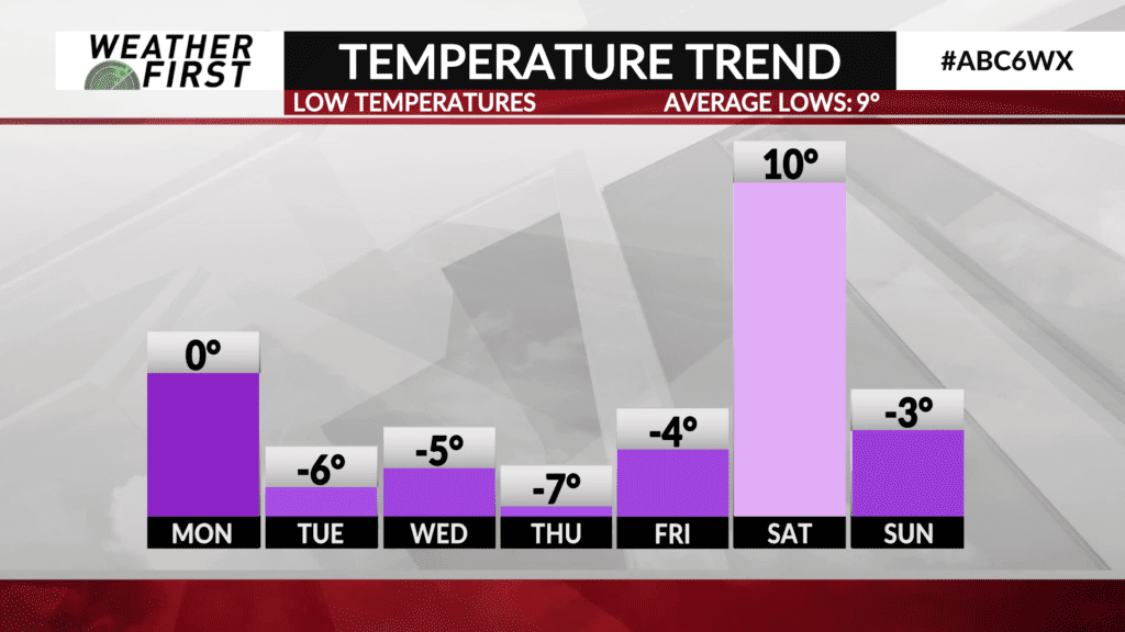
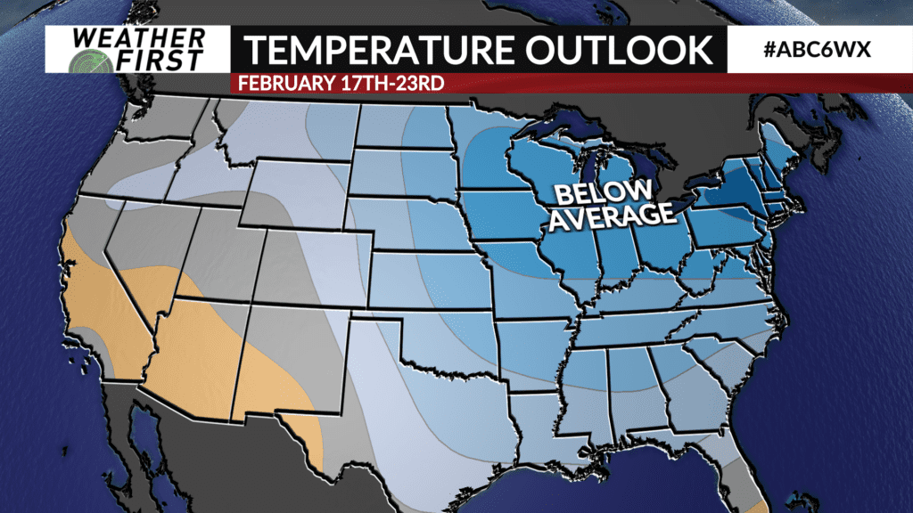
Below average temperatures look to continue through the 3rd week of February with little exception.