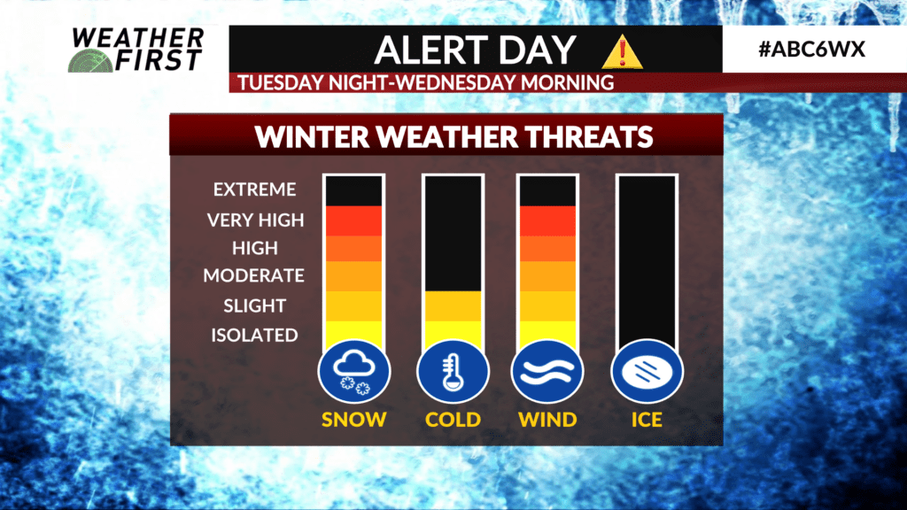
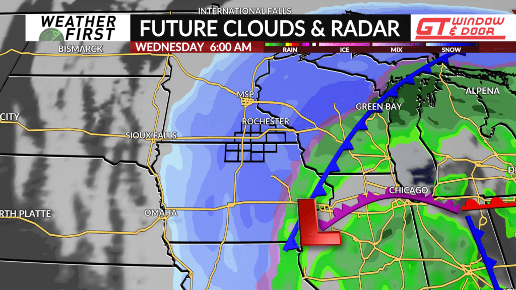
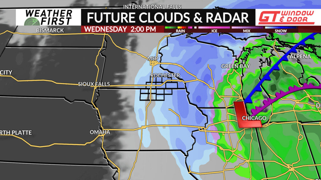
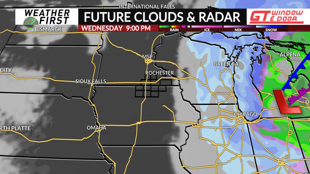
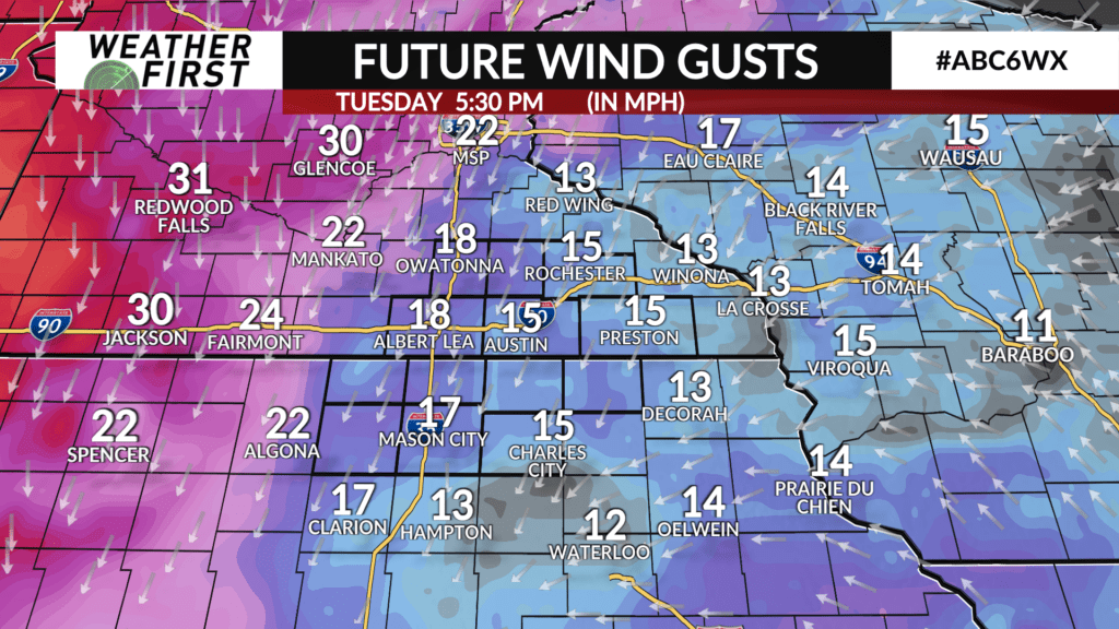
ALERT DAY: Tuesday night-Wednesday. Rain turns to heavy snow combined with strong wind
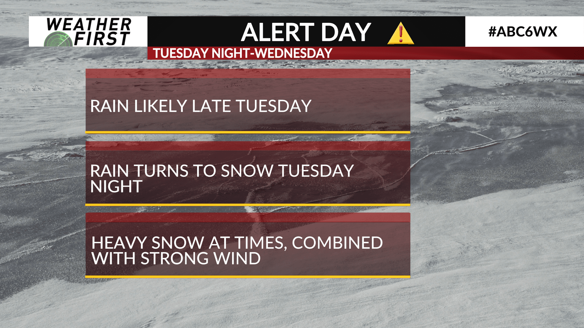
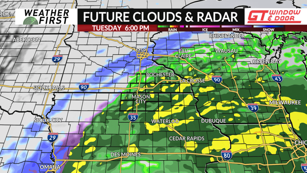
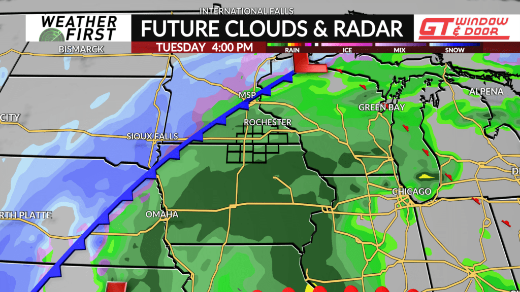
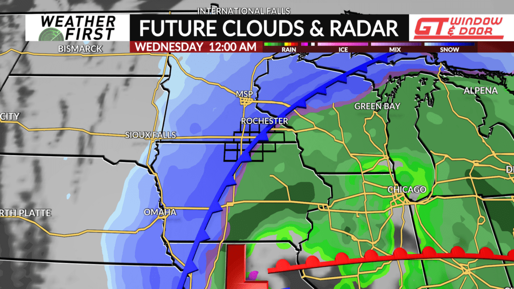
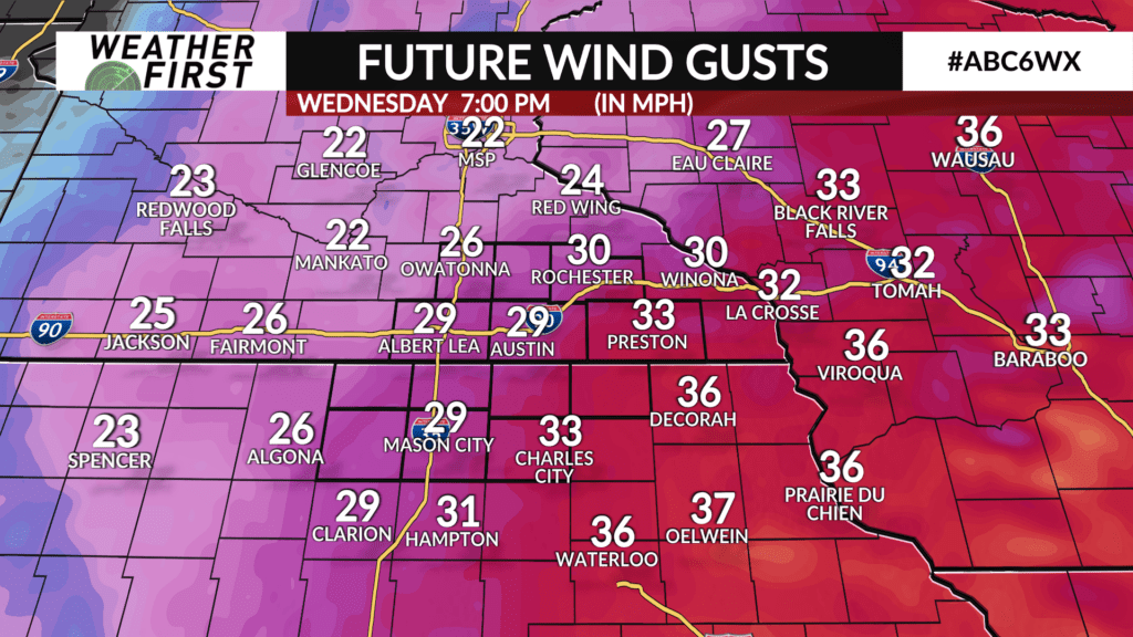
A strong, late season storm system will begin to affect southern Minnesota and northern Iowa this coming week. The primary time frame for significant impacts on us will be from Tuesday night through Wednesday morning. Snow will continue into Wednesday afternoon, but will be tapering off gradually from west to east.
Snowfall totals with this storm system are still uncertain, but there is growing consensus for the potential of more than 6 inches of snow for at least some of us in southern Minnesota and northern Iowa.
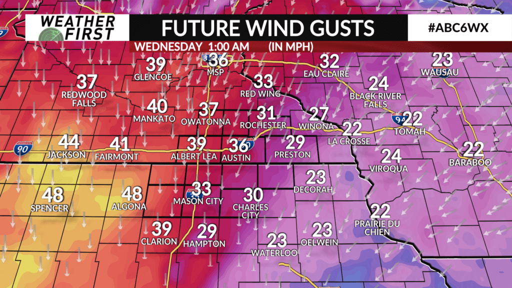
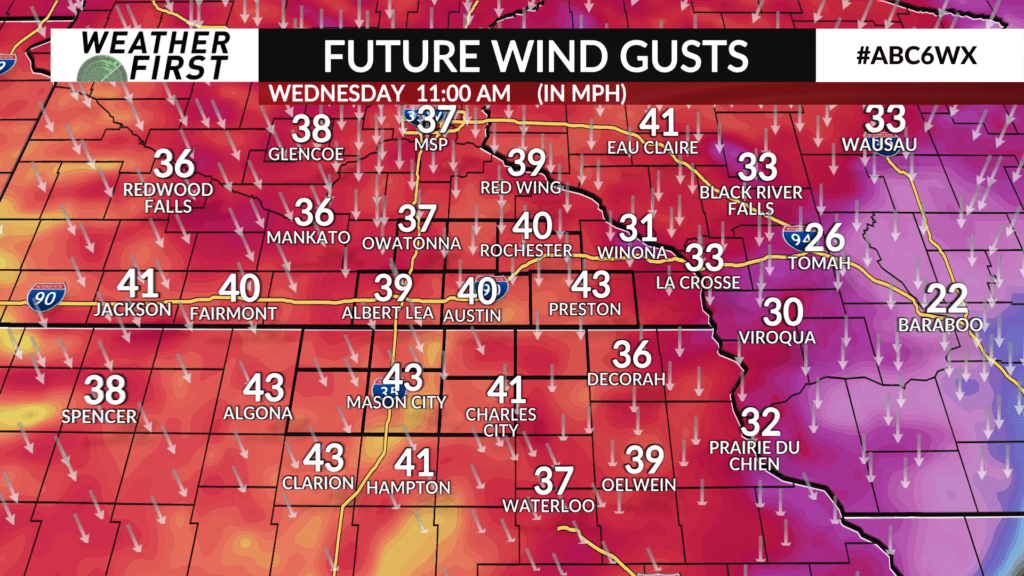
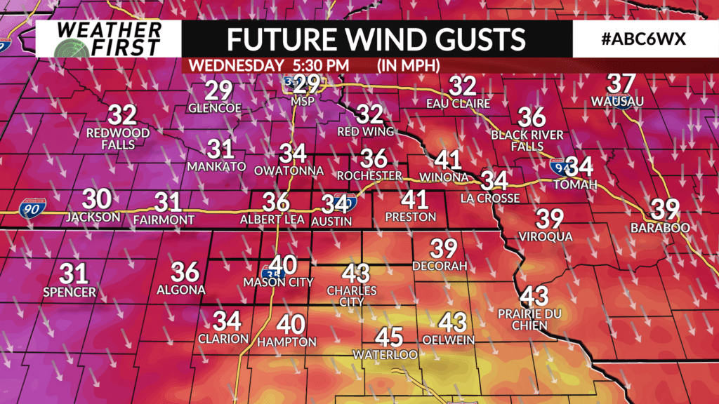
In addition to the development of heavy snow Tuesday night, winds will become especially strong very early Wednesday morning through the afternoon. Wind gusts of 40-45mph appear likely.
Travel will become difficult to hazardous Tuesday night through Wednesday.