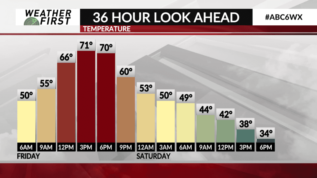
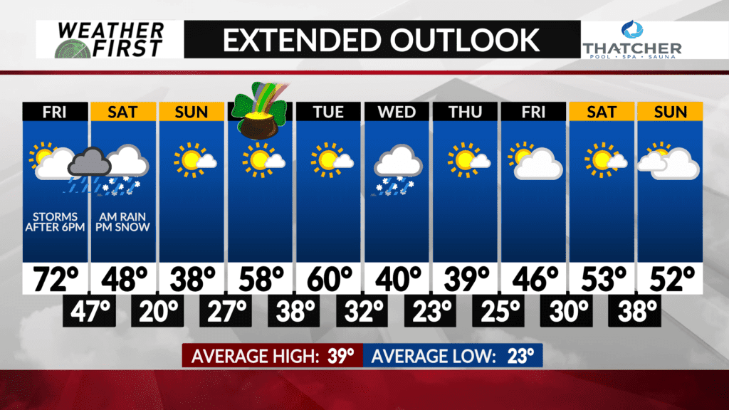
Even warmer Friday, late Friday storms, colder and gusty Saturday
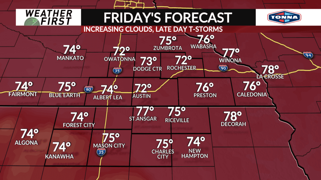
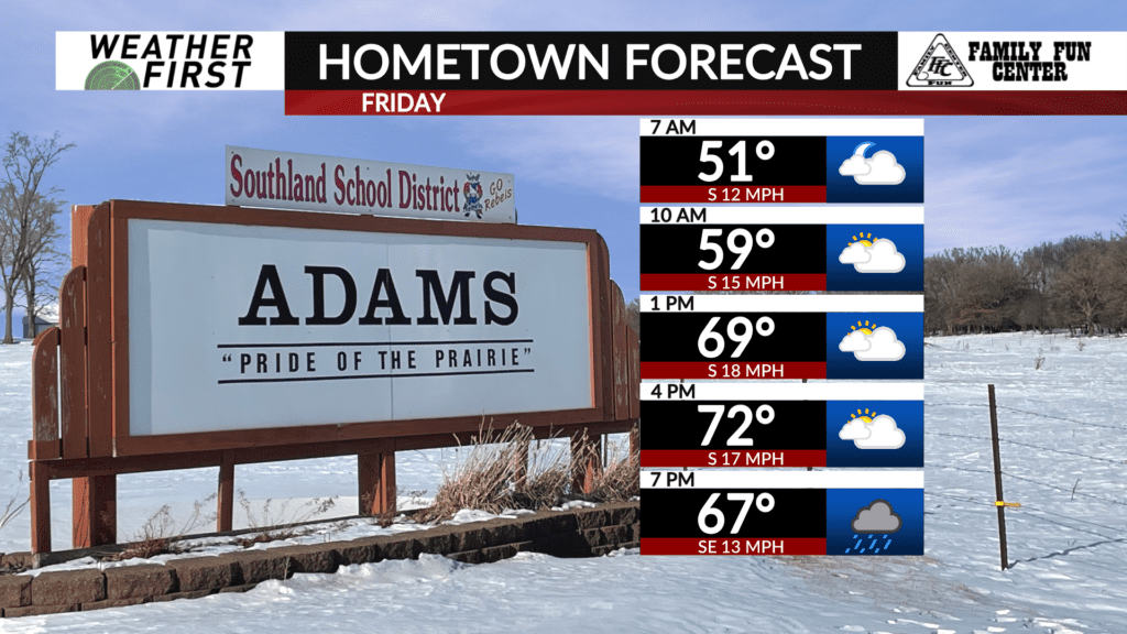
We’re in for a little weather whiplash from Friday into Saturday. With a storm system approaching from the southwest, temperatures will get another boost Friday. Highs will make it into the 70s Friday afternoon, even with an increase in cloud cover.
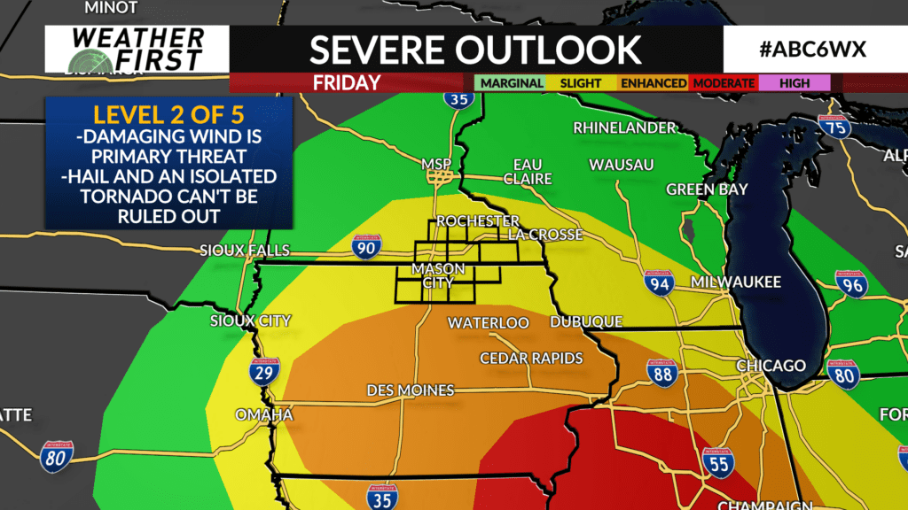
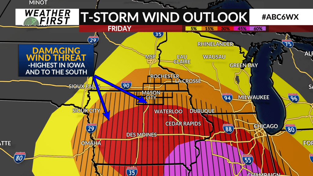
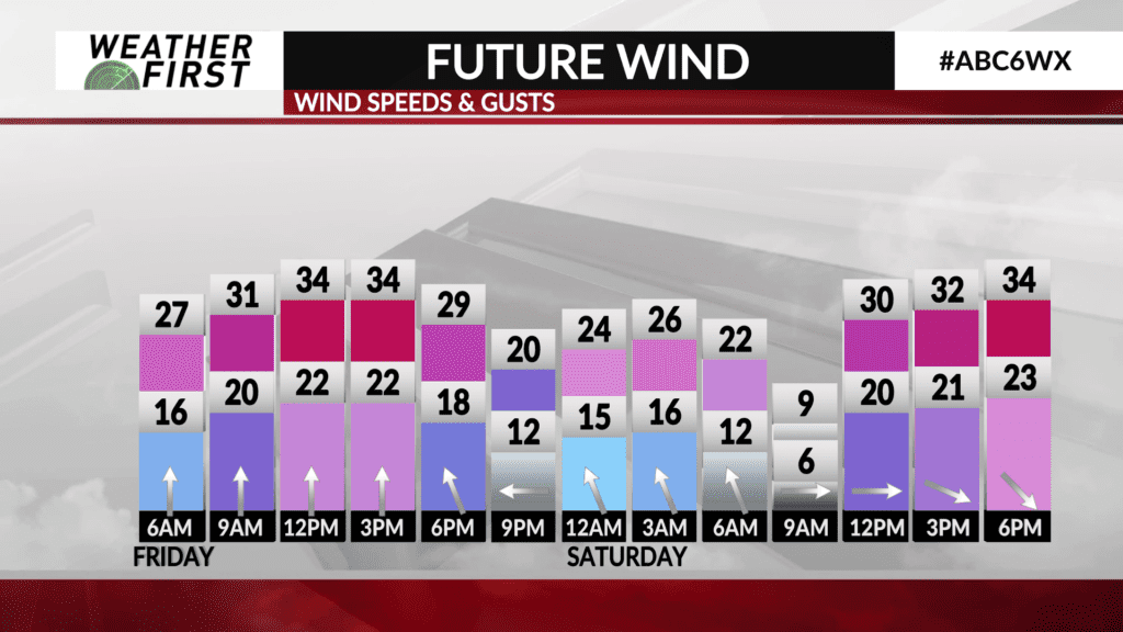
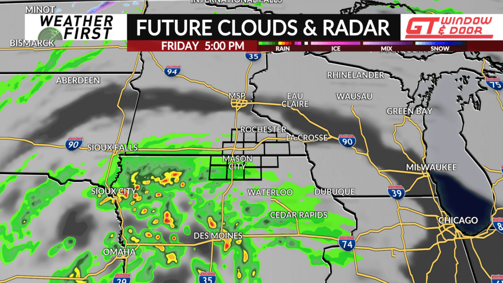
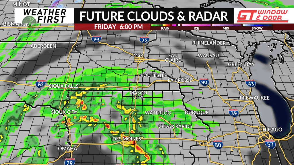
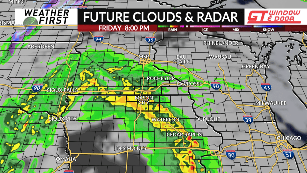
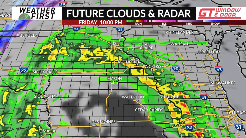
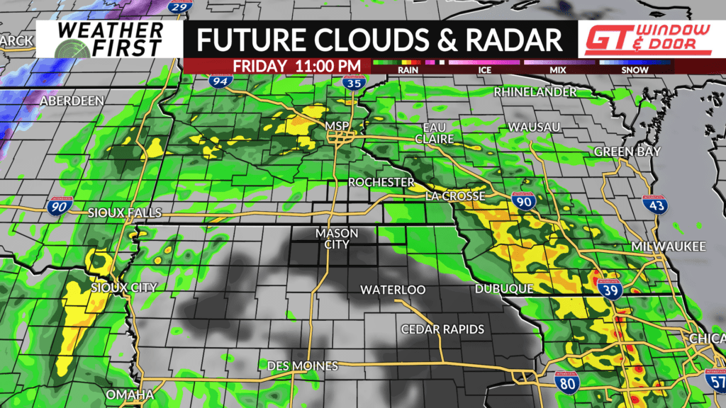
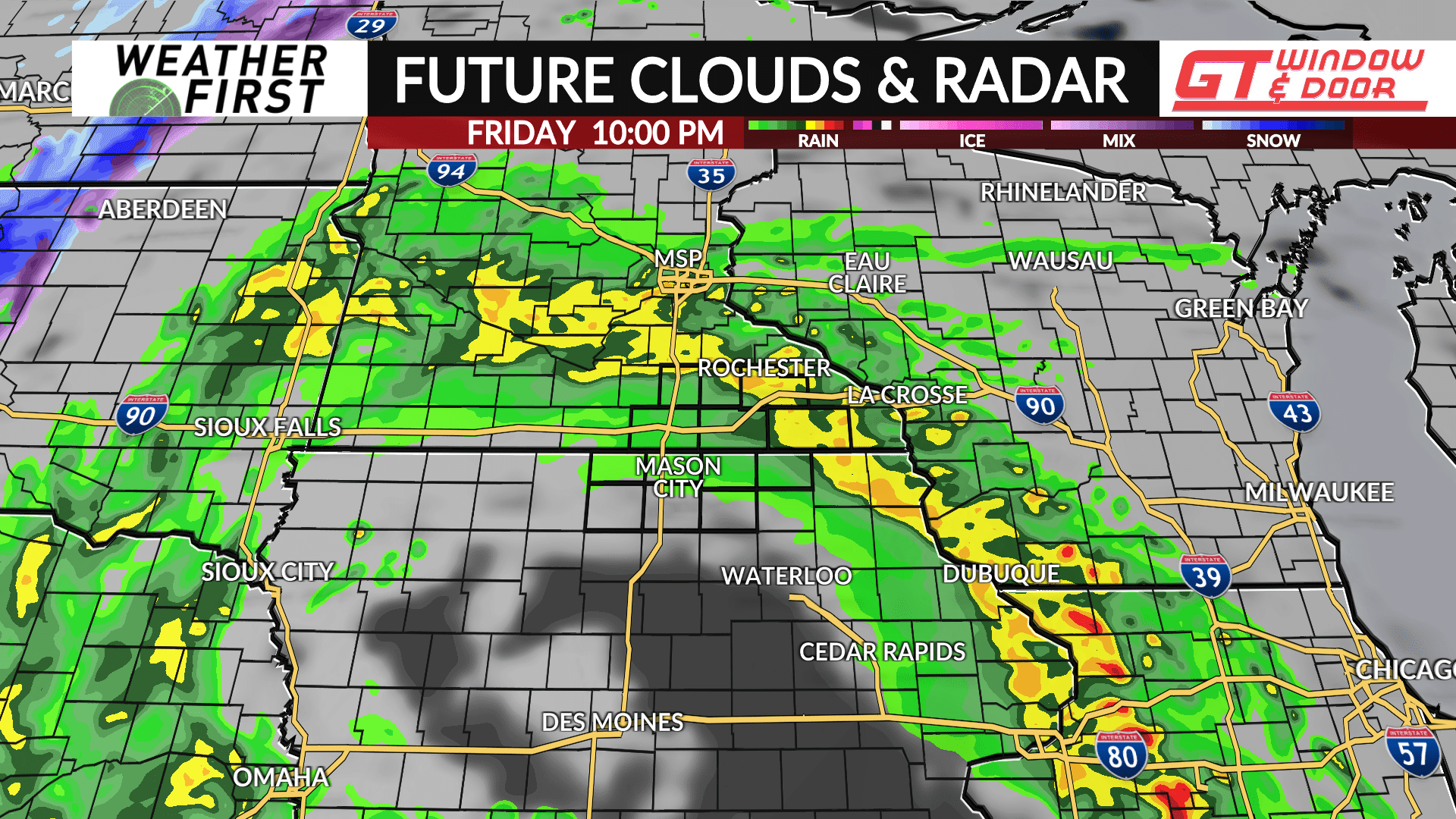
Thunderstorms will develop to our southwest Friday afternoon and move through north Iowa and southern Minnesota from 6 PM to 11 PM Friday evening. Some of those storms could be strong to severe with damaging winds the primary threat.
Cooler air will begin pouring in behind that storm system on Saturday. While we’ll see some lingering rain Saturday morning, it will be cold enough in the afternoon to evening for some snow showers to join the mix.