Winter storm potential growing for Wednesday
We continue to watch chances increase for a powerful winter storm to impact portions of our area Tuesday night into Wednesday, but the exact details are far from certain at this time.
Our area will remain dry through the day on Tuesday, but cloud cover will begin to increase as an area of low pressure approaches from the southwest. By Tuesday night, a narrow, semi-stationary boundary will serve as a focus point for the convergence of cold/dry air from the north and warmer/moisture rich air from the south.
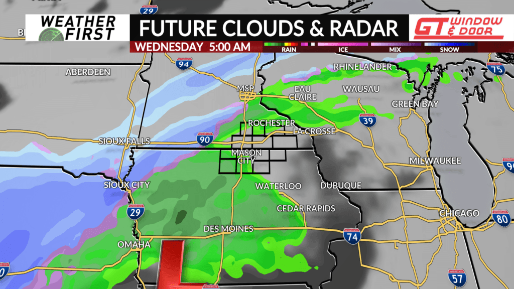
This boundary will set up across southeastern Minnesota and northern Iowa Tuesday night, resulting in increasing precipitation chances throughout the night.
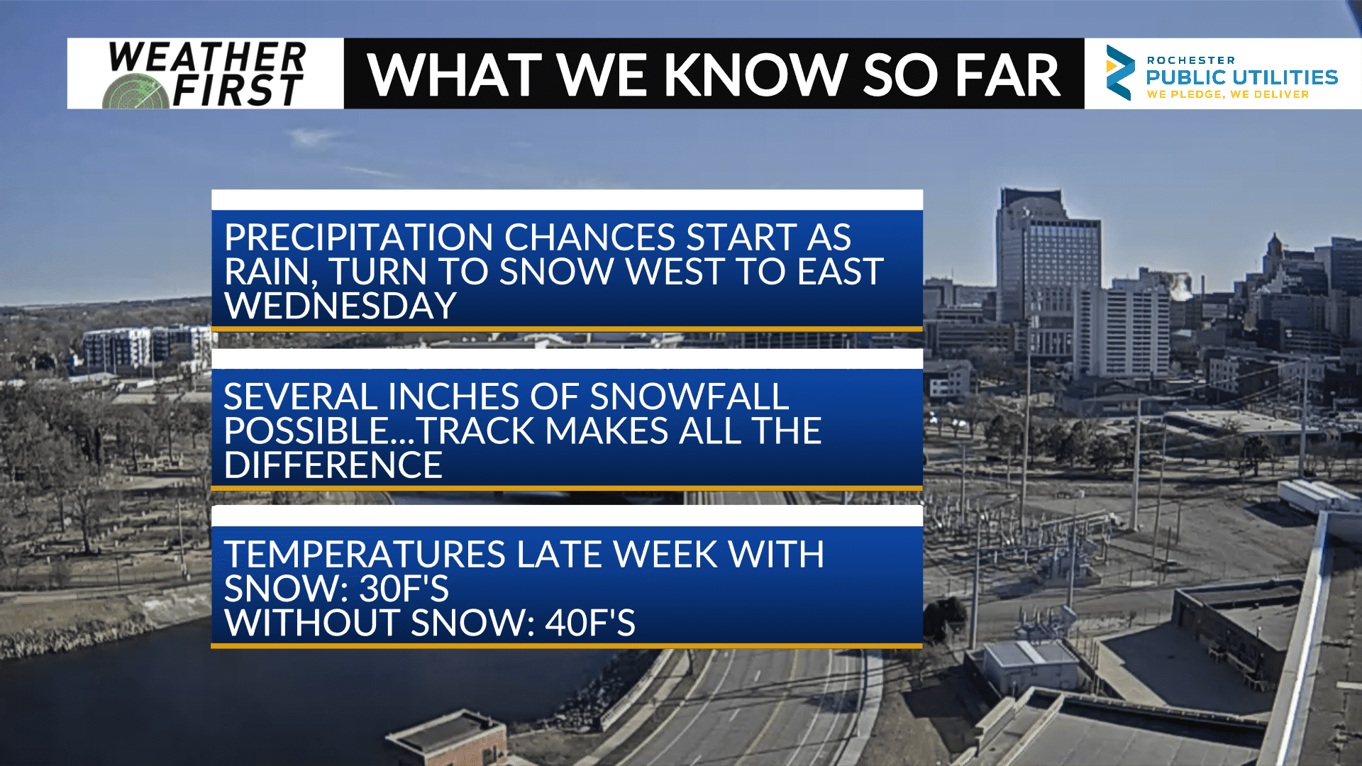
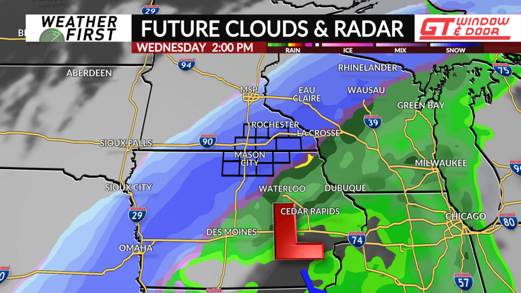
Initially, precipitation will be in the form of rain, thanks to surface temperatures, and temperatures aloft, above the freezing mark. In fact, there even will be a surge of instability northward across our northern Iowa counties, opening the door for thunderstorm potential near, east and south, of Charles City, IA.
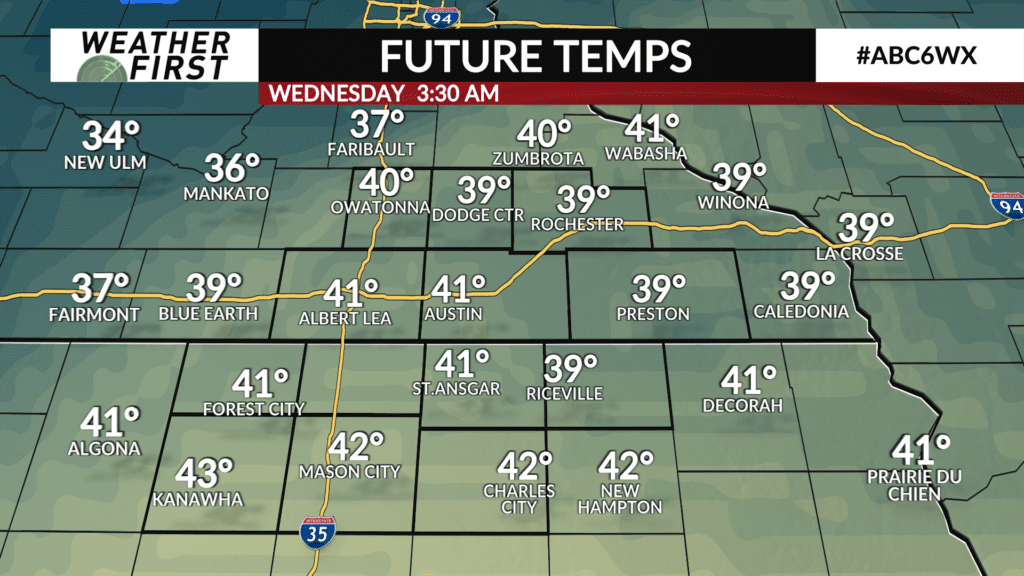
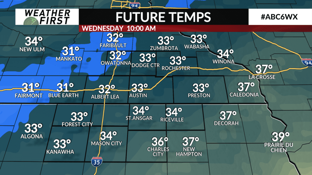
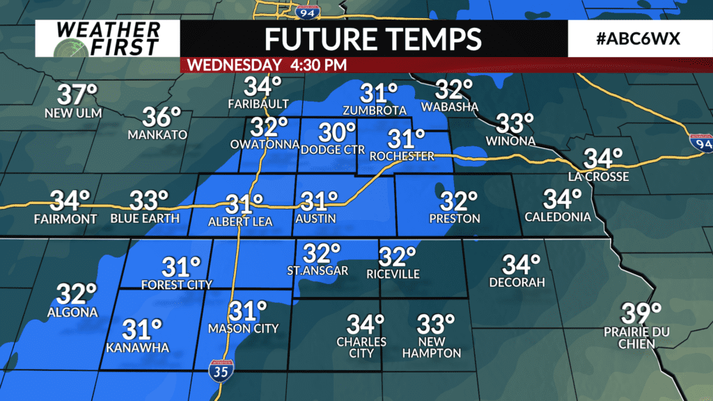
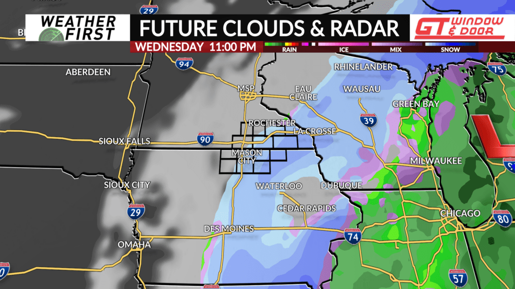
By Wednesday morning, however, temperatures begin to drop into the 30F’s, as a cold front approaches from the northwest. This will allow rain to change over to heavy, wet snow across all of our area by Wednesday afternoon. The speed at which this process happens, though, and where the convergence line sets up, will make all the difference on how much snow each location sees.
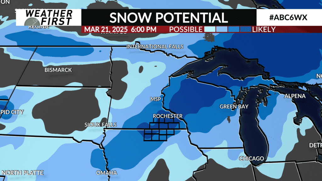
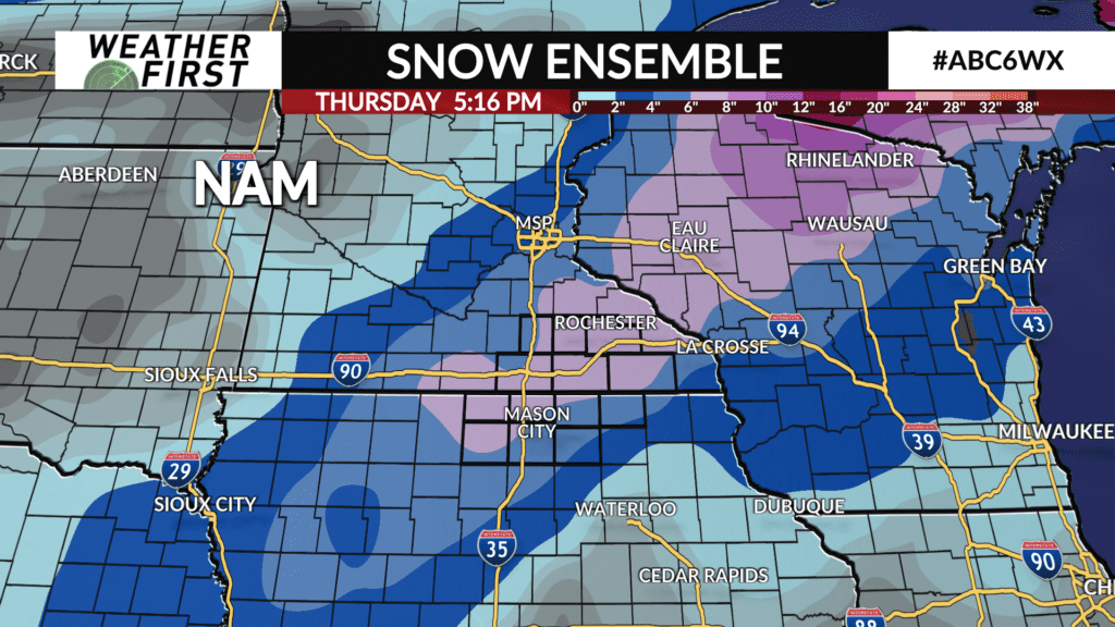
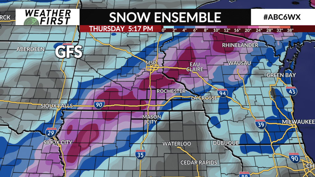
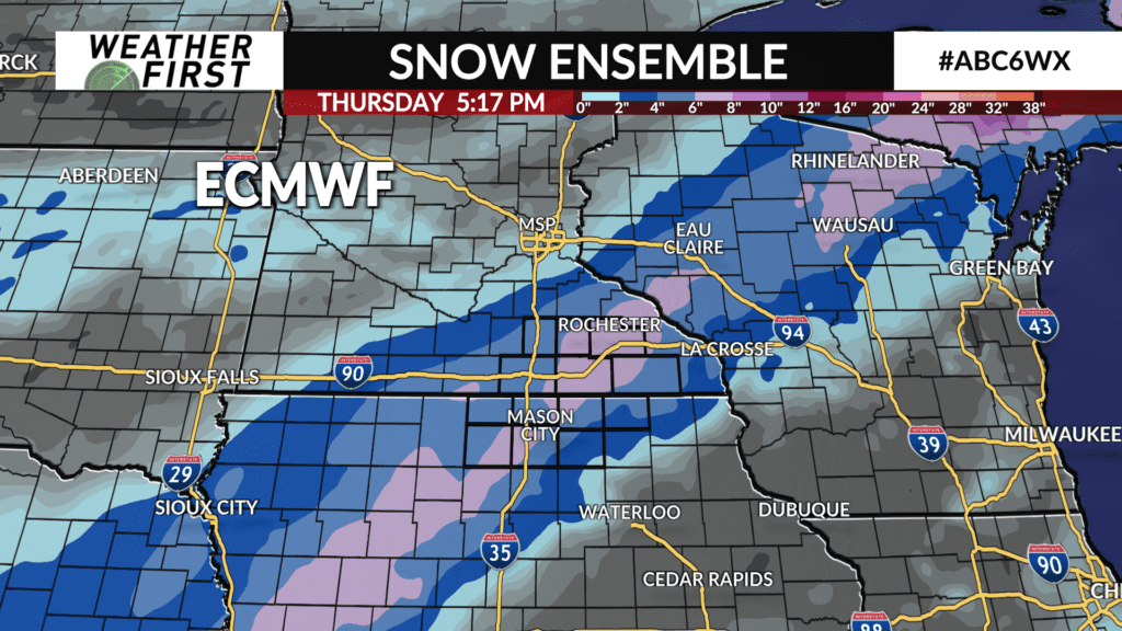
Model guidance is in agreement that a heavy snow band will set up somewhere across southeastern Minnesota and northern Iowa, but the exact location is impossible to know at this time. It will also be a narrow band of heavy precipitation. This means that even a 10 to 20 mile shift in where this band sets up could mean the difference between 1 inch of snow and several inches.
As far as timing, precipitation will start Tuesday night, and continue through Wednesday morning. Rain turns to snow Wednesday, and will continue through the afternoon hours. With that said, we can expect impacts to the morning and evening commutes. What these impacts will look like, though, is dependent on how much snow each location receives.
An early look at snowfall accumulation potential points to at least a few inches of snow accumulation late Tuesday night through Wednesday afternoon. The best chance for heavier snow accumulation, at this time, appears to be along and south of the I-90 corridor.
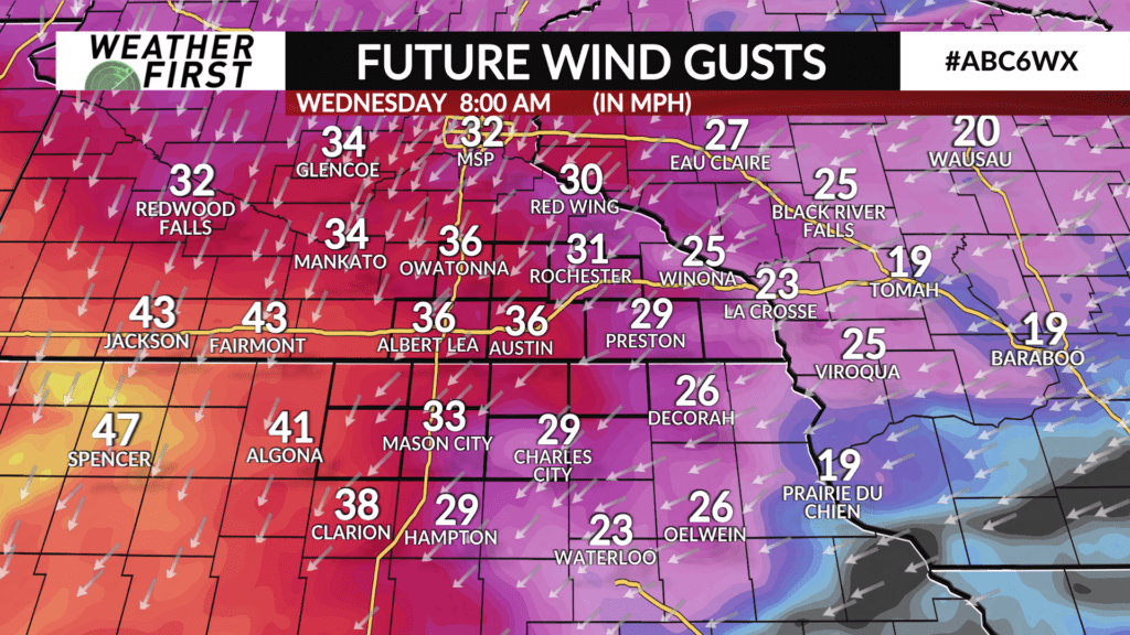
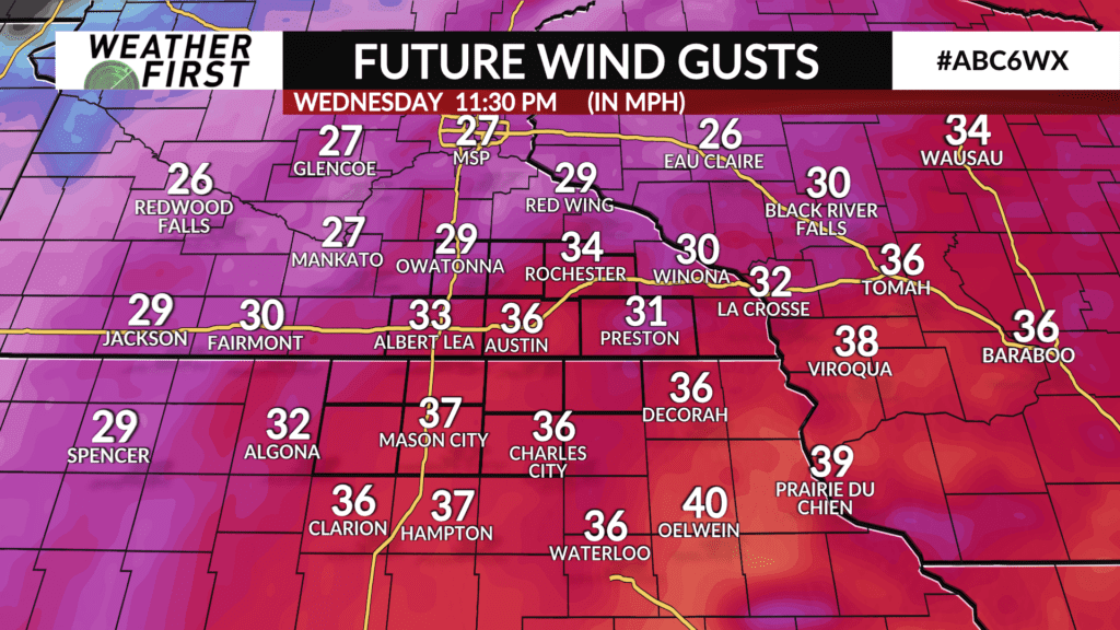
Winds will also be stronger out of the northwest, with gusts easily reaching 40 mph across the region. With winds such as these, blowing/drifting snow will be a potential hazard, as well as reduced visibilities on Wednesday.

The bottom line with this potential snow storm is there are still a lot of details we have to work out over the next few days. There are a lot of moving parts to this forecast, so the best thing to do for the time being is to keep an eye on it, and stay updated with the latest forecast information over the next 2 to 3 days.
We will have plenty of more information on this forecast in the coming days, so stay tuned!