ALERT DAY: Blizzard Warning goes into effect Wednesday morning, snow and wind to make travel hazardous

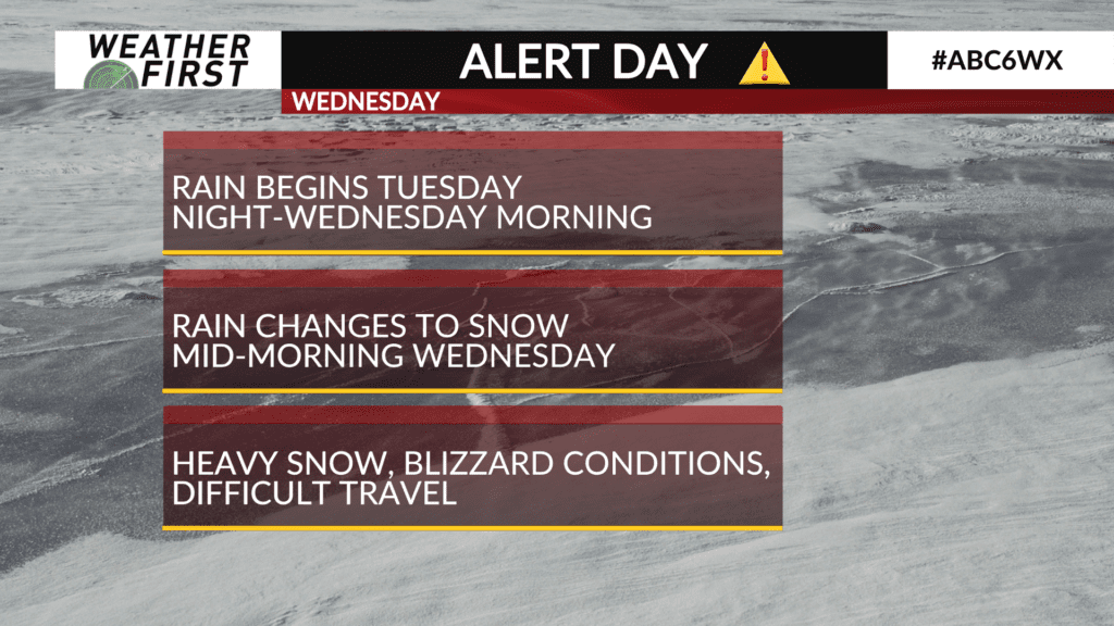
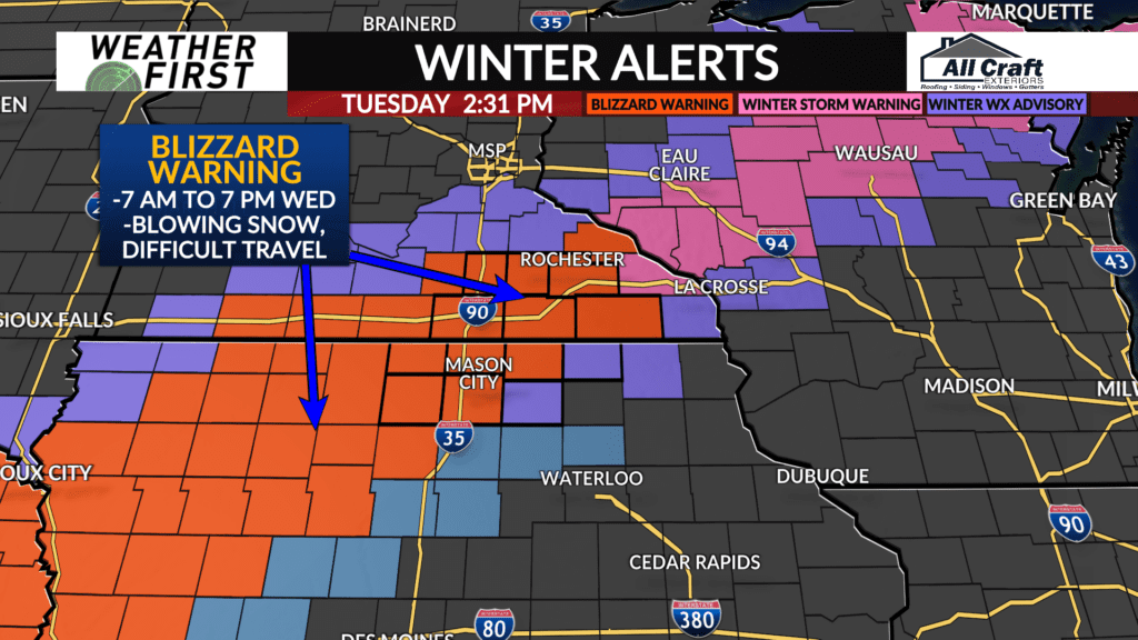
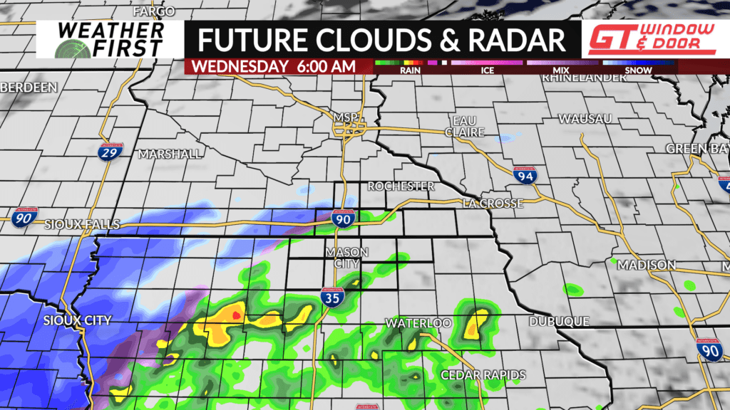
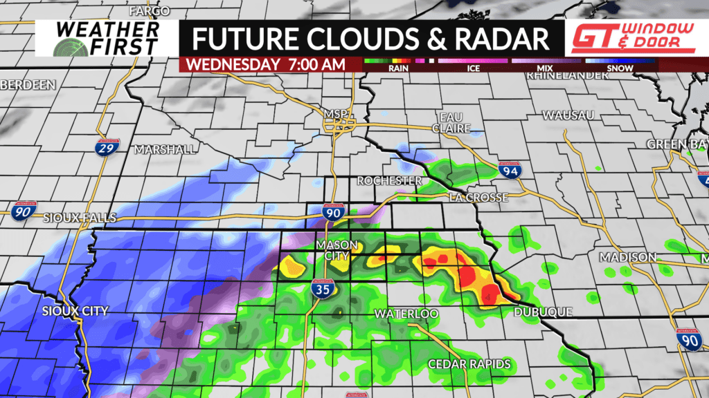
A strong storm system will arrive in northern Iowa and southern Minnesota Wednesday morning, and conditions will deteriorate quickly. A BLIZZARD WARNING goes into effect at 5 AM in north-central Iowa, and at 7 AM in southern/southeast Minnesota and in Mitchell County in northeast Iowa.
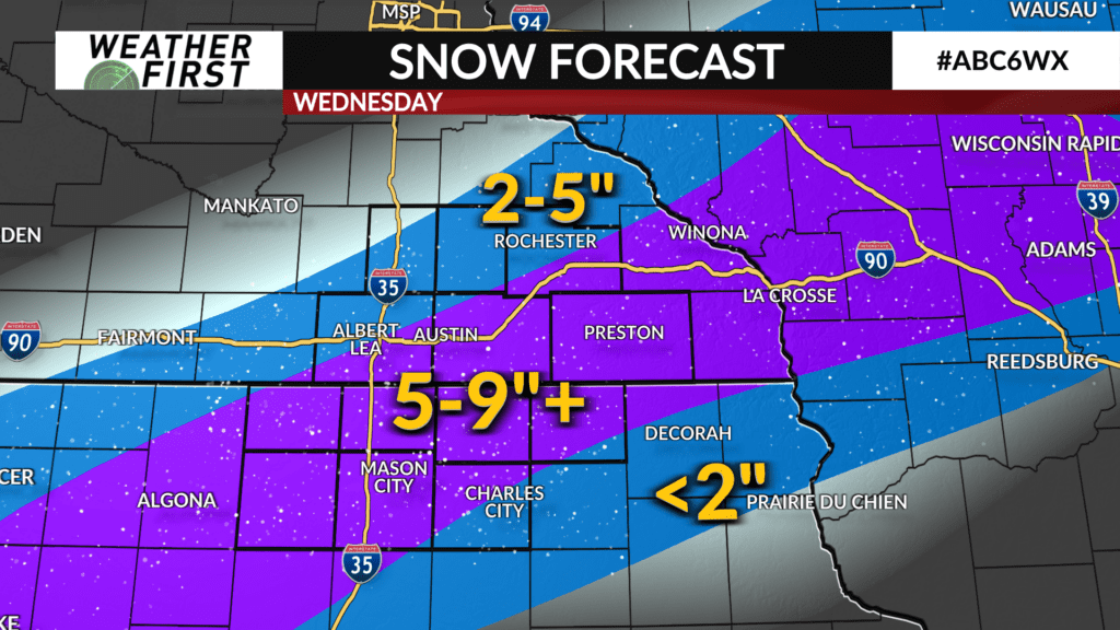
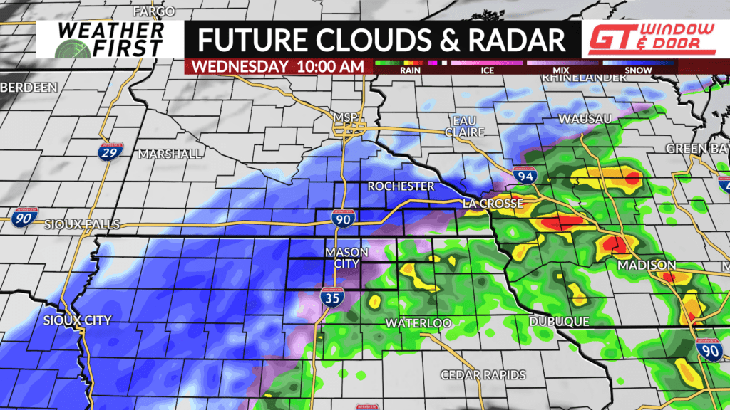
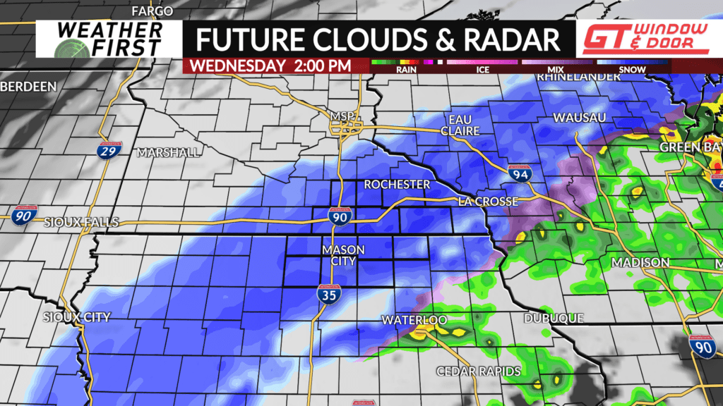
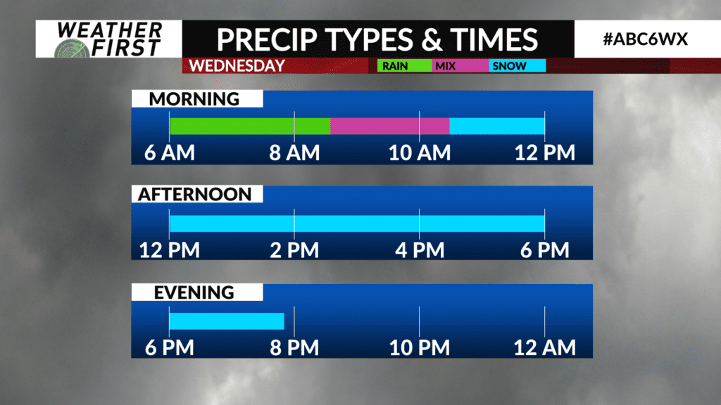
Precipitation will start out as rain between 4-8 AM closer to I-35, and will spread across the area by 10 AM. Rain will transition to snow between 8 AM and 10 AM from west to east, and snow will begin falling heavily at times by the mid to late morning.
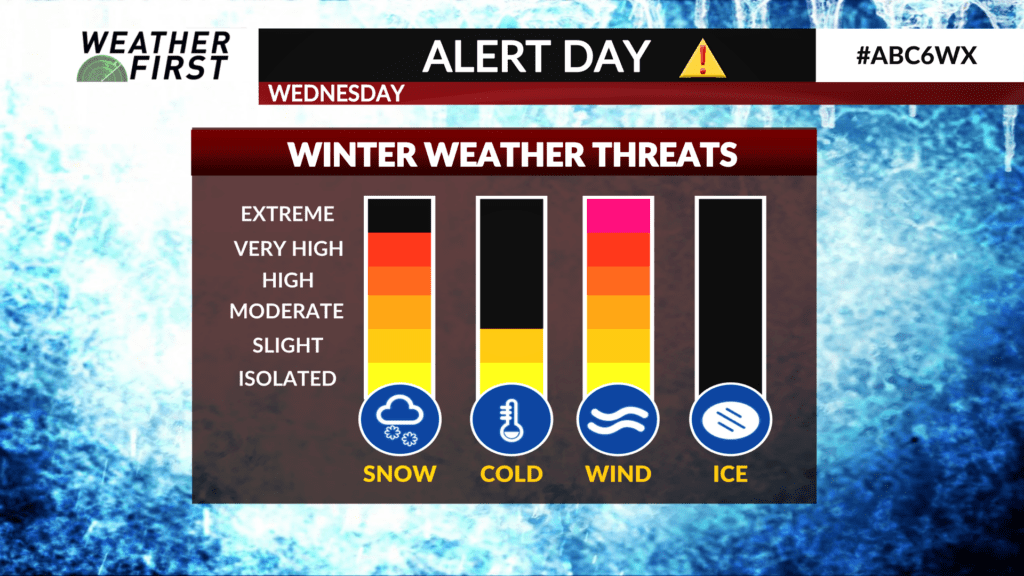
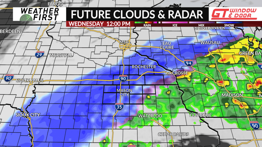
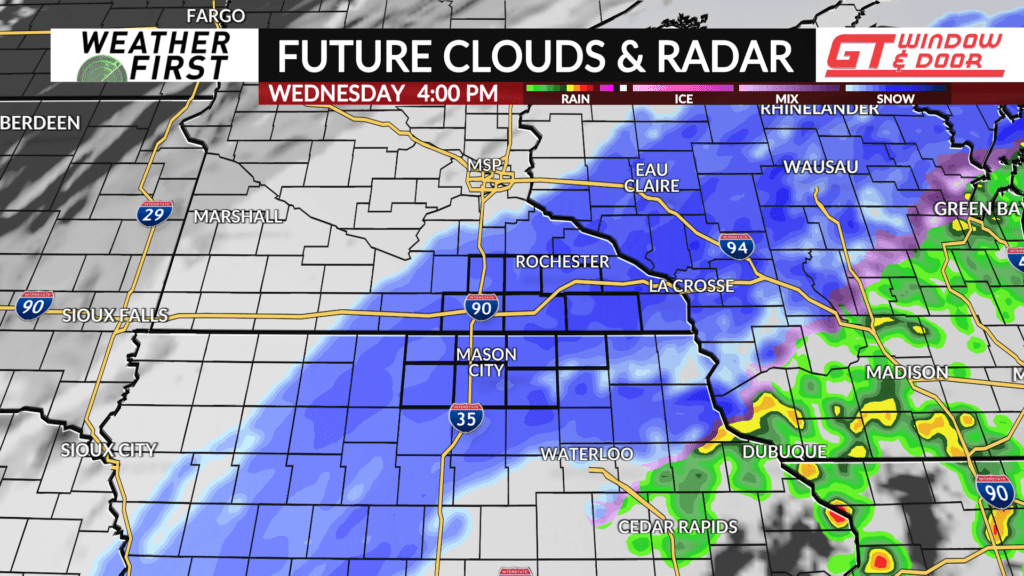
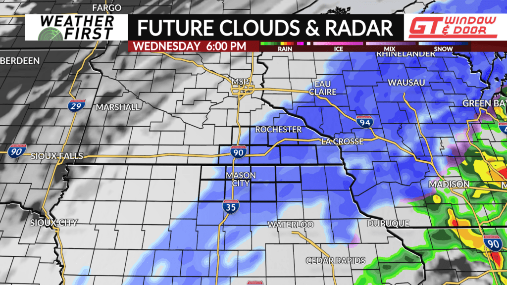
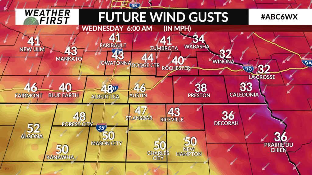
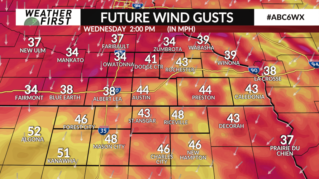
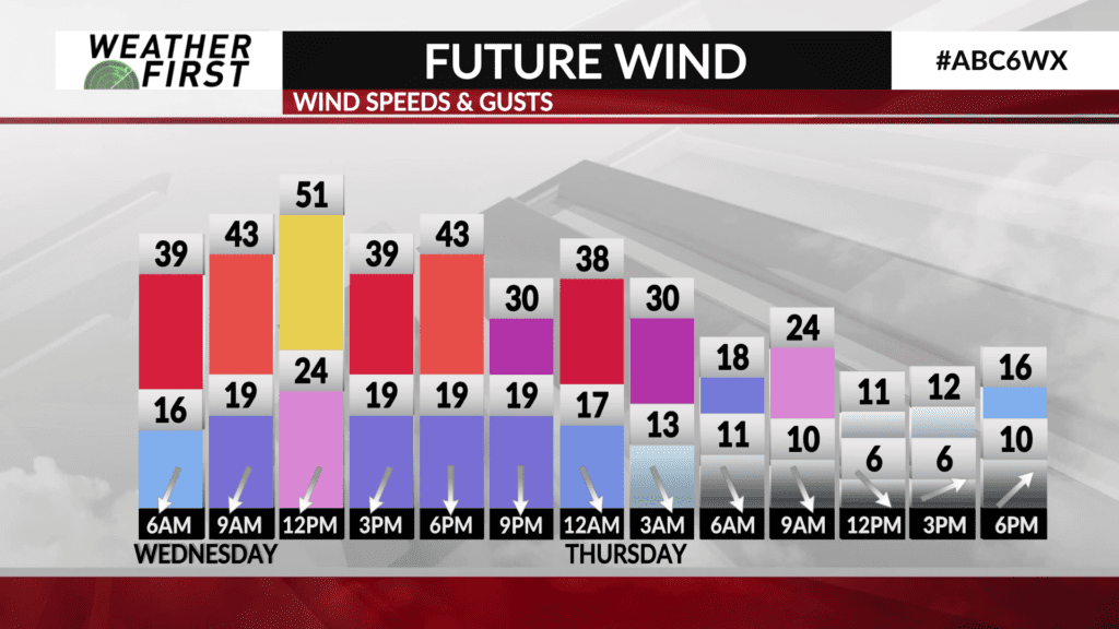
Winds are going to pick up quickly Wednesday morning with wind gusts up to 50mph. That wind will remain strong through the entirety of Wednesday. Combined with heavy snow with rates of 1-2″ per hour, blizzard conditions are likely to develop where heavy snow is occurring. That’s likely to be in a line from north-central Iowa into southeast Minnesota by the late morning and through the afternoon.
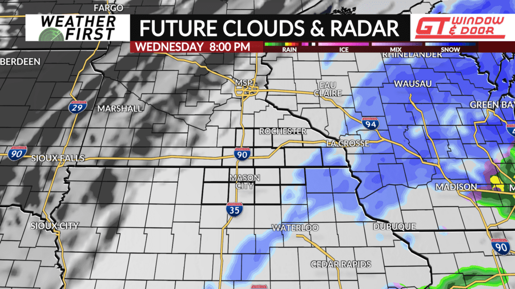
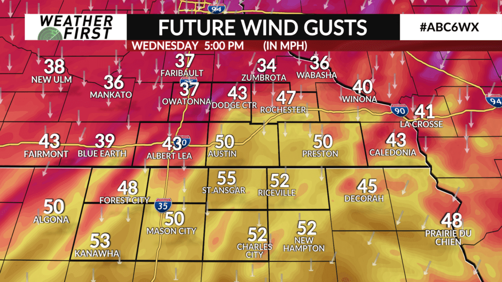
Snow will begin tapering off after 6 PM but winds will remain strong through Wednesday evening. This will make for areas of blowing and drifting snow, especially in wide-open, rural areas.
The weather, and the roads, will improve quickly Thursday morning thanks to more sunshine and a lighter wind.
Resources: Interactive Radar, School, Church, and Business Closings, Weather Alerts, Weather First