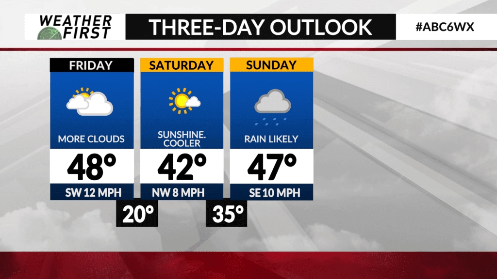
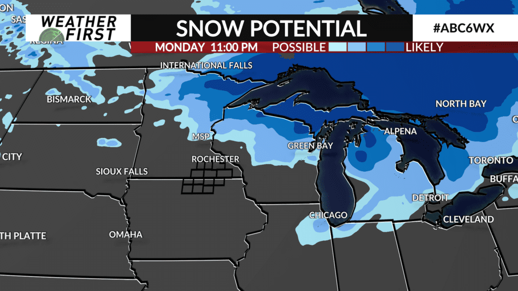
Cool weekend ahead with rain likely Sunday

Temperatures are expected to be seasonably cool over the weekend with a system arriving late Saturday and Sunday leading to precipitation developing.
Saturday will be a quiet day with some passing clouds and a mostly sunny sky. Temperatures are expected to be in the lower-to-middle 40s for highs which is near or slightly above average. The wind will be light out of the south.
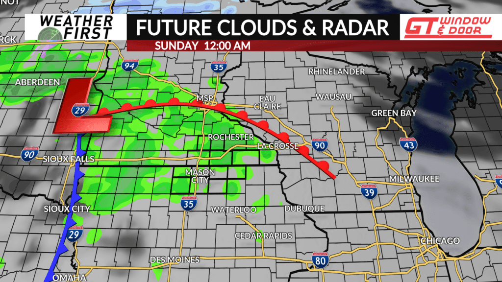
Clouds will thicken up Saturday night as a clipper system approaches. There will be enough energy and moisture that precipitation will be likely sometime Saturday evening into the overnight hours. Temperatures will be above freezing so rain will be the predominate precipitation type although a few snowflakes can’t be ruled out for some.
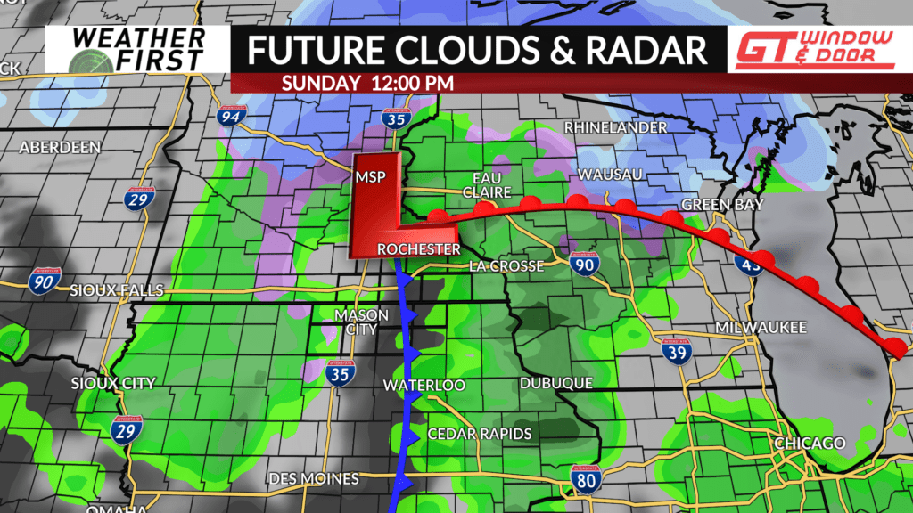
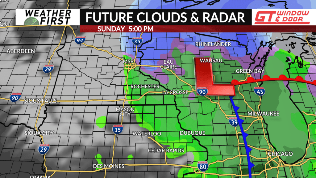
The system will pass overhead on Sunday with rain chances continuing before ending by early evening. Most areas will likely see around 0.25″ or less of precipitation. Any accumulating snow is expected further north across northern Minnesota and Wisconsin.
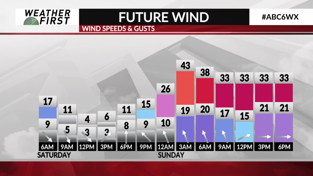
High temperatures on Sunday are expecting to be around the upper 40s and it’ll be a breezy day with wind gusts possibly up to 40 mph out of the west.