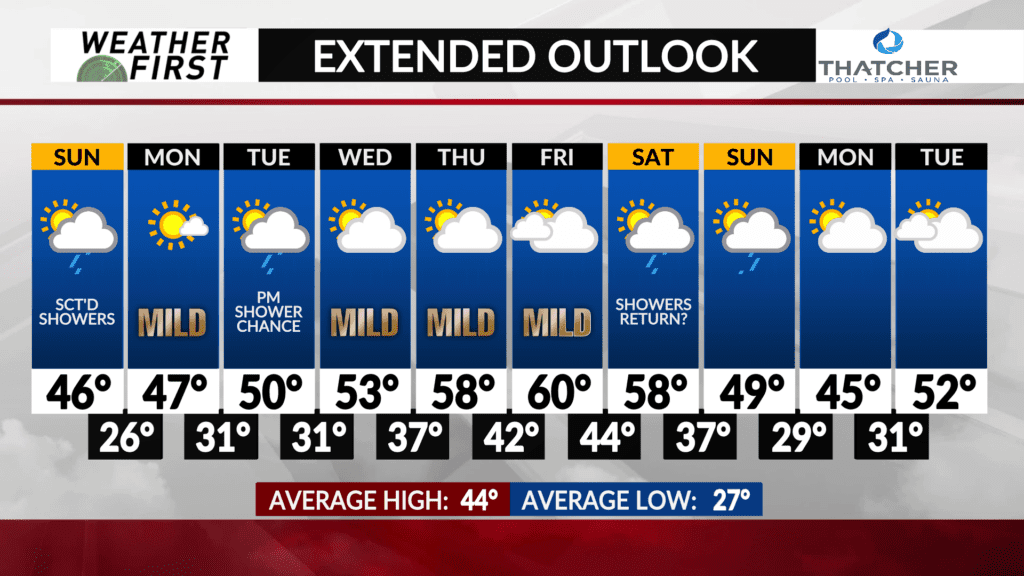
A few precipitation chances possible next week
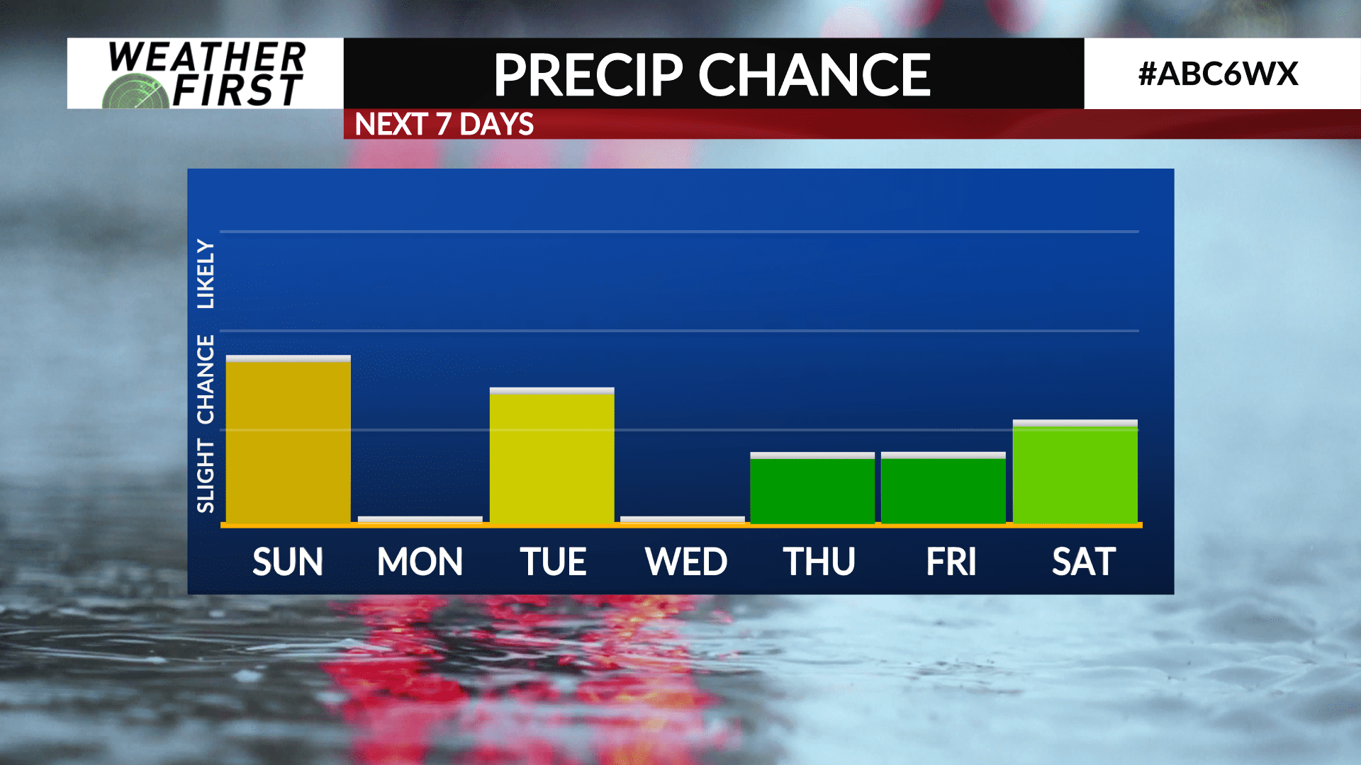
While a majority of the next week is leaning dry, there are a few precipitation chances that are beginning to pop up over the coming days, now that we are getting a better idea about what the upper level atmospheric pattern will look like.
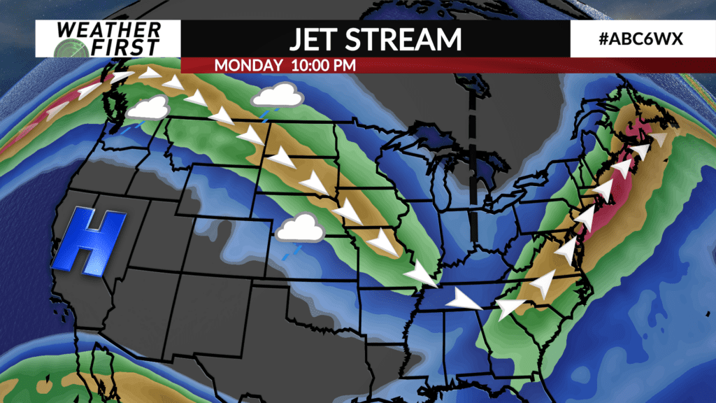
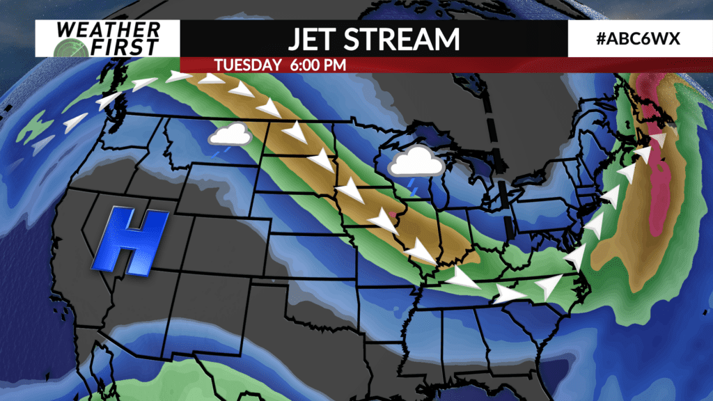
The upper level jet stream will be flowing almost directly overhead, orientated from northwest to southeast through mid week. While this jet stream orientation does not indicate a major storm system will be on the way, it does open the door for multiple smaller systems to pass through out area.
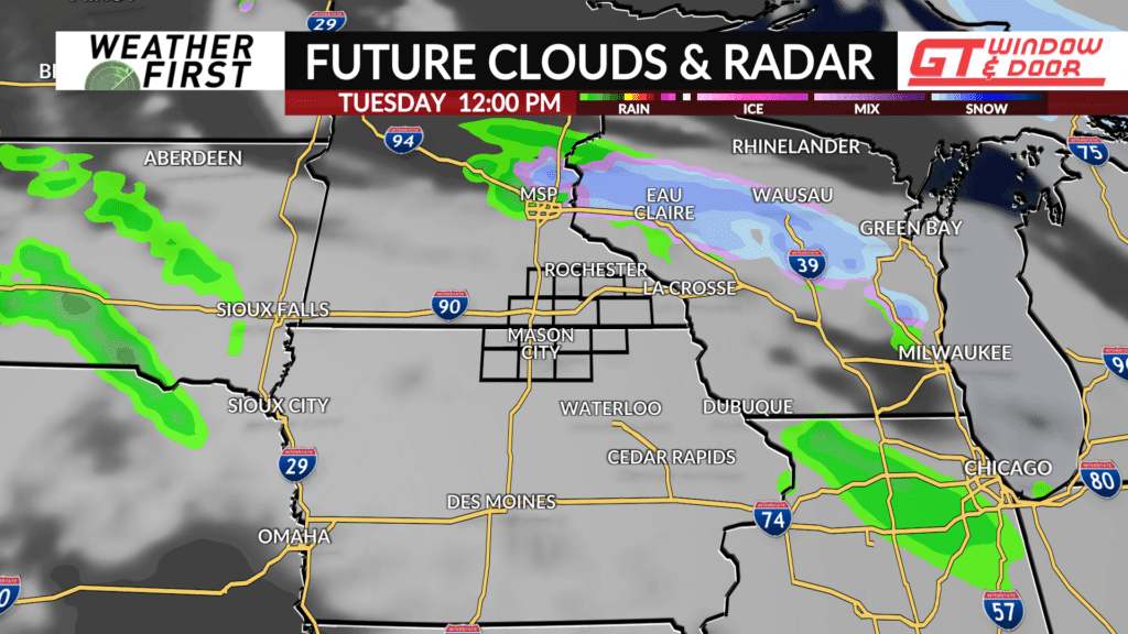
The first chance of precipitation arrives on Tuesday. A weak pulse of energy will travel along the jet stream Monday night into Tuesday, prompting the development of at least a few scattered showers across Minnesota and Iowa, primarily late Monday night into Tuesday.
Model guidance is a bit split on just how much precipitation will actually accompany this feature. The main question will be how much moisture is present in the mid and low levels of the atmosphere. So far, the amount of moisture looks to be lacking, which is typical of systems tracking from northwest to southeast.
Any rain that does fall will certainly not amount of much at all, so this will not be a major rainfall event by any means. Having an umbrella on hand would not be the worst idea when heading out the door Tuesday, however.
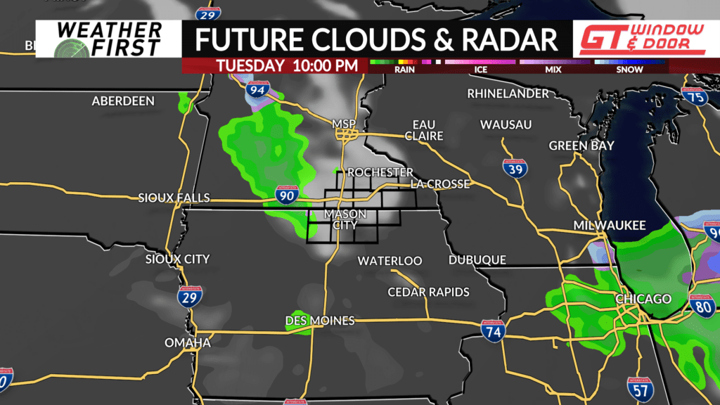
The next chance for showers arrives Thursday night, as another weak pulse of energy passes overhead. This will likely have a lot in common with Tuesday’s rain chance. Just some widely scattered shower activity due to limited moisture supply.
Rain chances are also beginning to increase for next weekend, although model guidance is far from in agreement on what any storm system would look like, if there even is one. Overall, while there are a few chances of light rain in the next several days, the odds of a larger rain/snow maker are on the lower end for now…