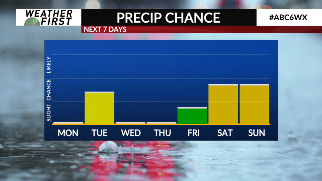
A few precipitation chances this week

While a majority of this next week will be dry, there are a few precipitation chances in the forecast.
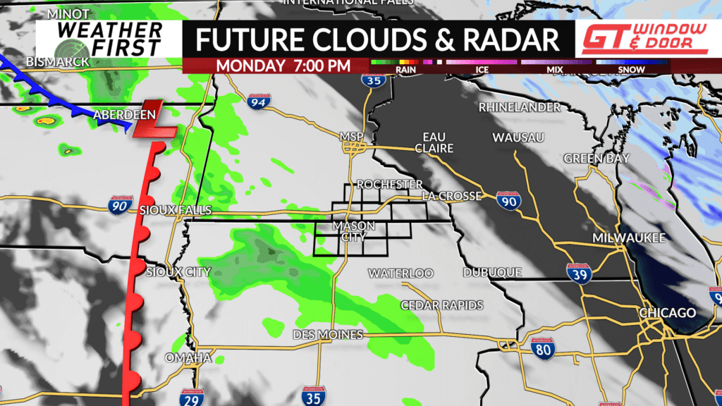
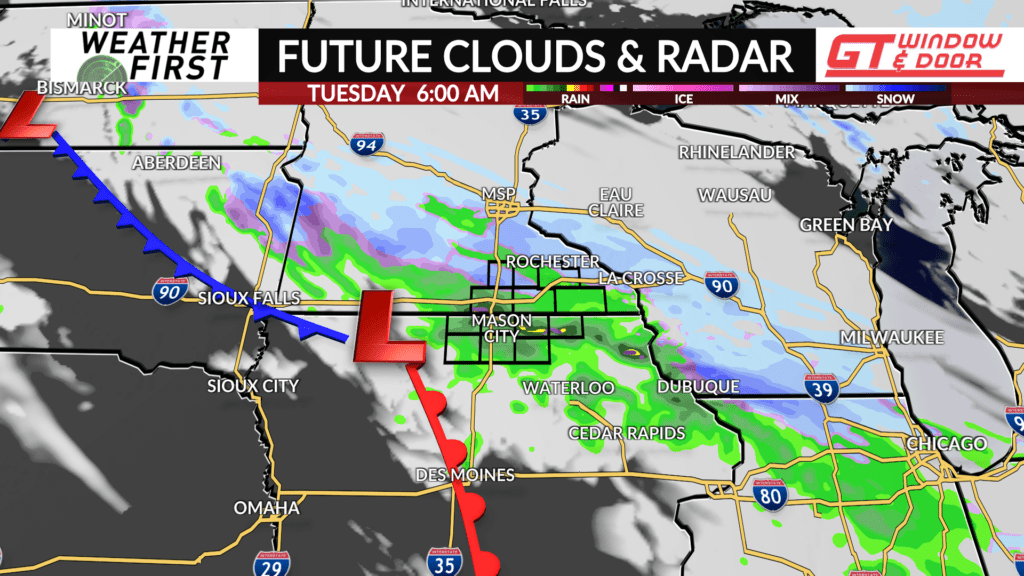
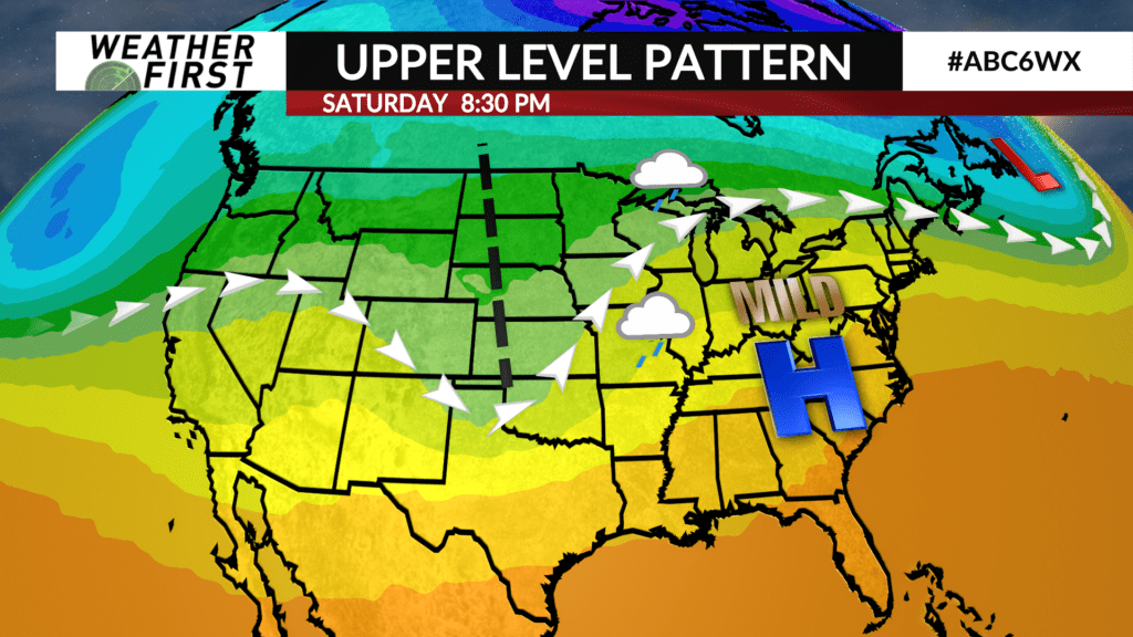
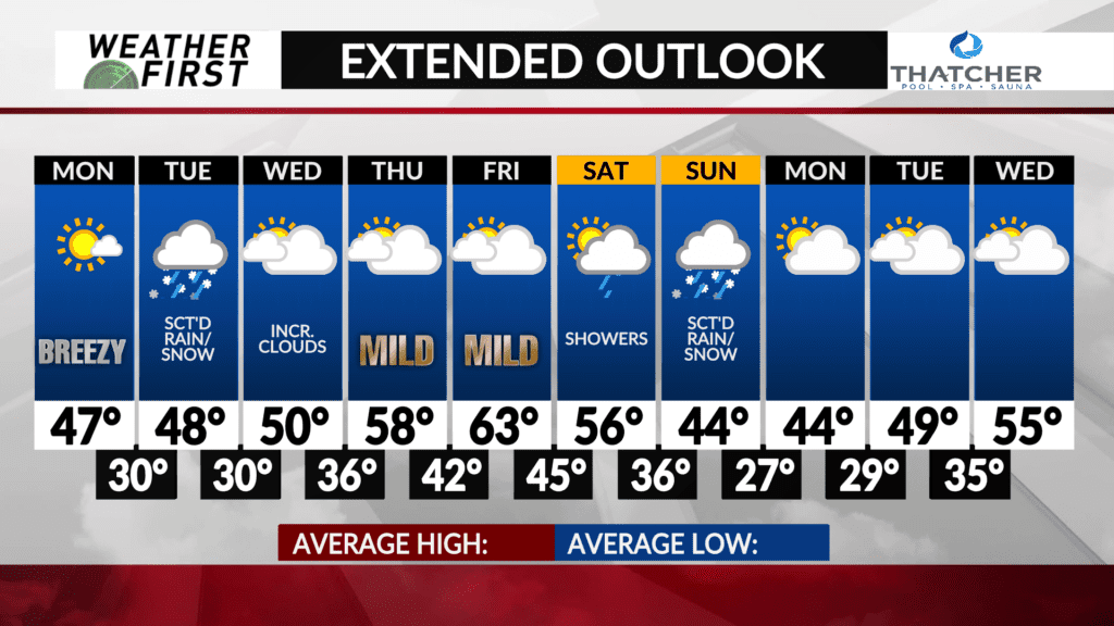
The next precipitation chances arrives Monday night and Tuesday. The jet stream will be positioned almost directly above Minnesota and Iowa early this week. This positioning will allow a subtle trough of low pressure to track through the area Tuesday into Tuesday night.
Ahead of this trough, enough lift will be present to kick off at least some scattered precipitation across the area late Monday night into Tuesday morning. Significant moisture will be lacking, which will limit the intensity and coverage of this precipitation event, however.
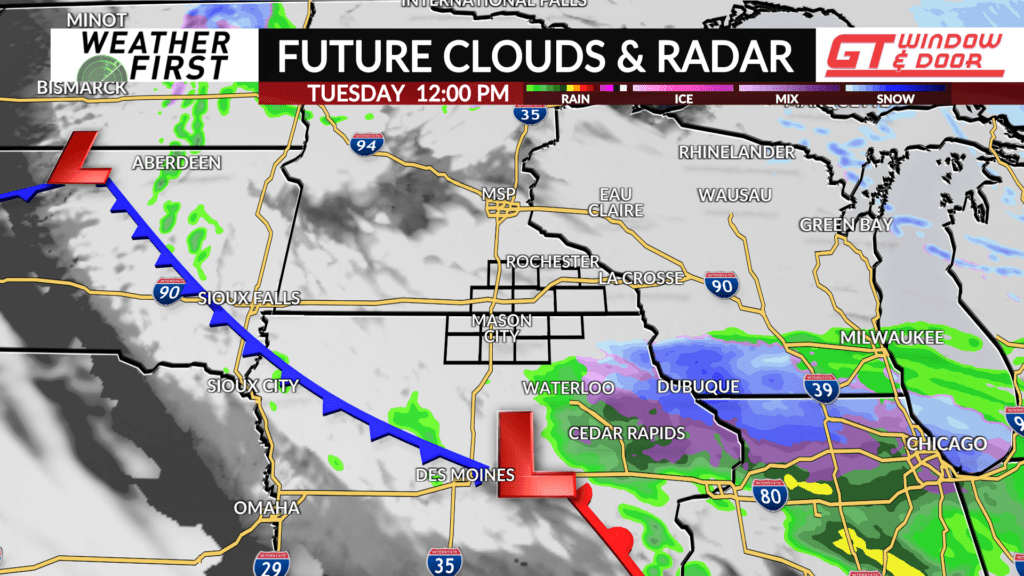
Temperatures will be cold enough for snow to mix in with rain Monday night and Tuesday morning, with any snow accumulation remaining limited to a light dusting on grassy surfaces. The best chance of precipitation will be across northern Iowa Monday night and into Tuesday. Temperatures warm enough Tuesday mid morning and afternoon for precipitation to transition to all rain.
Scattered shower chances continue into Tuesday afternoon, but this will be a hit or miss event, with not everyone seeing rain. Not a washout, but having an umbrella on hand wouldn’t be the worst idea.
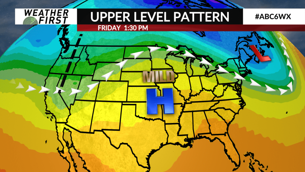
The next chance for precipitation will hold off until next weekend, when a trough of low pressure sweeps in from the western United States.
Rain chances will increase Friday night into Saturday, with a chance for Saturday’s rain being more widespread than Tuesday’s event. Too far out to dive into any specifics, but worth watching for the time being. Snow could mix in Sunday as colder temperatures wrap around the backside of the low, but again, too early to work out any specific details.