A few snow chances next week

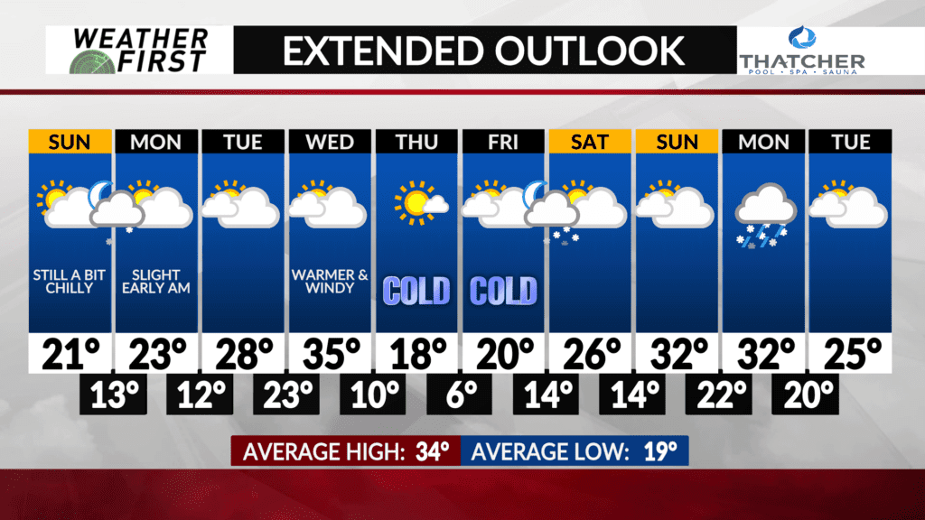
There are still a few snow chances in the forecast through next week, but there is increasing confidence in no highly impactful snowfalls around the area.
The first chance of snow arrives late Sunday night into early Monday morning. A weakening Alberta Clipper will descend out of North and South Dakota Sunday into Sunday night. Dry air across Iowa and Minnesota will act to weaken this system, and could completely polish it off before it reaches us.
Odds favor at least a few light snow showers and flurries making their way into the area, especially south of I-90 and west of I-35. Any accumulations would be relatively minor, well under an inch…if any accumulation at all. No major morning commute disruptions are anticipated Monday.
Another Alberta Clipper passes our area by to the north and east Wednesday, but the primary forcing and moisture is likely to stay well to the east and north of the area. Certainly cannot rule out a few rain/snow showers Wednesday afternoon given the systems closer proximity to us, but odds favor us staying dry for the time being.
The best chance of snow is still quite a ways out, arriving next Friday evening. Another Alberta Clipper will follow the jet stream southeast and enter Minnesota/Wisconsin Friday evening into the overnight hours. Difficult to work out any details past that, but current model guidance shows any accumulation staying under an inch across the area.
Overall, the snow chances we have are still generally slight, and no significant snow events are currently anticipated through the entirety of the extended forecast.


