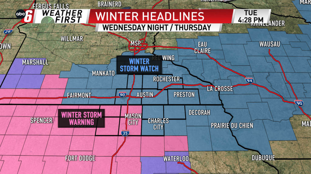
A good ol’ snow storm
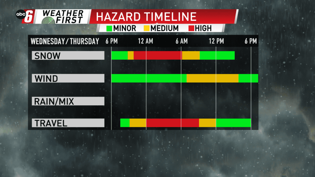
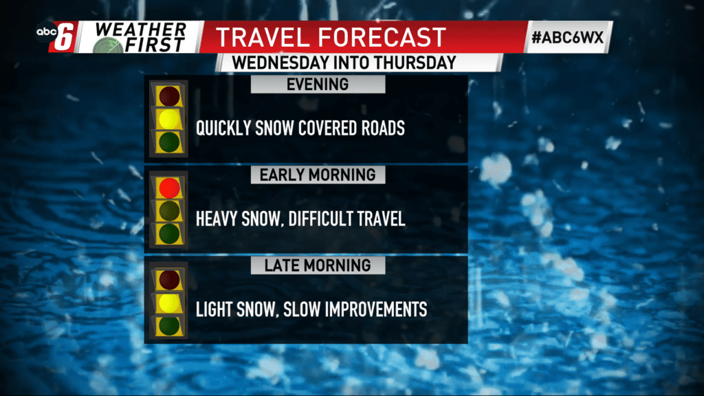
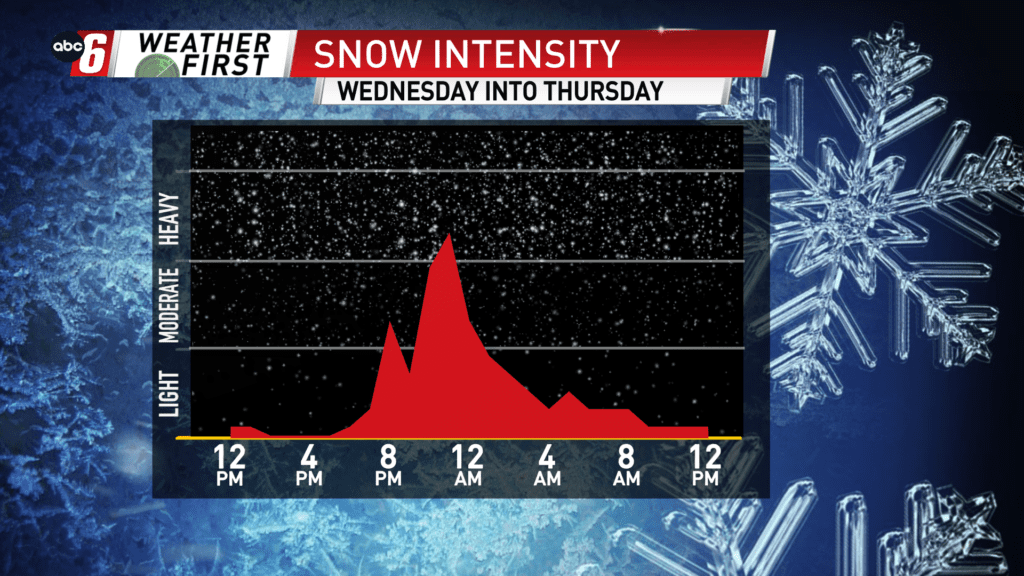
That’s it. A snow storm. A touch of wind. Poor travel. That will about sum up the Wednesday night to Thursday morning timeframe. Snow showers extend a bit later in the day, but the aforementioned window is the target time for worst impacts. And heavy snow too.
Snow hits hard, building in 6 PM and after from south to north. While the heaviest falls through mid morning, snow finally exits by about 3 PM on Thursday. At the onset, snowfall rates may briefly find their way up to 1-2″ per hour. We’ll pick up most of our accumulations prior to sunrise.
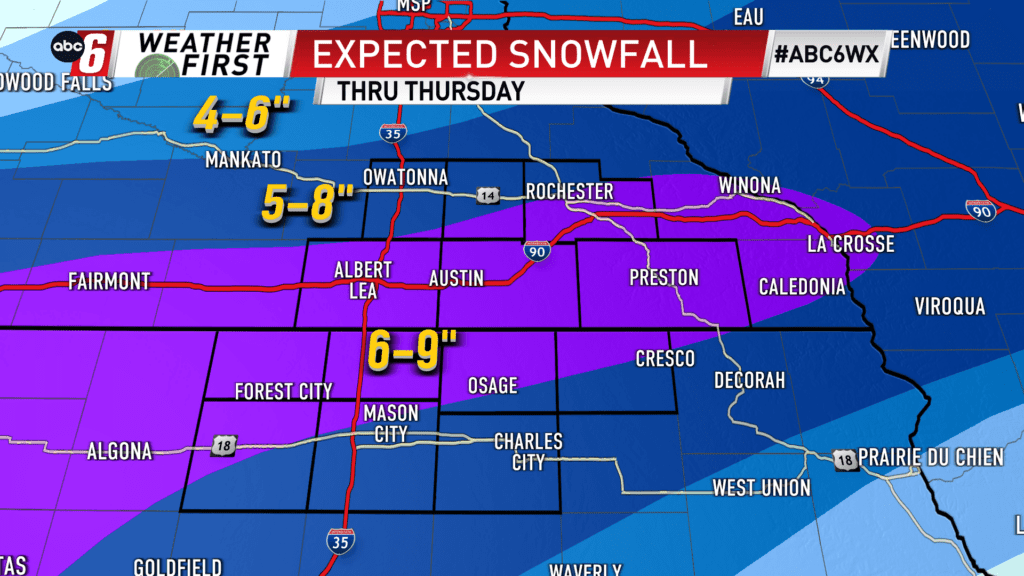
5-9″ is the going total snow forecast. The range is fairly uniform across our area. There is a slight edge to the higher end of that range for communities closer to the state line.
There’s a bit of a breeze to contend with. From NE to NW with time, gusts will reach 25 mph. This won’t reduce visibility any further but it will lead to a bit of blowing/drifting snow in the open.
Travel is at its worst Wednesday night through the Thursday morning drive. A slow improvement is expected after.