A gradual warm up early next week
After a few days of very cold temperatures and wind chills below or near 0F, a gradual warm up is expected to take place heading into early next week.
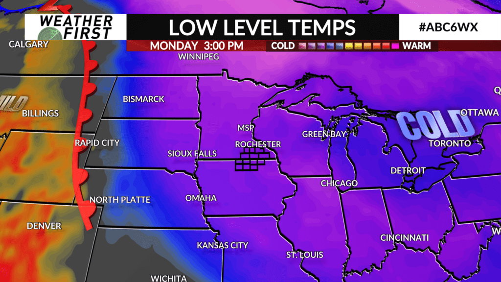
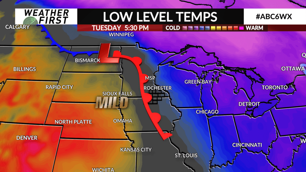
A warm front will begin to form on the eastern side of the Rocky Mountains as low pressure develops further north on Monday. This warm front will gradually approach our area through the beginning of next week, along with an upper level ridge of high pressure sliding east as well. This will act to force the colder air we have been dealing with further east.
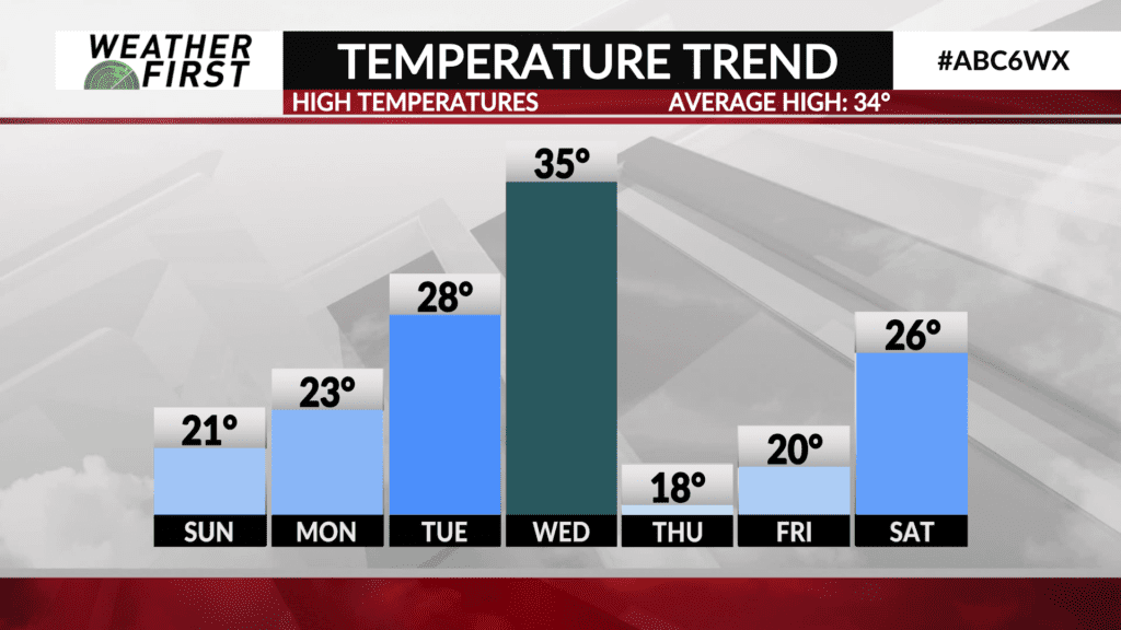
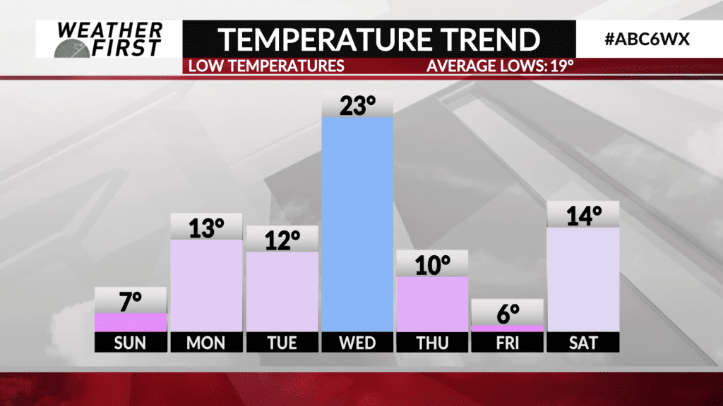
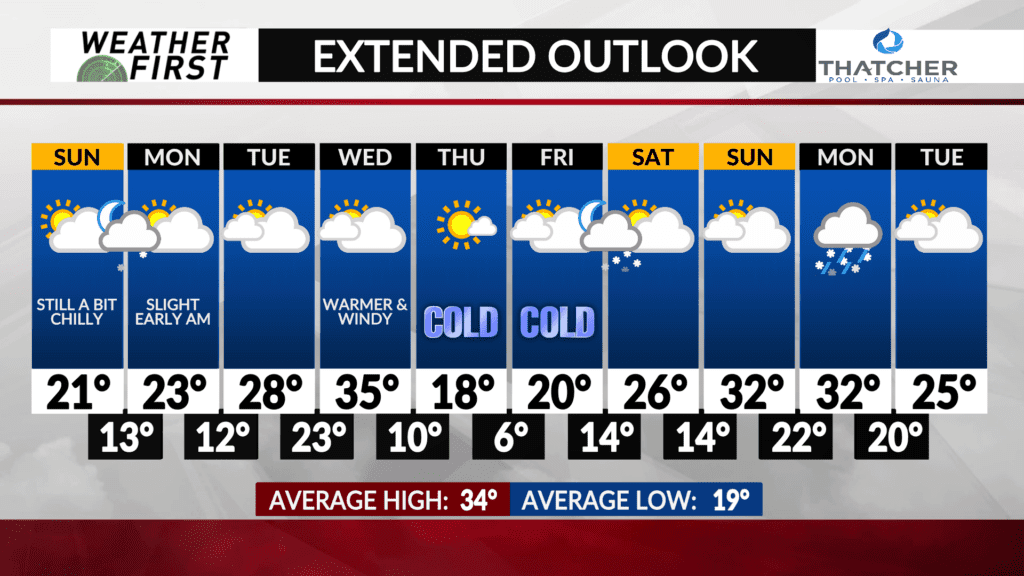
Highs on Monday will be in the low to mid 20F’s across the area, which is still a good 10 degrees below the long term average for this time of year. High temperatures climb into the upper 20F’s on Tuesday, with overnight lows in the low 20F’s as well. Balmy!
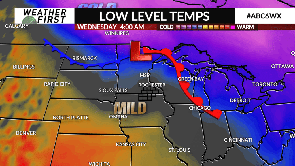
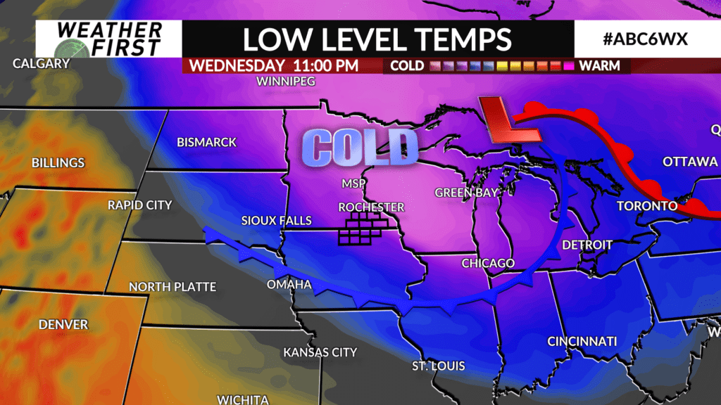
The warm front passes through late Tuesday into early Wednesday, bringing a brief bout of warmer air resulting in highs in the mid 30F’s Wednesday. The mild temperatures come to an end quickly as an arctic cold front blasts through the area Wednesday night.
By Thursday, high temperatures will be back to around 20F, with overnight lows Thursday into Friday morning dipping into the single digits once again. Regardless, it will be nice to have a few days break from the arctic air, especially since there will be no major winter storms to worry about during this time either!
