A gradual warming trend next week
After a few chillier days and cold nights, we are approaching a gradual warming period across southeastern Minnesota and northern Iowa heading into this next week!
Snow across the viewing area has melted at a remarkable rate over the last few days, with only a narrow strip of snow still showing up on satellite imagery! This bodes well for warmer temperatures to make their return over the next week, and climbing above the average highs for this time of year.
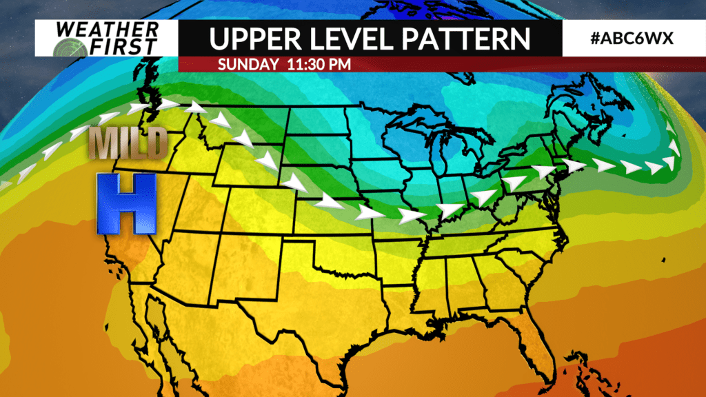
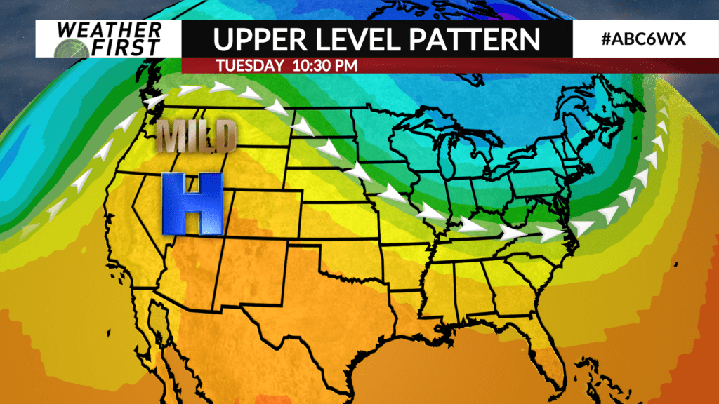
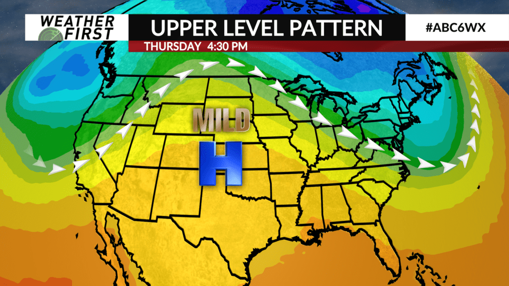
From an upper level atmospheric perspective, the jet stream will be essentially right over us the next several days. This will allow for warmer temperatures to gradually make their way back north and east, with the colder air being trapped further north.
Over the next week, a ridge of high pressure will begin to build off west, forcing the jet stream further north. This will only lead to further warming across the Midwest, thanks to mainly quiet weather, apart from the occasional rain chance.
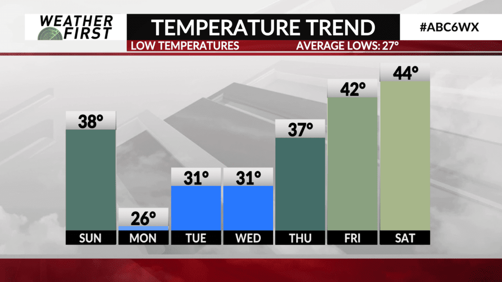
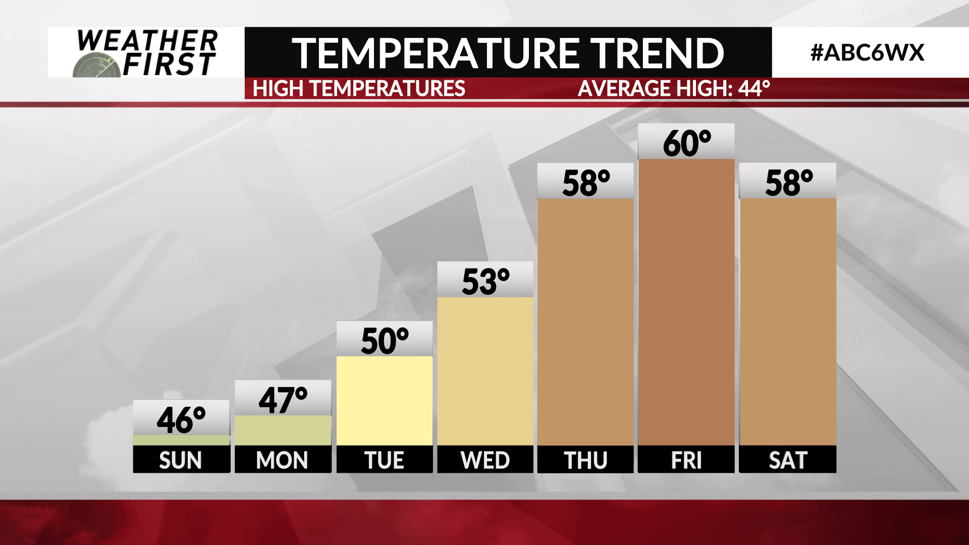
The result of this building ridge will be a gradual increase in the daily high temperature each day beginning Monday, and continuing through the remainder of the work week.
Highs on Monday will be in the mid to upper 40F’s, under a partly to mostly cloudy sky. High temperatures will approach 50F as soon as Tuesday, with low to mid 50F’s arriving for Wednesday. Even warmer temperatures arrive Thursday, with highs in the mid to upper 50F’s.
There is the possibility that 60F’s return to the region by the end of this upcoming week, but there is still considerable uncertainty on how quickly the ridge breaks down and allows for stormier/colder weather to make its return to our neck of the woods.
Regardless, temperatures will be above average the next several days, with plenty of dry time in between any precipitation events!