A look at the weekend ahead!

Since it’s almost Friday, now is a good time to look ahead at the weekend weather wise to see what is in store for us across southeastern Minnesota and northern Iowa!
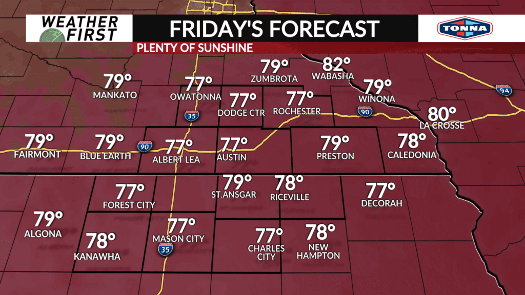
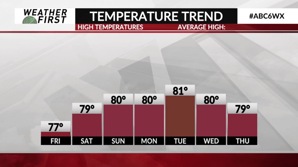
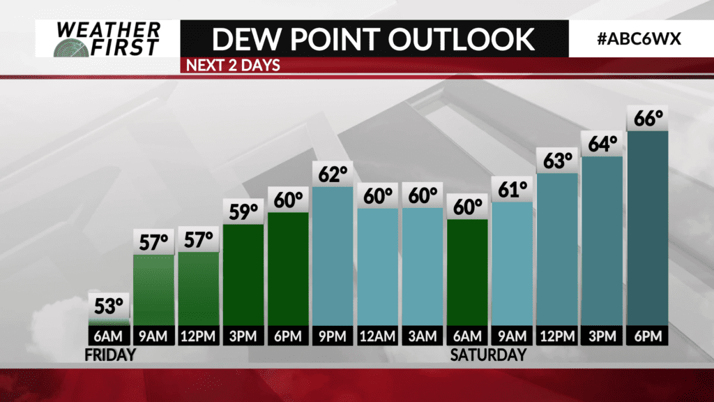
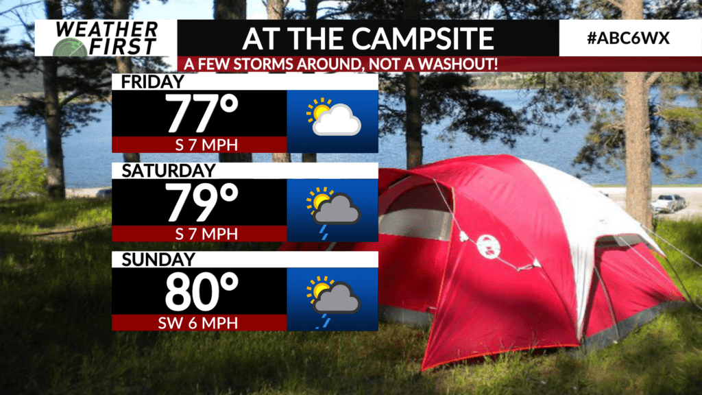
Friday is going to be a great day overall, with high temperatures in the mid to upper 70F’s, plenty of sunshine and dew points nearing 60F. Rather comfortable overall and not too different than what we have seen today.
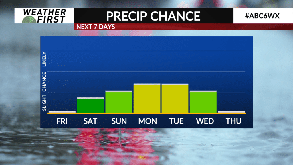
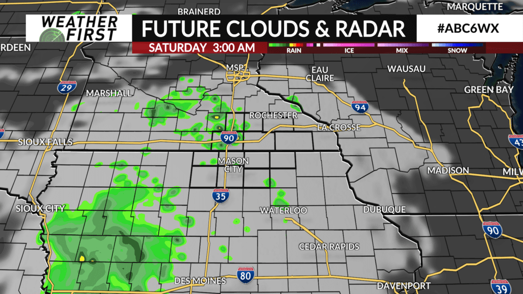
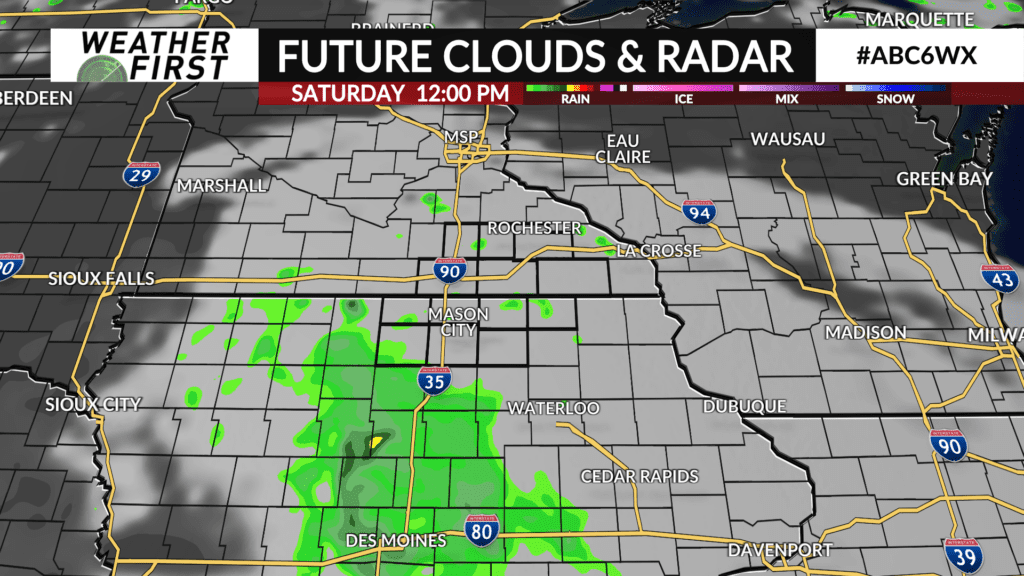
Heading into Saturday, there will be a slight chance for a few showers around throughout the day thanks to a disturbance passing us by to the south. Best chances for rain will be in the southern portions of our viewing area, but even there, chances are on the lower side.
Dew points are going to start increasing again on Saturday while daily high temperatures remain rather stagnant around 80F. It will begin to feel quite muggy out there by the end of the day on Saturday, with dew points reaching into the upper 60F’s, potentially even approaching 70F.
Sunday there is a better chance for a few storms but again, they will be more isolated in nature and not everyone is going to see rain. This weekend will certainly not be a washout and I would not cancel any weekend plans over these isolated rain chances.
The threat for severe weather at this time is relatively low. With the storms being more widespread in nature. The flood threat will also be relatively low and any rain shouldn’t impact water levels too much since any rain that falls will not be falling for very long.