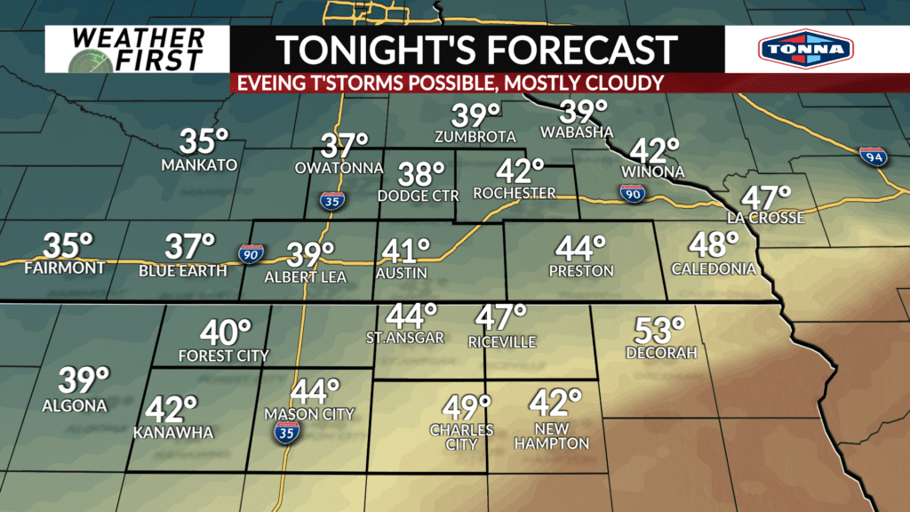
A soggy weekend ahead
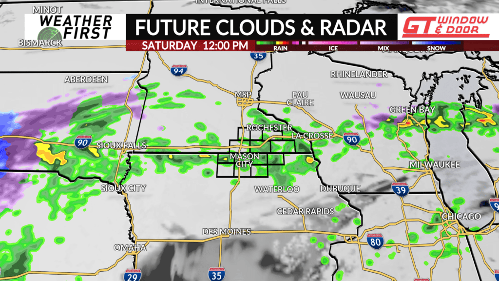
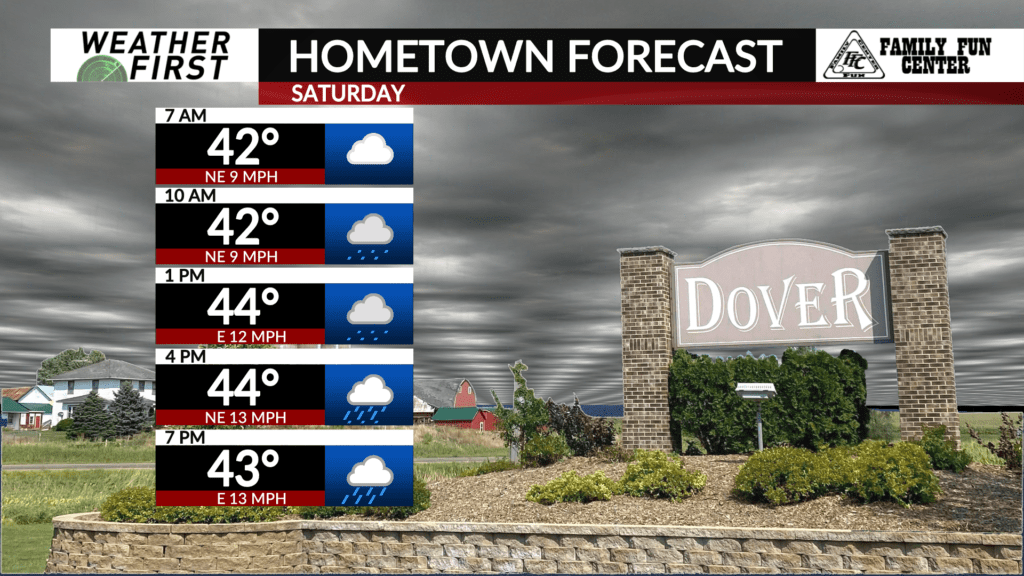
Chances of thunderstorms linger through Friday evening, before diminishing overnight. The clouds hang around Saturday, with a slight chance for a few showers during the morning hours.
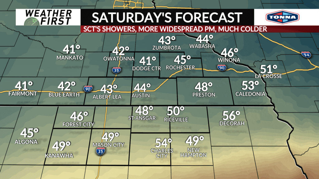
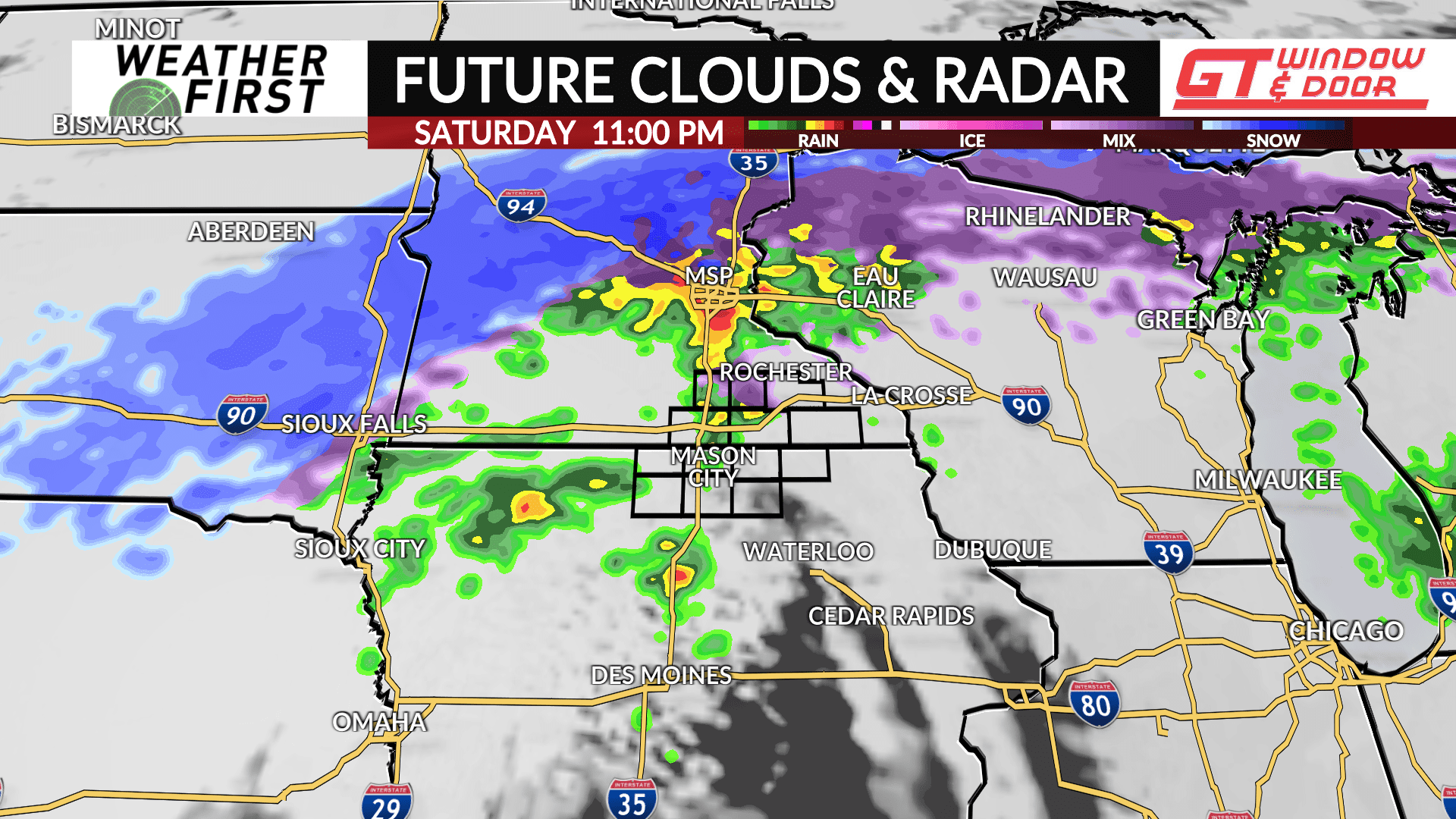
Scattered showers will begin to develop across the area during the afternoon hours as an area of low pressure approaches from the southwest. While there will be a good amount of moisture to work with, the best forcing looks to hold off until Saturday late afternoon, and perhaps Saturday night.
As a result, Saturday is unlikely to be entirely a washout, but having the umbrella on hand while is going to be a good idea.
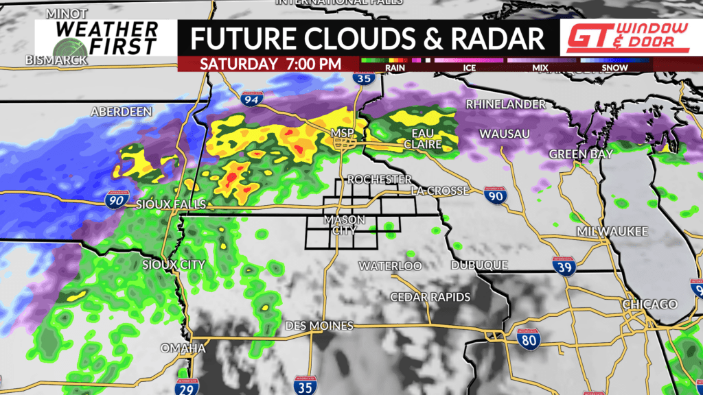
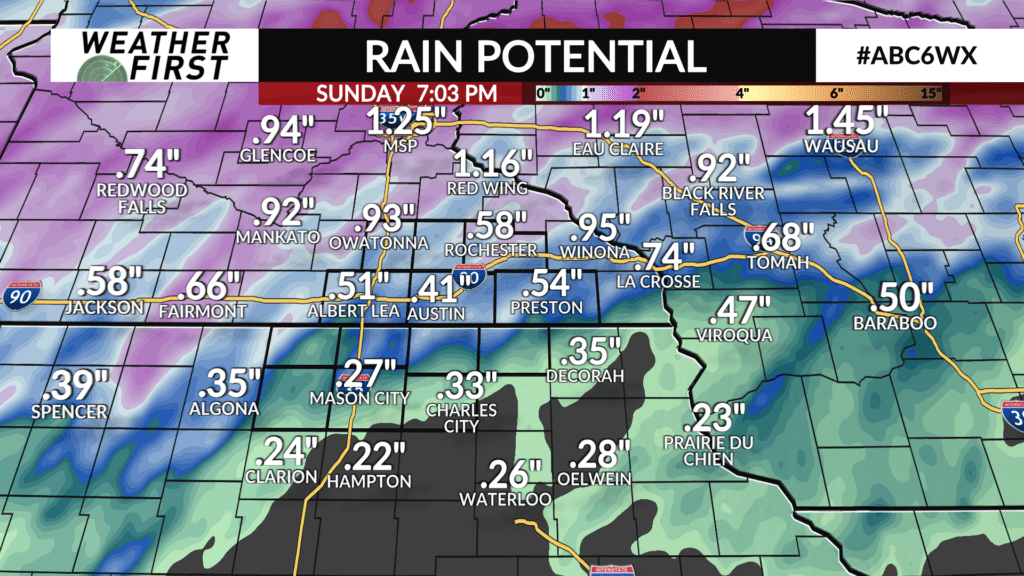
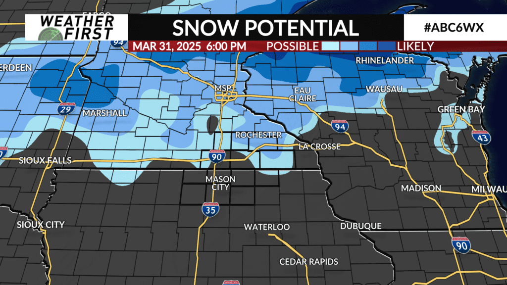
Widespread rain arrives Saturday night into Sunday as low pressure tracks into the area. Copious amounts of moisture will be available through the overnight hours, as well as forcing. This will result in many locations, especially north of I-90, seeing up to half an inch of rain between Saturday night and Sunday afternoon.
Temperatures will gradually drop throughout the weekend, with highs in the 40F’s Saturday, lows in the mid 30F’s Saturday night, and highs in the upper 30F’s Sunday. Temperatures may cool off just enough Saturday night for some snow and freezing rain to mix in, but odds do not favor this transition at this time. Looks like mainly rain for now!
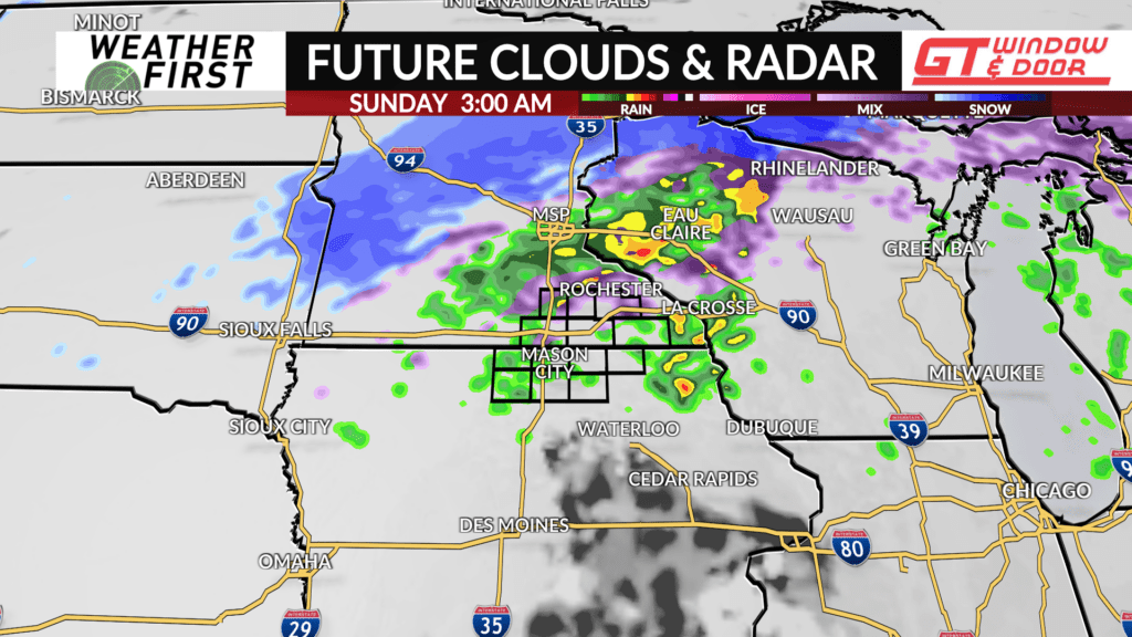
Rain will continue into Sunday, but odds of snow mixing in will increase throughout the day. Freezing rain and sleet will also be a concern heading into late Sunday afternoon, so there may be some slick spots on the roads as a result. Something to keep a close eye on!
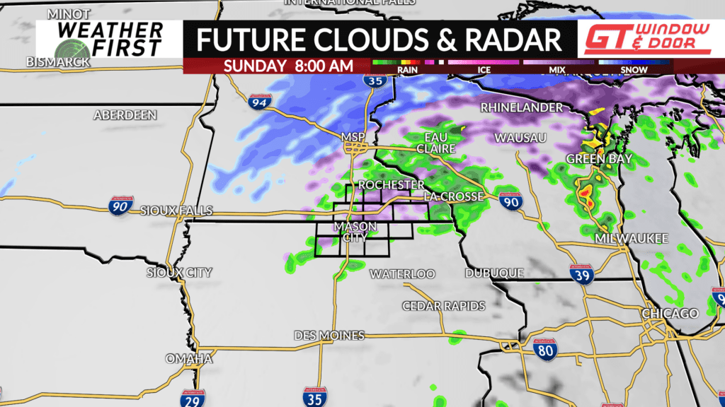
Rain will change over to all snow by Sunday evening, with a quick dusting to 2″ most likely north of the Minnesota/Iowa border. The best chances for snow will be primarily north of I-90. Again, there may be some slicks spots to watch out for Sunday evening. Make sure to tune in for the latest this weekend!