Alert Day Monday

Monday could be a big day across the Weather First area. Not only are we tracking the risk for extreme heat Monday afternoon, but we are also monitoring the potential for severe weather into Monday night. Because of these threats, Monday will be an Alert Day for our area.
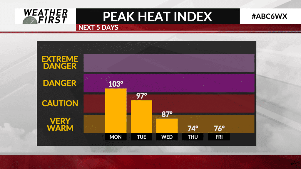
Just a quick reminder: a Heat Advisory remains in effect for all of our county viewing area until 8PM CDT tonight. Heat index values are in the 90F’s for most of the viewing area, with values over 100F coming in for our Iowa counties. Stay cool, hydrated and safe out there the rest of today! Now for Monday…
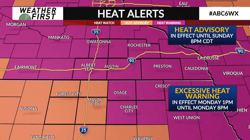
First off, an Excessive Heat Warning will be put into effect Monday 1PM CDT and will last until Monday 8PM CDT for the following local counties: Goodhue, Wabasha, Olmsted, Dodge, Steele, Freeborn, Mower, Fillmore, Mitchell, Howard and Floyd counties.
A Heat Advisory will be put into effect Monday 1PM and will last until Monday 8PM CDT for the following local counties: Cerro Gordo, Hancock, Worth and Winnebago.
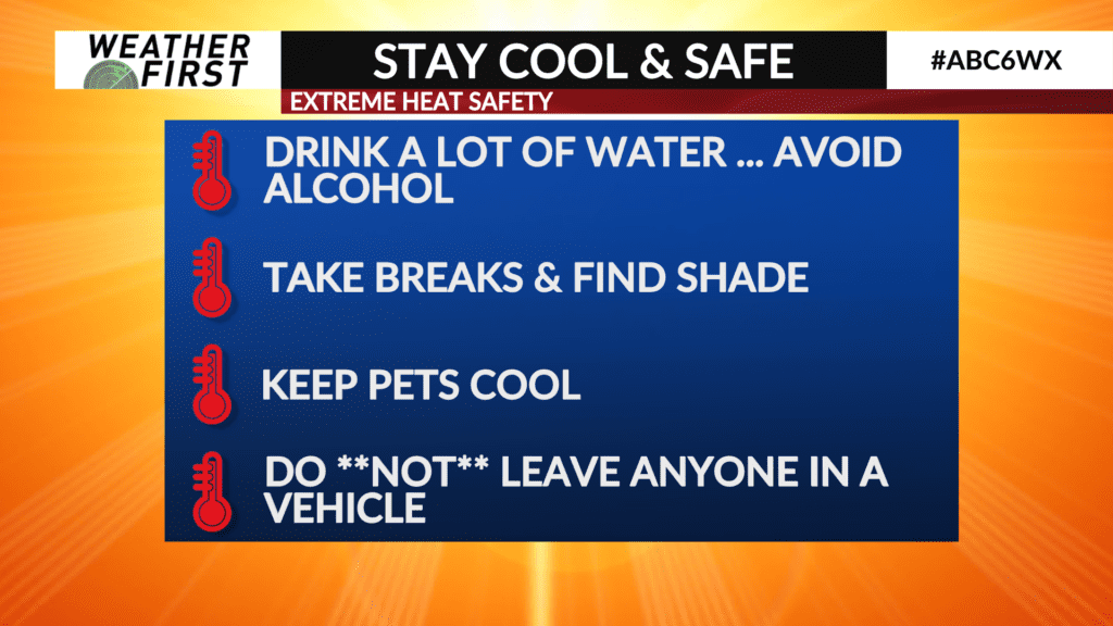
Staying cool and safe will be essential tomorrow for you, your family and your pets. Precautions that can be taken to limit risk for heat related illnesses such as heat stroke and heat exhaustion include: staying hydrated by drinking plenty of water (alcohol does not count), taking shade breaks frequently, keeping and eye on pets and family members and making sure they are staying cool, and most important, DO NOT leave anyone or any pet in a vehicle unattended! A parked vehicle can reach just shy of 140F in just a matter of an hour or two, which is deadly for pets and humans.
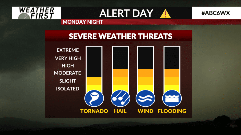
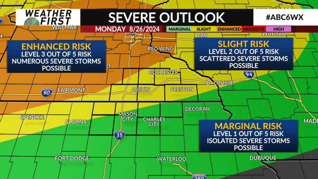
The other concern we are monitoring is the risk for severe weather going into Monday evening and night. A cold front is expected to track through the area Monday night bringing the chance for showers and t-storms with it. Given the environment consisting of very moist air and elevated shear along the front, severe storms are possible, especially the further north and northwest you are across the county viewing area.
The one thing going in our favor is that there is likely to be a cap most of the day Monday and into Monday night that may prevent any storms from making it into our area at all. While the southern extent of these storms is unclear at this time, the best chance for severe storms appears to be for our Minnesota counties, but Iowa is certainly not out of the woods.
Large hail, damaging winds and tornadoes will all be possible with these storms Monday night, so staying weather aware will be very important during this time period.