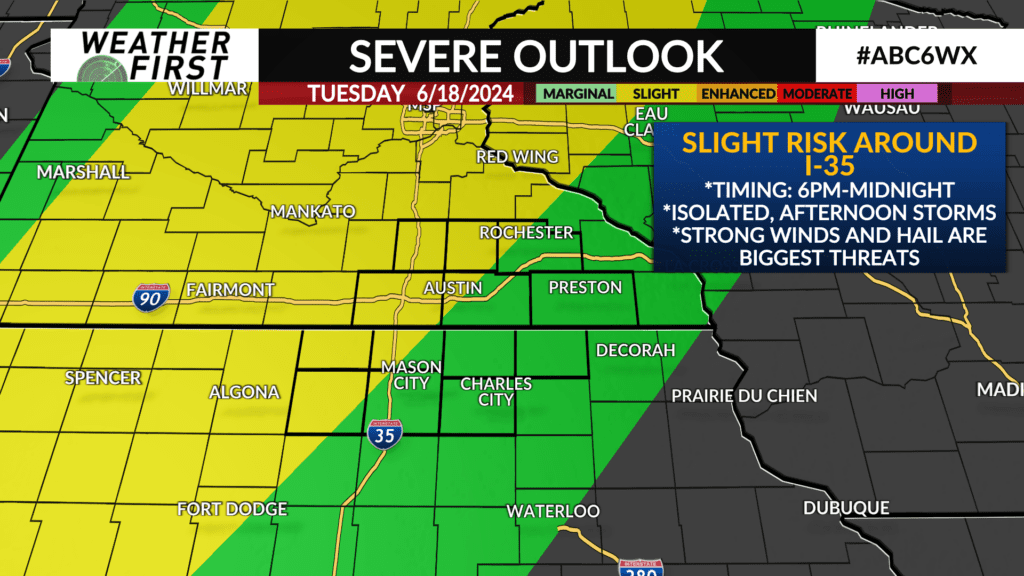
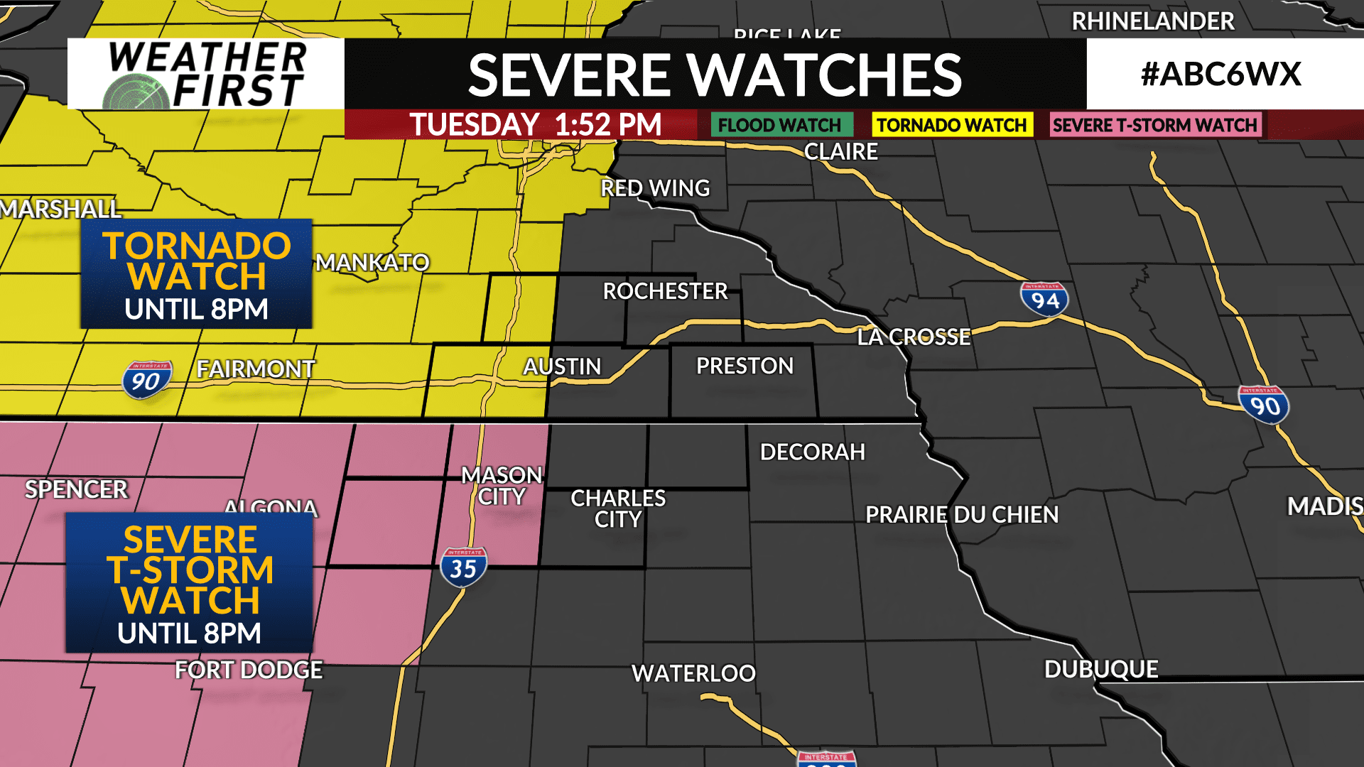
ALERT DAY: Watches have been issued until 8pm Tuesday evening
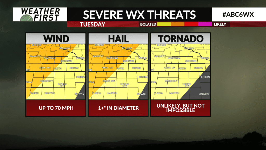
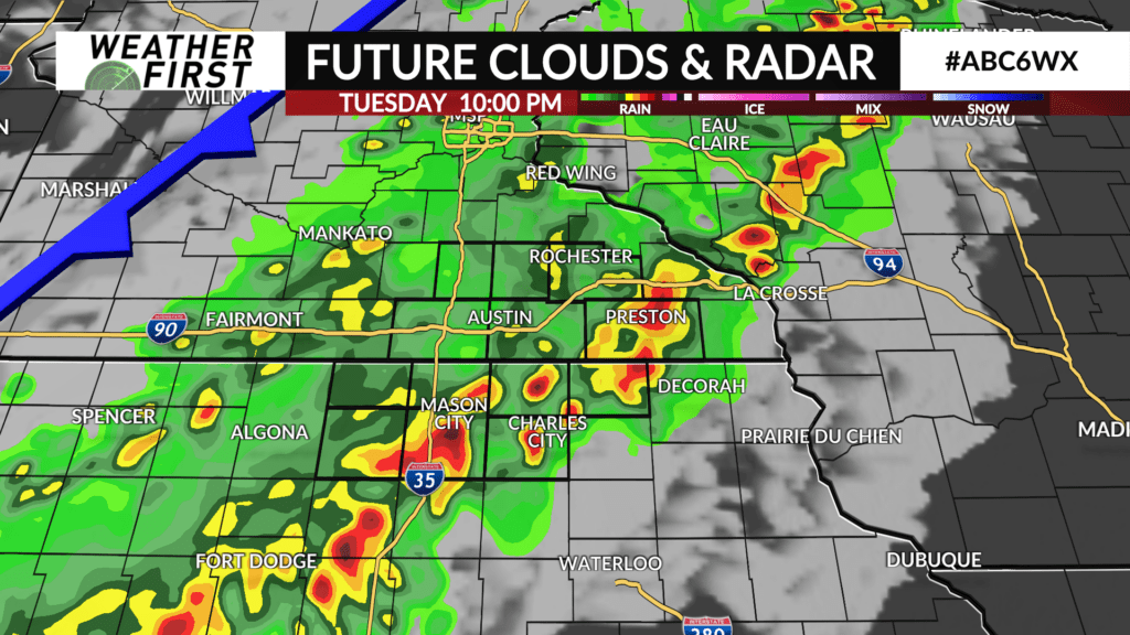
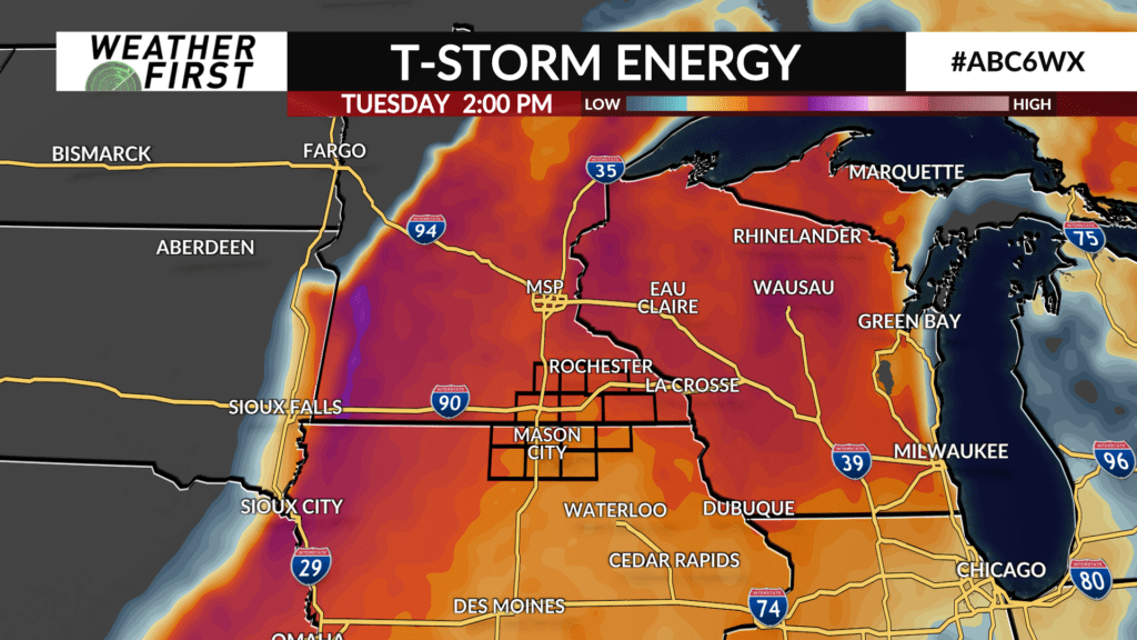
We are in an Alert Day for the second day in a row with another round of strong to severe storms on the horizon. While a couple cells could develop out ahead of the main line of storms, it is this evening where the main line will pass through. Along the leading edge of these storms, strong winds are expected and small hail cannot be ruled out.
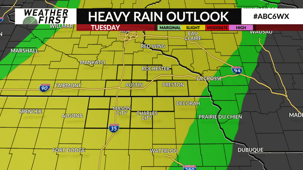
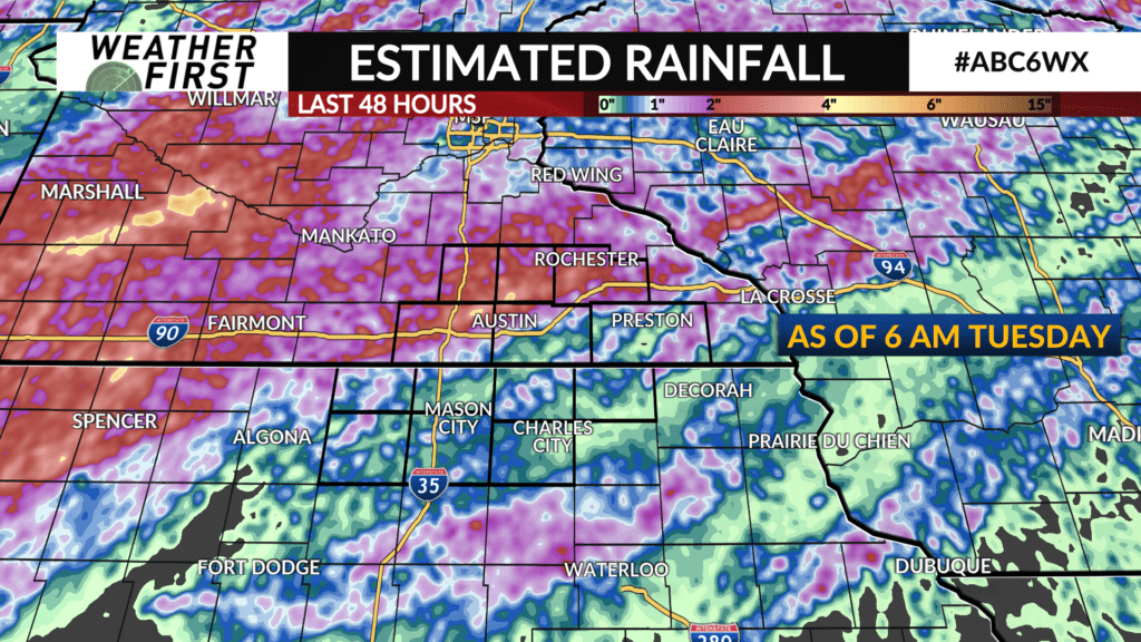
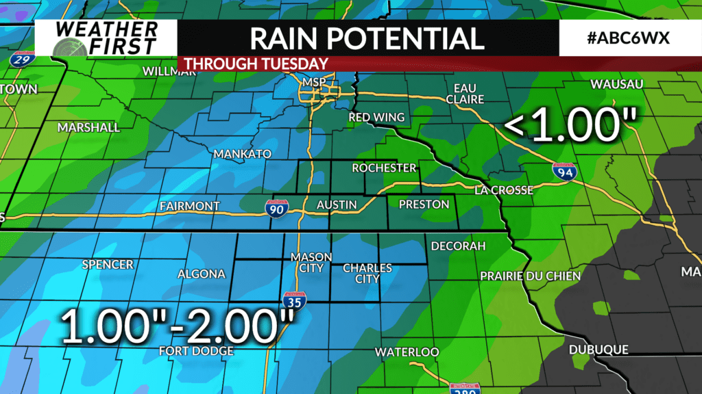
In addition to wind and hail threats, storms will also be capable of producing heavy rainfall yet again. Another 1-2″ of rain will be possible this evening. Depending on where the heaviest rainfall occurs, this could lead to some flooding.
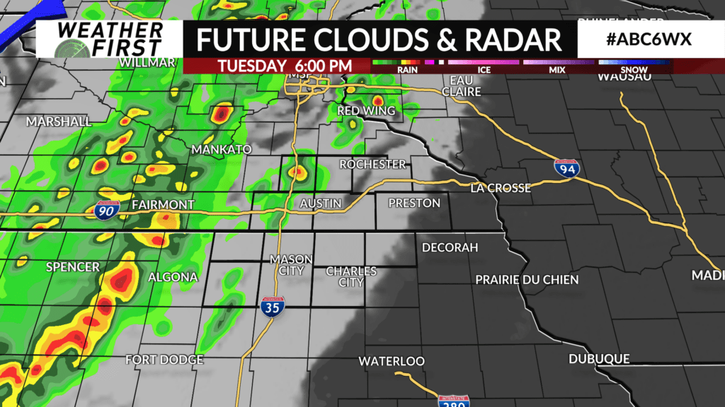
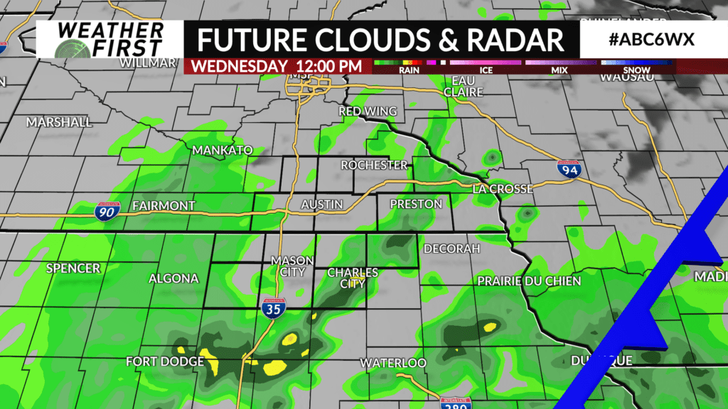
Around 3-5 PM, we could see a few smaller cells in our area with brief downpours. From about 6 PM to midnight is when the main line of storms is expected to pass through our area. Once the cold front behind these storms is out of our area, this will be the end of our severe threat.