An extended look ahead
With temperatures breaking records and no snow on the ground across southeastern Minnesota and northern Iowa, everyone is likely wondering how long this will last…
The Climate Prediction Center is saying things may do a 180 degree turn around the next 2 weeks, with colder air and snowier conditions setting in across the Upper Midwest.
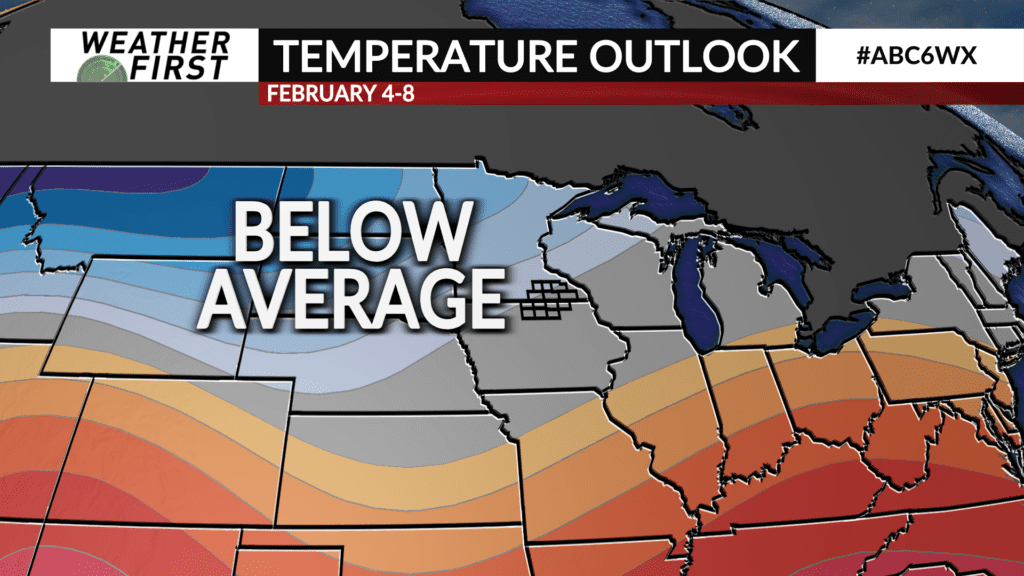
For the entire 6 to 14 day period, the CPC is forecasting near to slightly below normal temperatures across portions of southern Minnesota and northern Iowa. This comes as ridging across the southeastern United States drifts east, and the polar jet lowers back into the Lower 48. This type of pattern will bring the return of colder air, but extreme cold is not likely at this time.
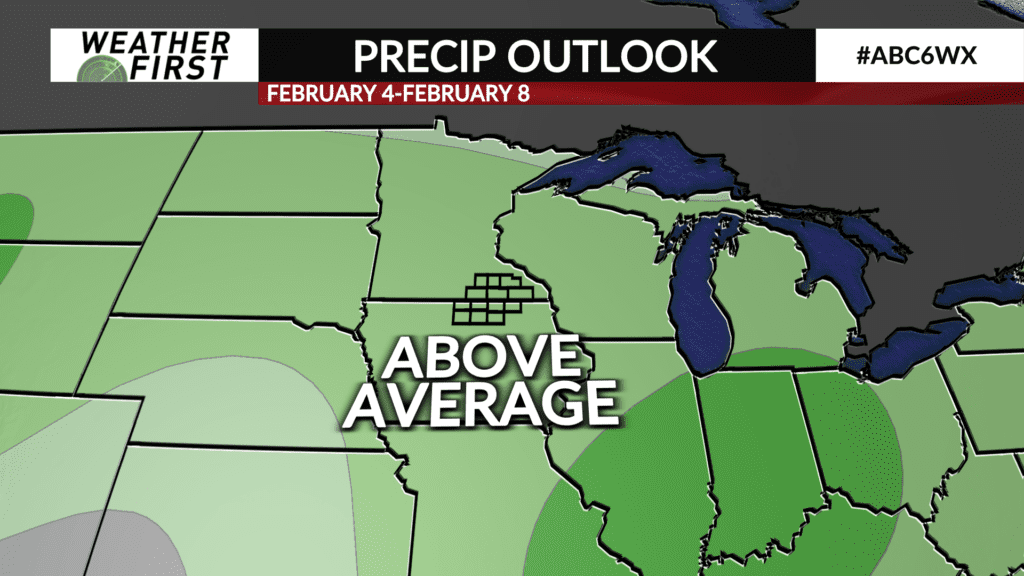
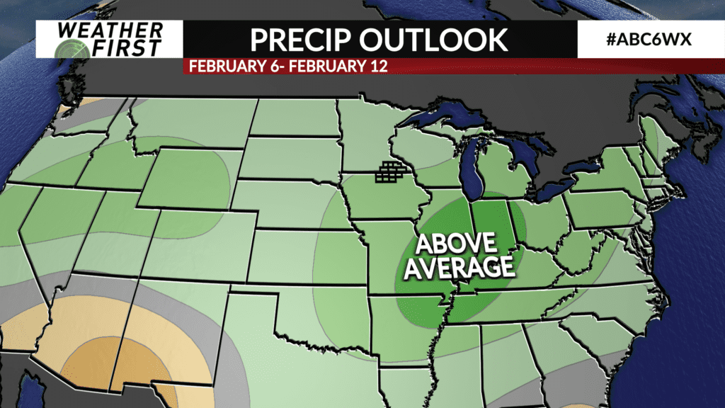
The same jet pattern may allow for more frequent precipitation chances across the area as well. The CPC is issuing fair odds of above average precipitation across a majority of the Midwest through the first half of February. With temperatures cooling off next week, it’s fair to assume that any precipitation would be in the form of snow.
Taking a look at the extended local forecast, there are slight chances of snow this weekend, and chances may need to eventually be added next week as well. There are no indications of any major winter storms as of now, however. Stay tuned!
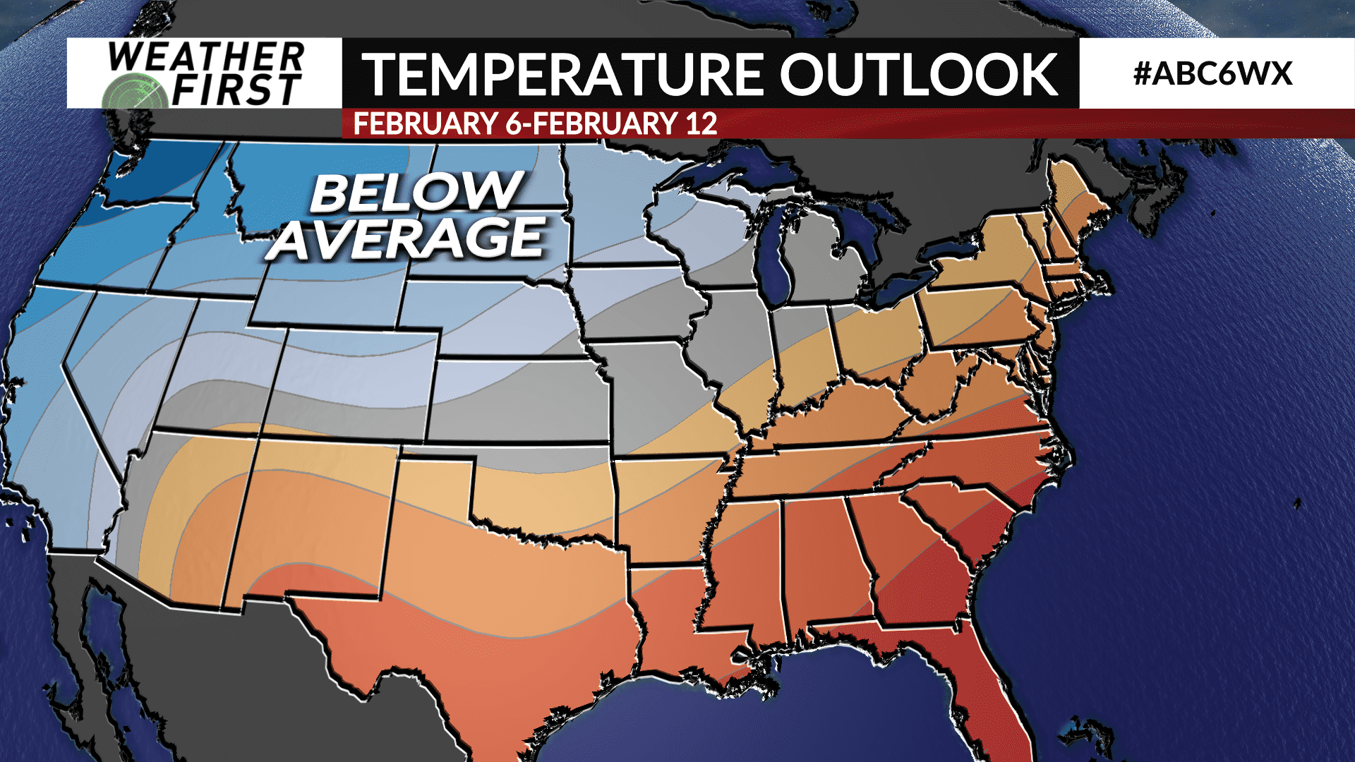
The CPC also predicts that colder air relative to average will stick around the northern United States into the middle of February. Moral of the story? If you are a fan of the warmth, take advantage of it today if you can!