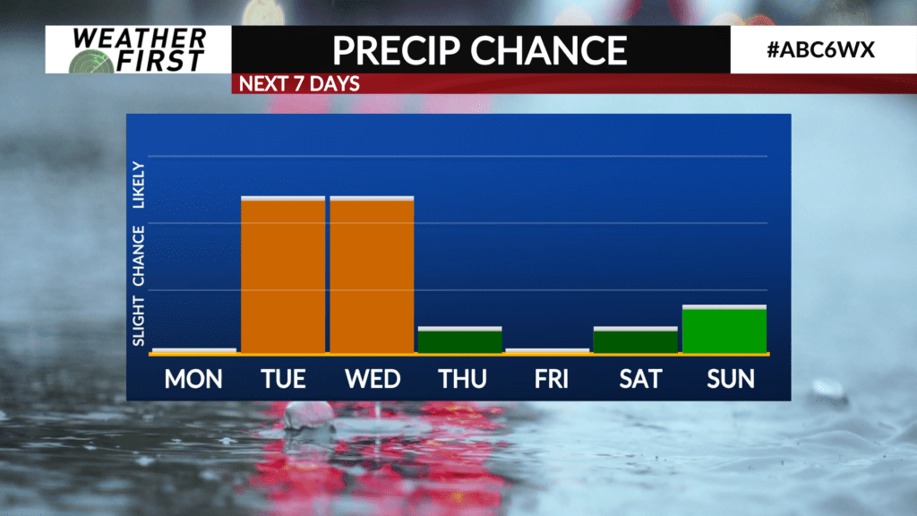
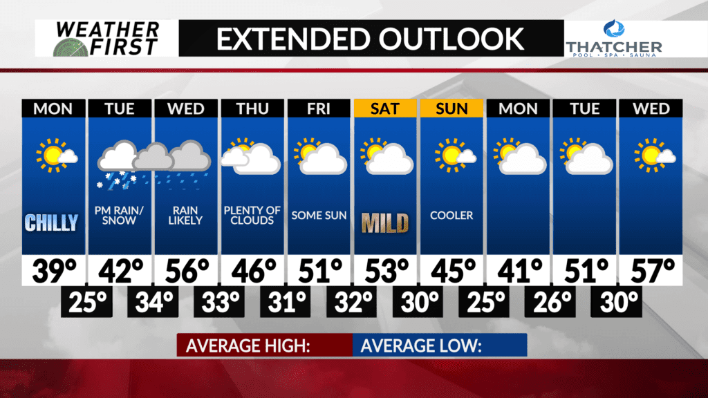
Another potent spring system Tuesday/Wednesday
With snow coming to an end across southeastern Minnesota and northern Iowa this evening, our attention will quickly turn to another potent winter system that will impact our area Tuesday and Wednesday.
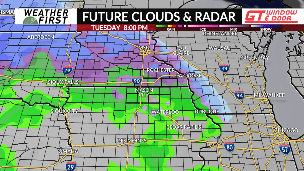
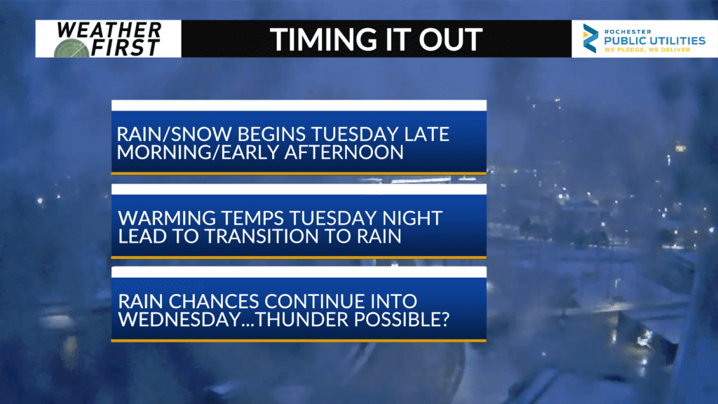
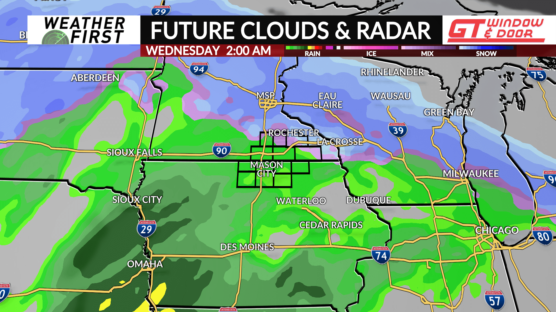
Precipitation onset has not shifted in time much since earlier this weekend, with a mix of rain and snow beginning late Tuesday morning into the early afternoon hours. The type of precipitation we see across the region will depend on not only surface temperatures, but temperatures aloft as well.
If temperatures near the surface and aloft are warmer, then precipitation will be in the form of rain primarily. If surface temperatures are warm (above freezing) but the warmth does not extend far above the surface, snow chances will be greater.
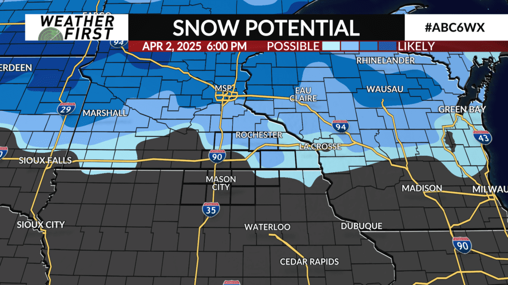
Snow accumulation would likely result if a more snow filled scenario takes place. Snow accumulations look to be in the 1″-3″ across southeastern Minnesota and perhaps portions of northern Iowa. Better chances for an all rain scenario are across northern Iowa.
If a more snow filled solution pans out, impacts to the Tuesday evening commute will be possible. Stay tuned!
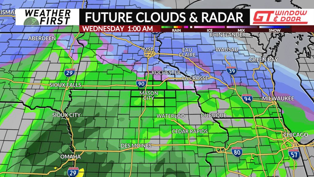
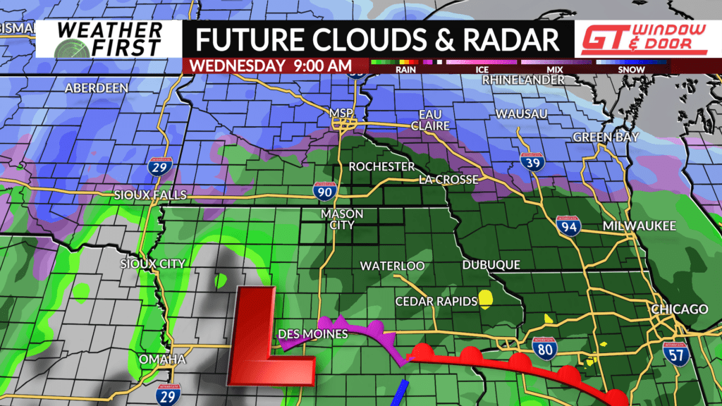
Surface temperatures will actually warm up as Tuesday night progresses, leading to a transition from snow to rain. By Wednesday morning, precipitation will likely be in the form of rain across the entire region.
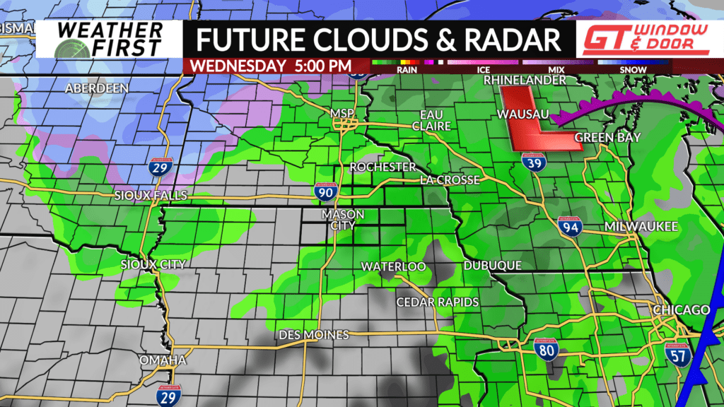
The surface low will track to our northwest during the day Wednesday, resulting in a continued surge of warmer temperatures. Highs Wednesday will be in the mid to upper 50F’s, allowing for precipitation to remain in the form of rain throughout the day.
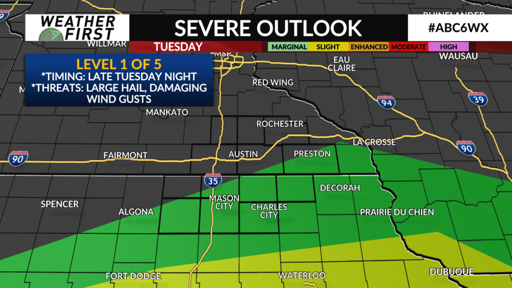
In fact, there is a chance for a few thunderstorms, especially across northern Iowa Wednesday. The Storm Prediction Center has portions of northern Iowa under a Marginal Risk (level 1 out of 5) for Wednesday. Large hail and damaging winds would be the main concerns. Something to watch!
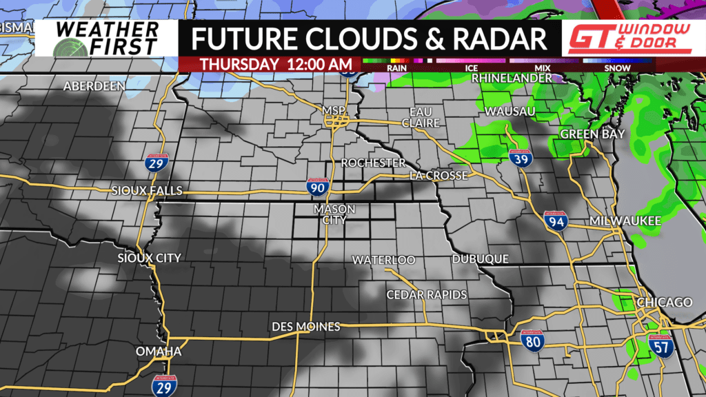
Precipitation is currently slotted to exit the area Wednesday evening, giving way to cloudy skies into Thursday. There are still plenty of details to narrow down with this system over the 24 hours, so make sure to check back in for the latest as it becomes available!
