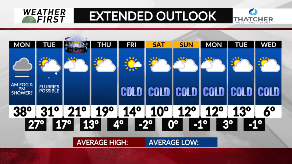
Arctic air on the way, how long does it stick?
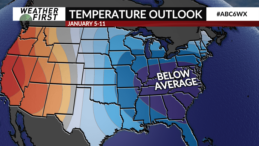
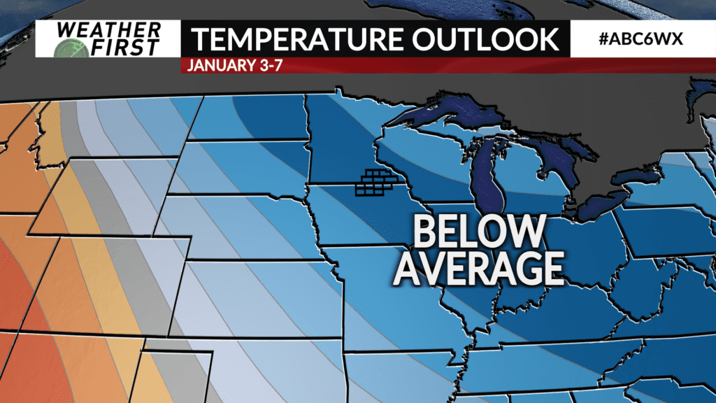
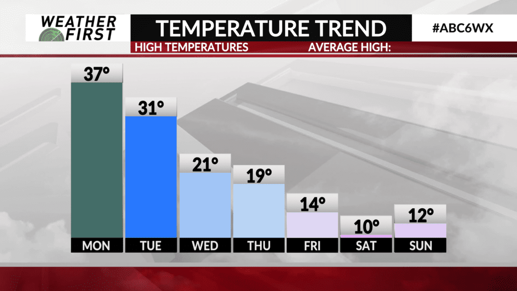
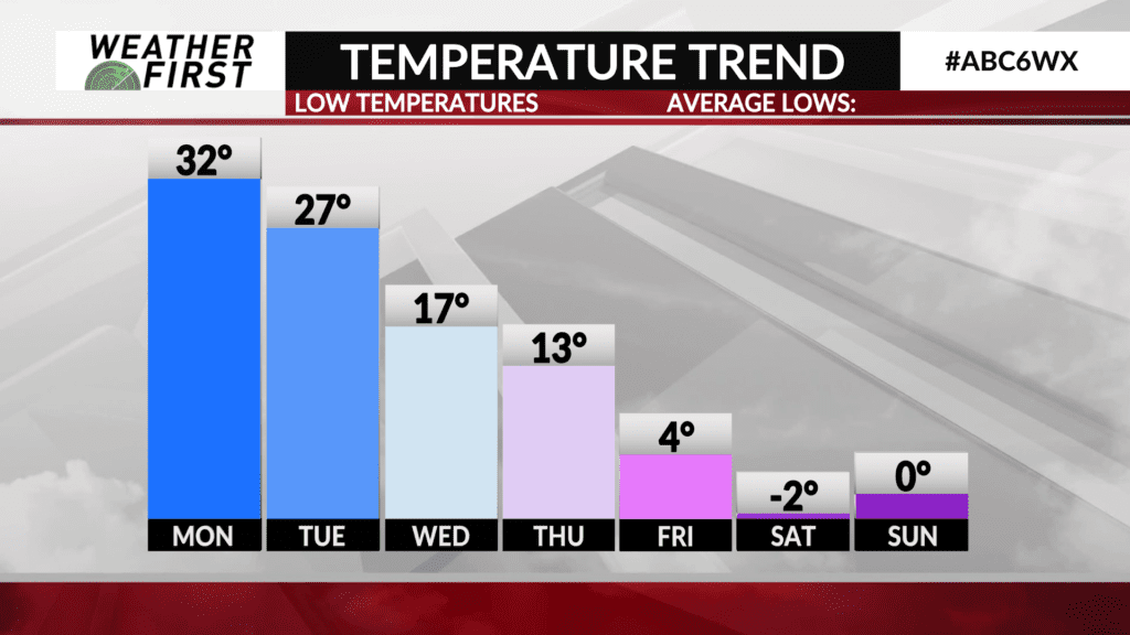
After a week of mild temperatures across our area, the stage is set for much colder air to set in across the Upper Midwest, and most of the country.
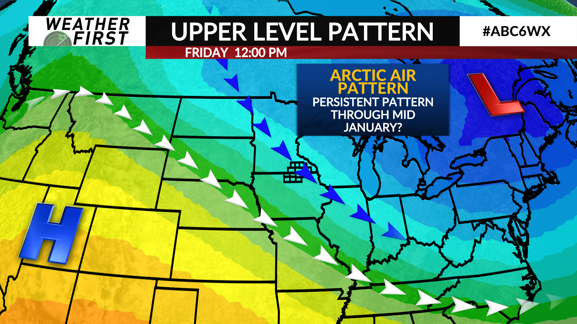
The shift toward a different upper level pressure pattern has already begun across North America as of this weekend. Multiple troughs have made their way across the country, and while they have not managed to bring any cold Canadian air southward, they have kicked off the formation of an upper level low over southeastern Canada.
Meanwhile, a ridge of high pressure is expected to develop off the United States west coast over the next week, further amplifying the upper level low over southeastern Canada, and forcing the jet stream to dive southward across the southern United States.
This pattern is highly favorable for not only a lack of major storm systems across our area, but also for a prolonged stretch of well below normal air temperatures across the northern United States, including Minnesota and Iowa.
Once this pattern is in full effect, there are no indications that it will subside all the way into the middle of January. This type of pattern is often known as a “blocking” pattern, and they tend to stick around for quite some time. They also are prone to return more quickly when they break down.
While there are no guarantees with the weather, especially over a week out, it certainly does appear that much colder, arctic air may be here to stay for quite some time as we enter the new year.
