Bitterly cold temperatures this week, milder next weekend?
Temperatures this next week are going to be bitterly cold, but there are early signals of a dramatic warm up on the horizon!
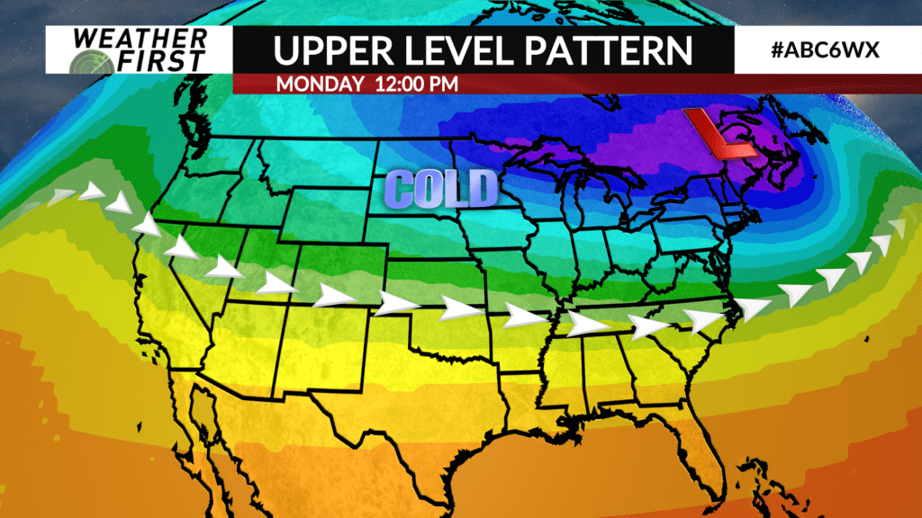
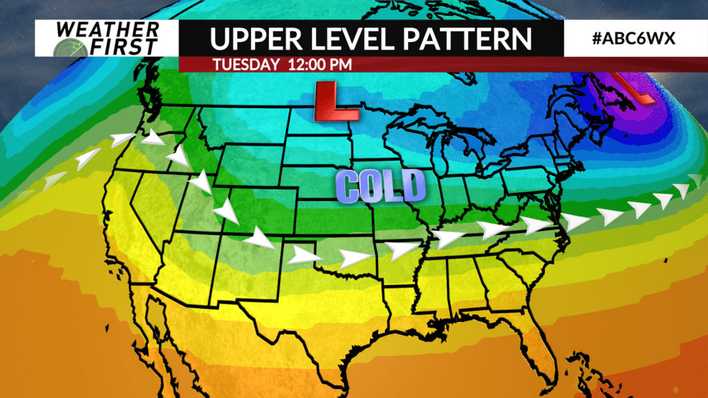
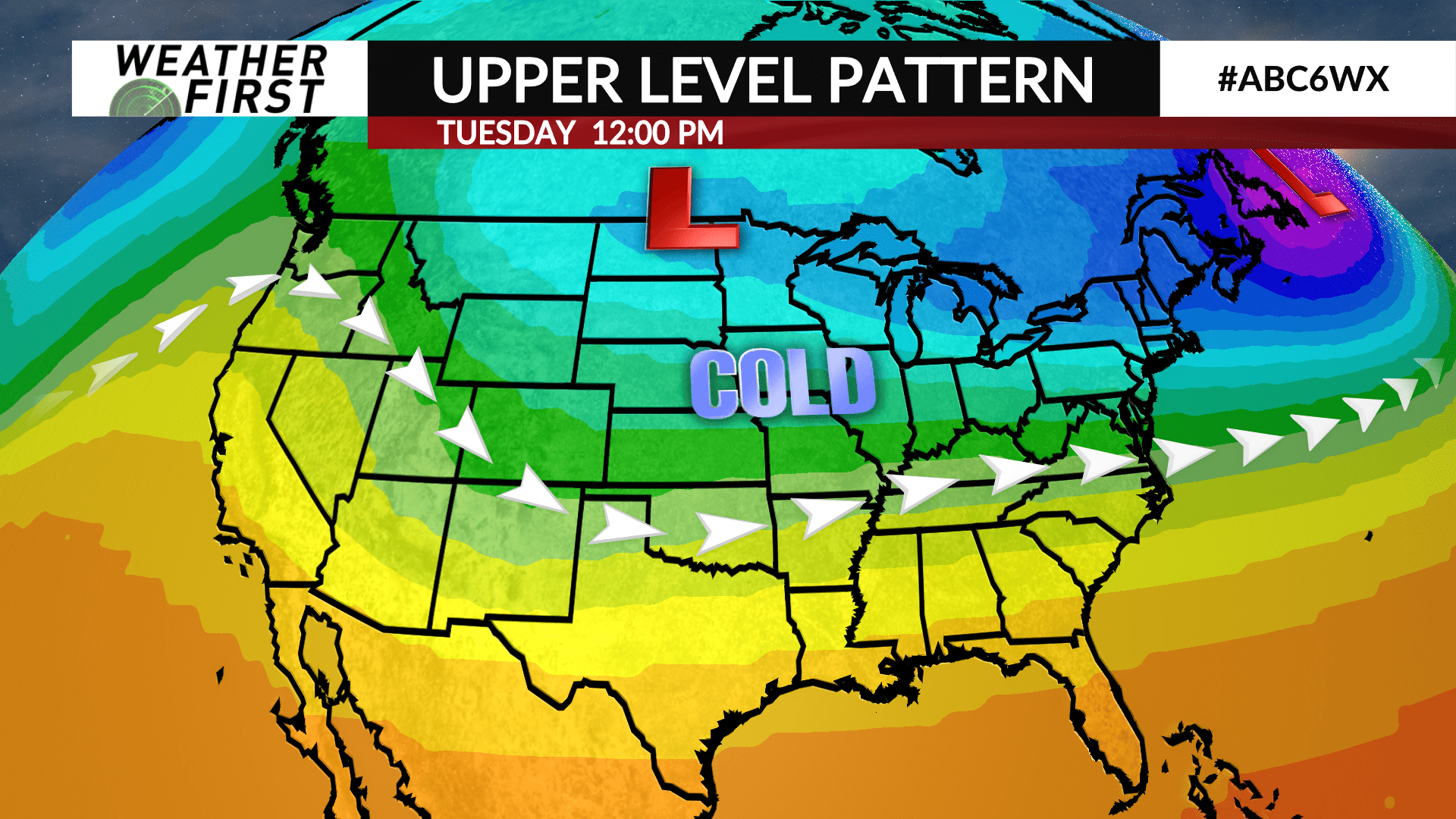
Arctic high pressure will continue to nudge southeastward over the next few days, bringing clear skies (at times), and bitterly cold arctic air. Clouds will increase at times throughout the week, especially as an elongated area of low pressure tracks across Kansas and Missouri Monday through Wednesday. Too cold for any snow here…
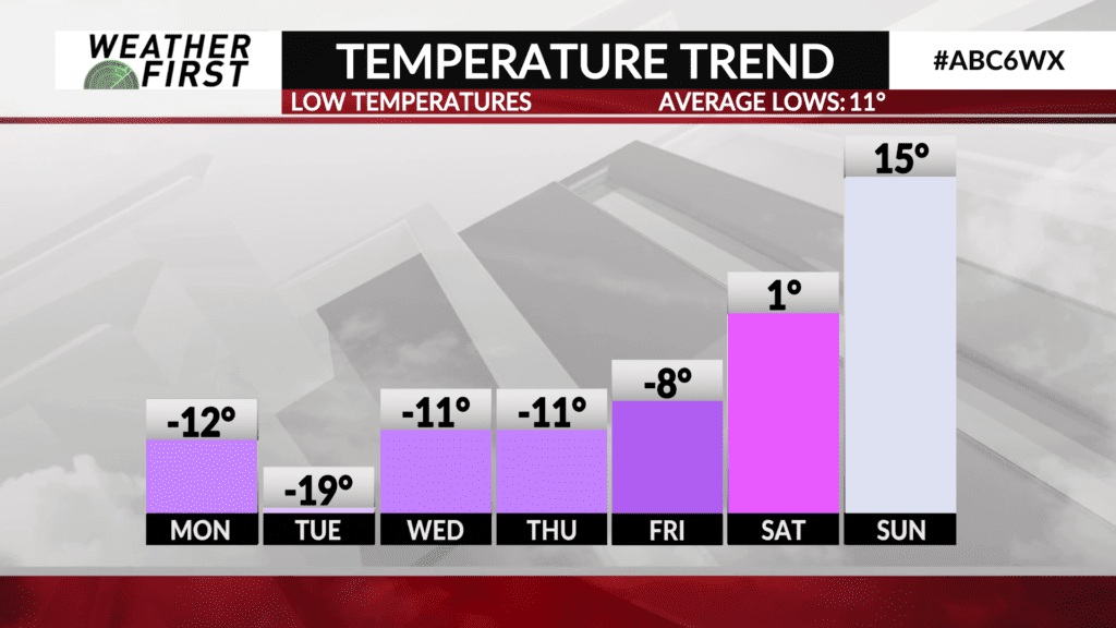
Winds remain breezy through Monday, before diminishing some Tuesday. These winds will result in wind chills between -20F to -40F at times Sunday night through Tuesday morning.
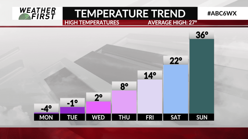
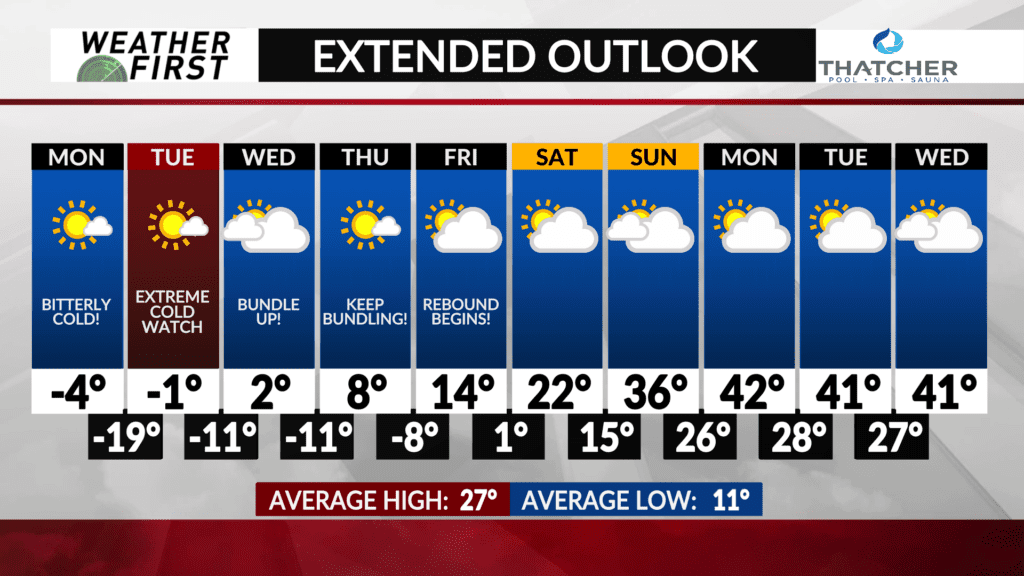
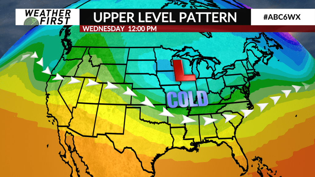
Temperatures will drop into the negative teens once again Tuesday night and into Wednesday morning, with wind chills remaining below 0F through the day Wednesday. High temperatures will only climb into the single digits above 0F.
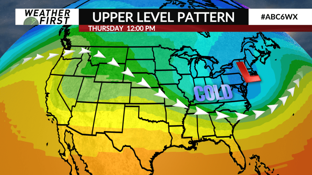
Thursday will not be much better, with highs in the single digits and wind chills remaining below 0F. Friday, high temperatures reach into the mid teens, but drop near, to below 0F Friday night into Saturday.
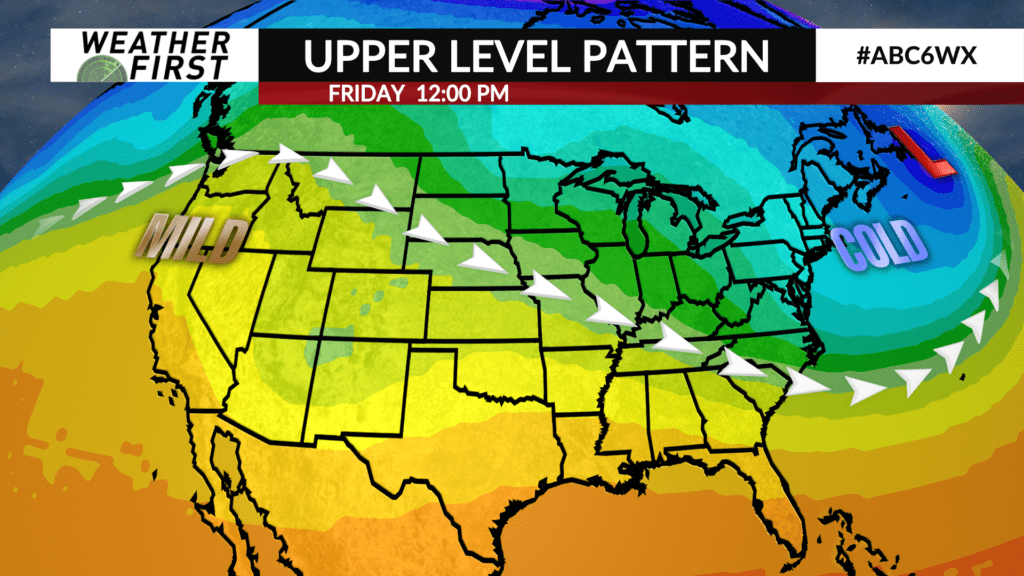
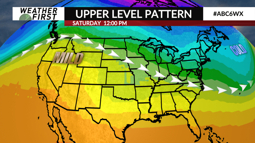
A pattern change looks to arrive next weekend! High temperatures climb into the 20F’s Saturday, with even warmer temperatures on Sunday. In fact, high temperatures could climb into the 30F’s by the end of next weekend!
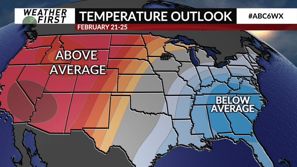
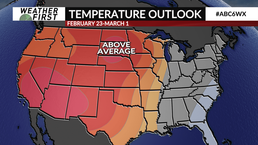
The Climate Prediction Center is currently anticipating higher odds of above average temperatures across much of the western and central United States by the end of February! Hypothetically, this would mean high temperatures well into the 30F’s and perhaps even 40F’s, but only time will tell. We can hope though!