Dramatic temperature swings ahead
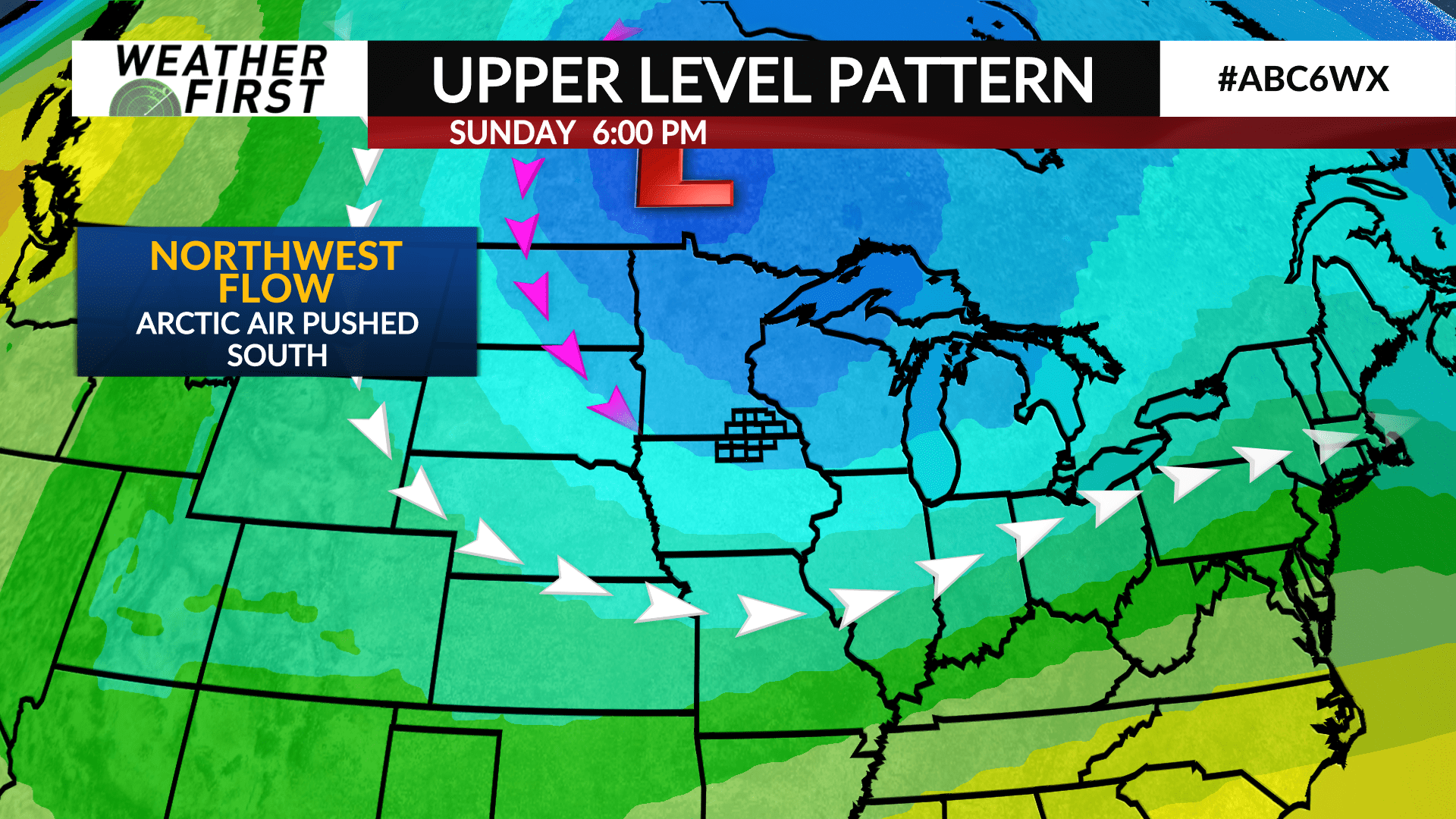
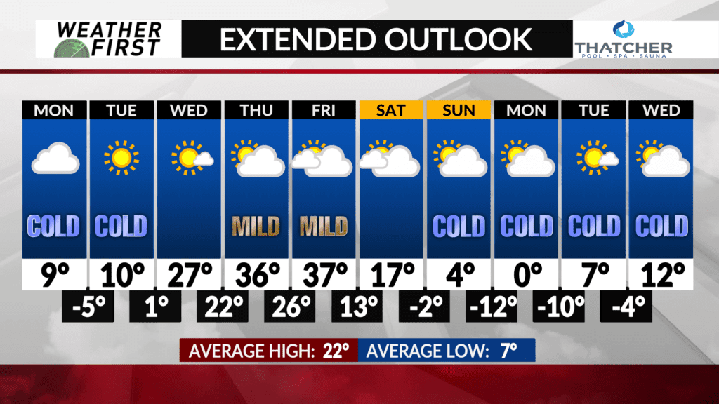
Temperatures are going to be up and down throughout the next week, with arctic air descending from Canada Monday through Wednesday morning, and more mild air moving in by midweek.
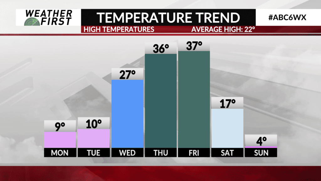
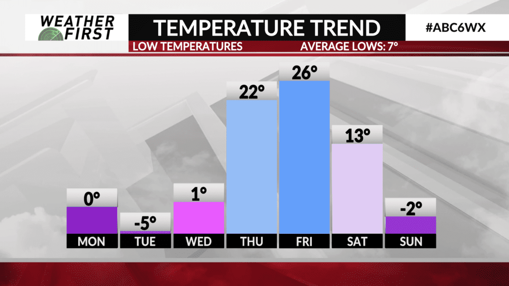
High temperatures will be in the single digits across portions of southeastern Minnesota on Monday, with wind chills as low as -20F during the morning hours both Monday and Tuesday. Northern Iowa will be slightly warmer, with highs in the teens both Monday and Tuesday. Highs reach the teens for southeastern Minnesota by Tuesday.
Southerly winds develop across the area Wednesday, drawing warmer air northward the second half of the work week. Temperatures climb into the mid to upper 20F’s Wednesday, above average for this time of year!
Thursday and Friday will feature highs in the mid to upper 30F’s across southeastern Minnesota, and potentially into the lower 40F’s across northern Iowa!
The mild air doesn’t stick around for long, however. Another large and sprawling mass of arctic air will slide southward next weekend and into early next week. This will send temperatures crashing back down into the single digits for daytime highs, and well below 0F for nighttime lows late next weekend and early next week.
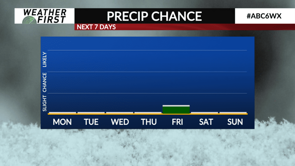
Precipitation chances are essentially nonexistent the next week or so, with upper level northwest flow preventing any moisture from making its way northward across the Upper Midwest. Great ice making weather, but not great snowmobiling weather.
