Entering a sluggish weather pattern this next week
We all love traffic jams I’m sure…but do you love weather traffic jams? We certainly will be in one over the next week or so, with our local weather staying more of the same temperature and precipitation wise.
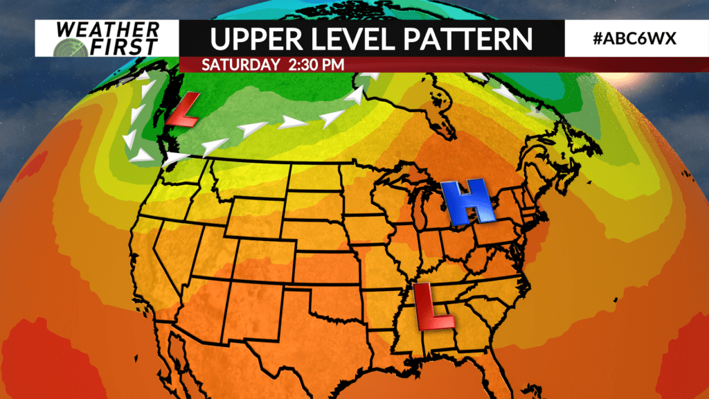
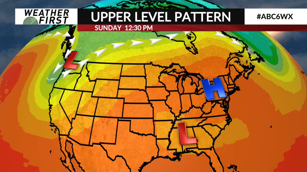
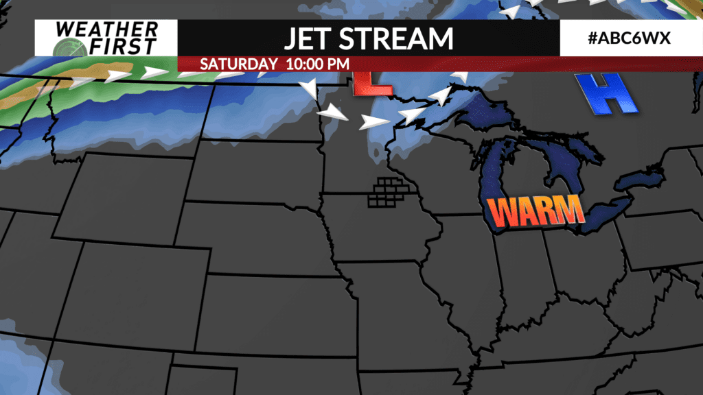
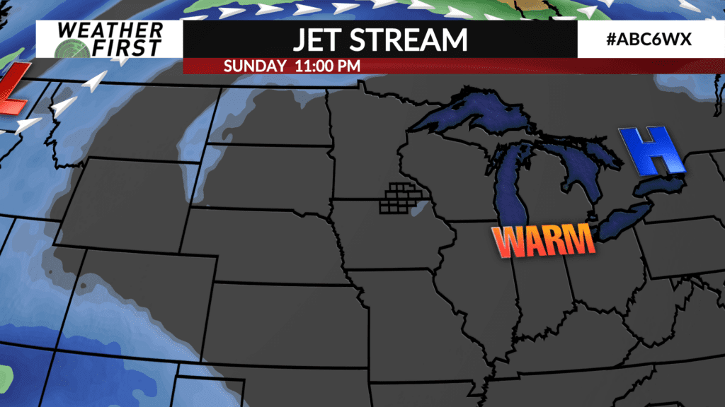
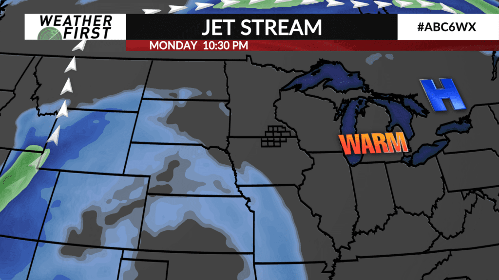
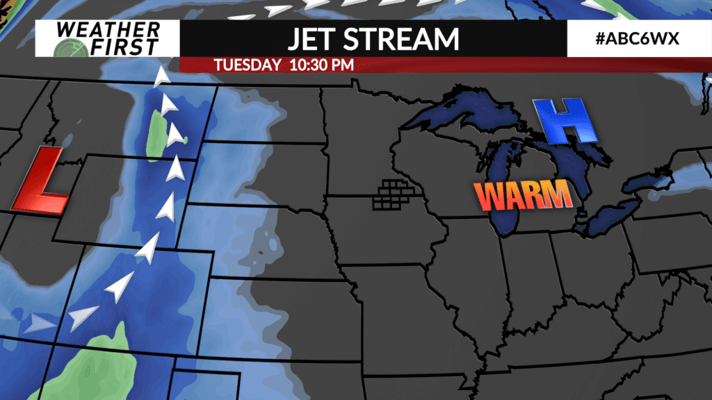
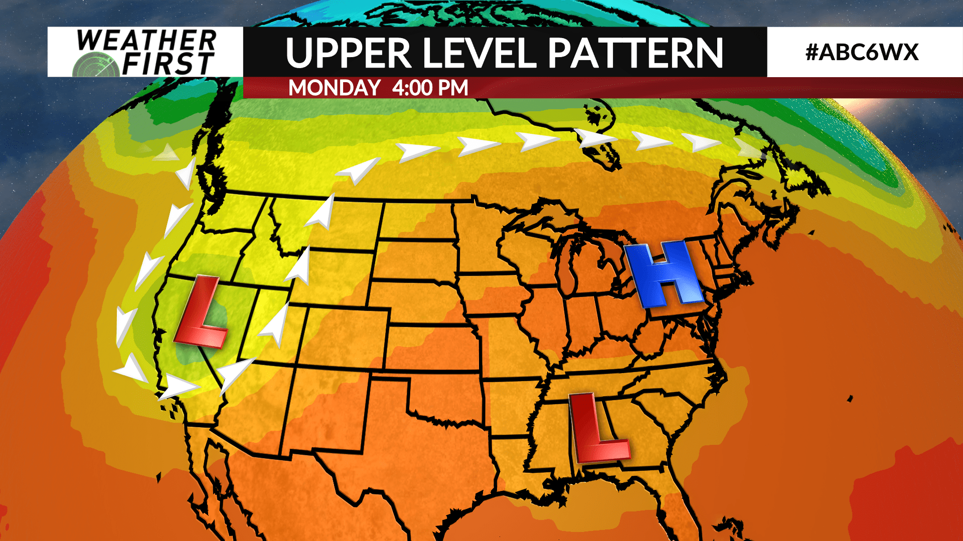
A ridge of high pressure will stall out to our east this weekend, with an upper level low stuck underneath it. This type of pattern, known as a Rex Block, is notorious for backing up the atmospheric flow for a week or longer. In simple terms, weather won’t be changing much around here this next week!
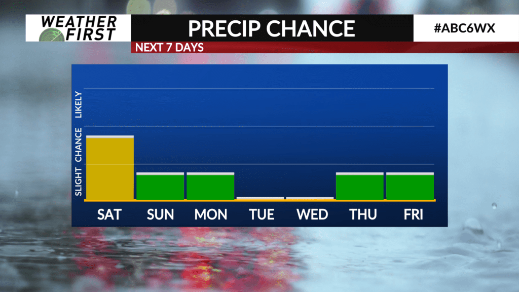
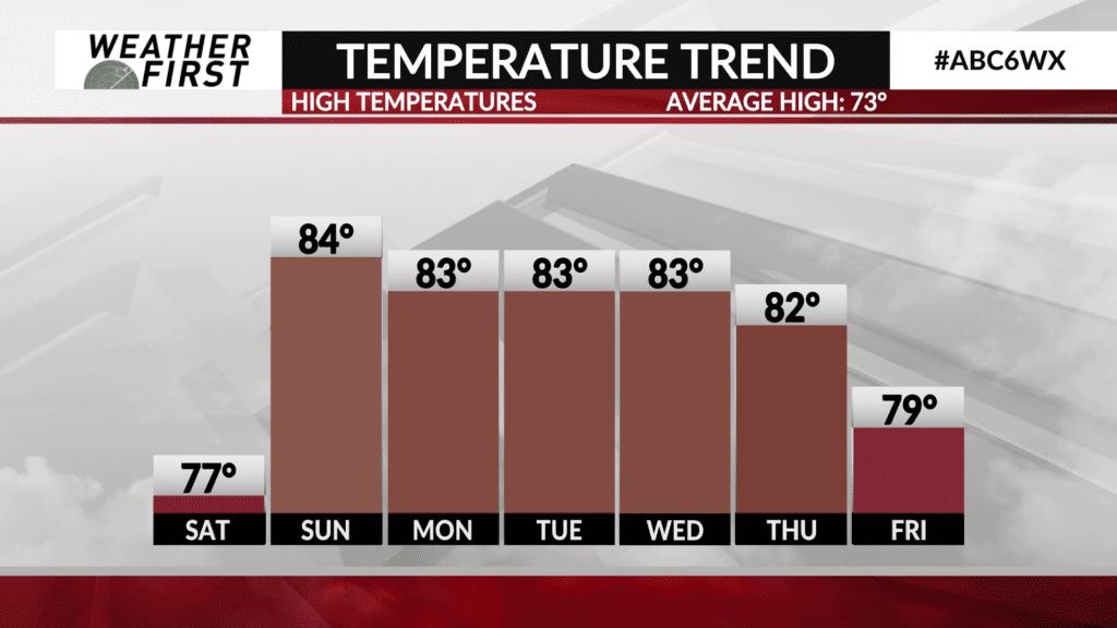
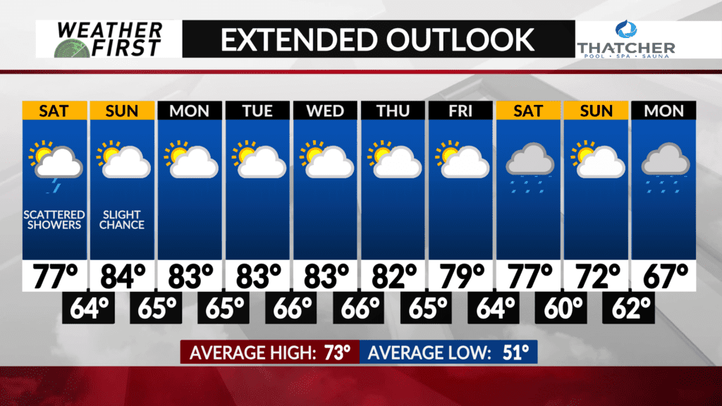
Monday will feature sunshine, warmer temperatures, higher humidity, and a slight chance of a few spotty showers and t-storms. Highs will be in the low to mid 80F’s across the area, with dew points in the mid to upper 60F’s. A warm and humid day!
Tuesday and Wednesday will feature plenty of sunshine, with highs in the low to mid 80F’s once again, and dew points in the mid 60F’s. Thursday will be the final day in the low 80F’s across our area before slightly cooler weather begins to arrive by next weekend, with highs in the mid to upper 70F’s.
There is a lot of uncertainty in the forecast past next Wednesday. Model guidance indicates that a trough of low pressure will begin digging southward across the Rocky Mountains by the end of next week. They differ, though, in how far east the trough can advance given the blocking pattern to our east.
Some models show the trough advancing far enough east to provide multiple chances of rain toward the end of next week and into the following weekend. Other model guidance keeps us entirely dry through the whole forecast period. Still a lot of time to work these details out luckily, so check back with us in a few days on what the end of next week may look like!