Fall arrives end of next weekend?

I mentioned the Rex Block stalling out our weather in the previous Weather First article…but what happens when this blocking pattern breaks down? What will it mean for our area?
Model guidance is still a bit finicky regarding the timeframe of late next week and into the weekend, but there is increasing agreement that the trough of low pressure lurking to our west will finally swing through end of the week and into next weekend.
As this trough passes through, there is a good chance our area will see at least one or two rounds of more widespread precipitation, especially next weekend. Exact timing is almost impossible to pin down this far out, but scattered showers are a good bet through the weekend.
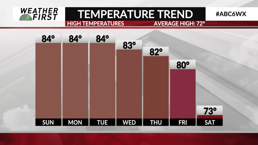
This trough would also mean a surge of Canadian air making its way into the northern United States behind it. While temperatures do not look to get too cold behind the trough for us locally, they certainly will be a step down from the low to mid 80F’s we are expecting most of the coming week.
Current guidance suggests that highs across the Weather First area may drop into the mid to upper 60F’s by the end of next weekend and into the following week. This is still a long ways out though, so there is more unknown than known. The bottom line is that there certainly is a good possibility our summerlike pattern comes to an end next weekend, and we finally see our first prolonged taste of early fall weather!