Friday temperatures with precipitation likely this weekend
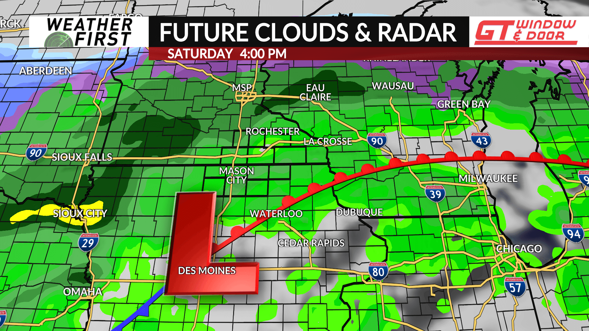
A warm front will lift into the region and setup near or in the area on Friday which will be the focal point of precipitation heading into the weekend.
There is still some uncertainty on where the front will ultimately layout which will impact temperatures. If the front were to layout north of the area, strong southerly flow would lead to temperatures likely climbing into the 70s and even some 80s. However, it’s possible the front could be further south around the Minnesota and Iowa state line which would put Southeast Minnesota on the “cool” side of the front leading to highs in the 40s and 50s, while North Iowa would be on the “warm” side with temperatures in the 60s and 70s. Still lots to sort out in the days ahead.
A surface low pressure will move along the front from the Central Plains into the area beginning late Friday night with rain showers developing. Periodic showers will be likely through Saturday. The heaviest precipitation will likely fall in the vicinity of the frontal position. Showers will come to an end by Sunday morning, however some snowflakes are possible as colder air builds in behind the system.
Another wave of energy will move along the front Sunday night into Monday which may bring some rain and/or snow to the area. However, there is quite a bit of uncertainty on where this will track.
Specific details will be sorted out in the days ahead so keep checking back for future updates.


