Friday’s (3/7/2025) Almanac
Friday was a beautiful day for early March across southeastern Minnesota and northern Iowa…for those who didn’t see some morning snow that is.
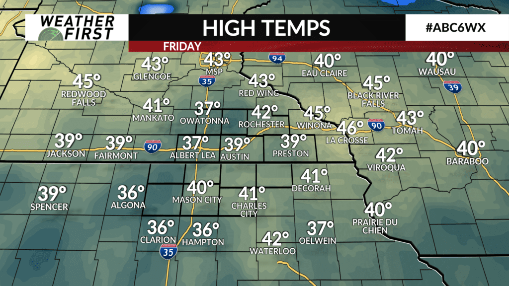
High temperatures across southeastern Minnesota and northern Iowa were largely in the upper 30F’s to lower 40F’s, with the cooler locations being Owatonna, Albert Lea and Algona, IA. These cooler highs were the result of snow on the ground in these areas, thanks to the blizzard earlier this week.
A brief explanation for why this is…snow has a high albedo, which means it has a higher ability to reflect sunlight back in the direction it is coming from. With more sunlight being reflected back into space, less energy is absorbed at the surface, and in the lower atmosphere, leading to cooler temperatures.
This phenomena results in cooler temperatures for locations with snow on the ground, and this was indeed the case today across much of southeastern Minnesota and northern Iowa.
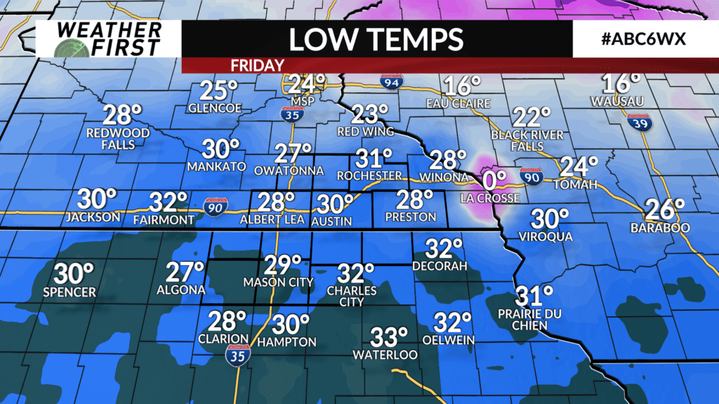
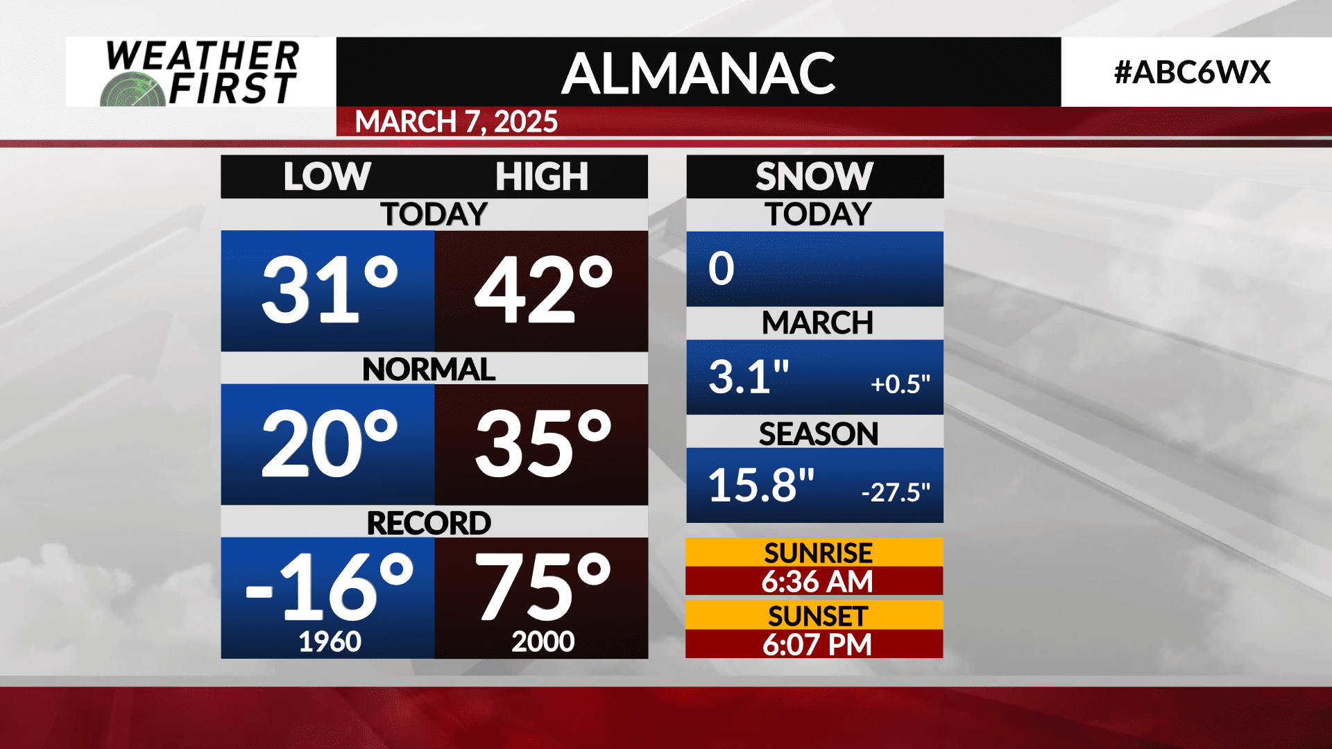
Rochester was let off the hook from these cooler temperatures a bit thanks to less snow being on the ground. The city saw a high of 42F, with a morning low of 31F. Both the high and low fall above the long term average high and low, but do not come close to approaching any records.
The record high for March 7th is a staggering 75F, set back in 2000. The record low, on the other hand, is -16, set back in 1960. What a difference!!!
While portions of northern Iowa saw snow this morning, Rochester missed out, and did not see any measurable precipitation today. The city has seen quite a bit of rain this month already, however, with 1.12″ of rain falling this past week. Rochester has seen a good deal of snow as well, with 3.1″ falling earlier this week.
From a precipitation standpoint, Rochester is in good standing for the first time in a LONG time!