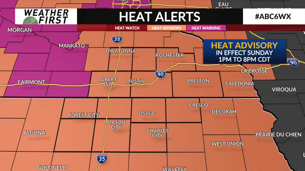
Heat lingers into early next week

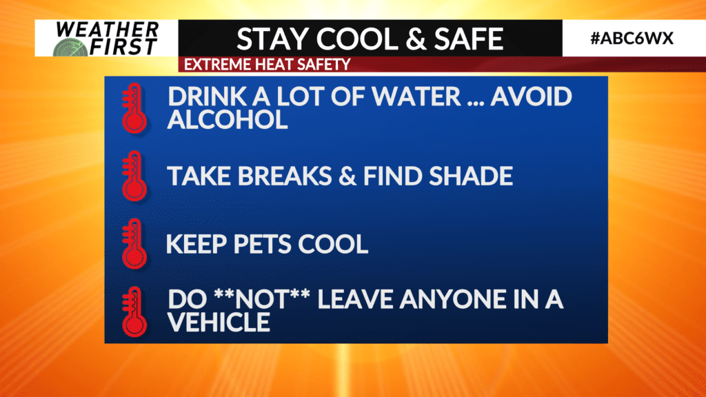
With the unofficial beginning of meteorological fall in sight, summer is rearing it’s head one last time across the viewing area, bringing the hot and muggy smack down upon us.
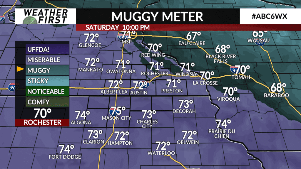
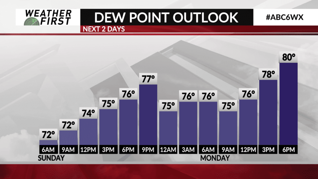
Temperatures only drop to the low 70F’s overnight tonight, with dew points hanging around the 70F mark. Crank up the AC for sure if you have an AC unit!
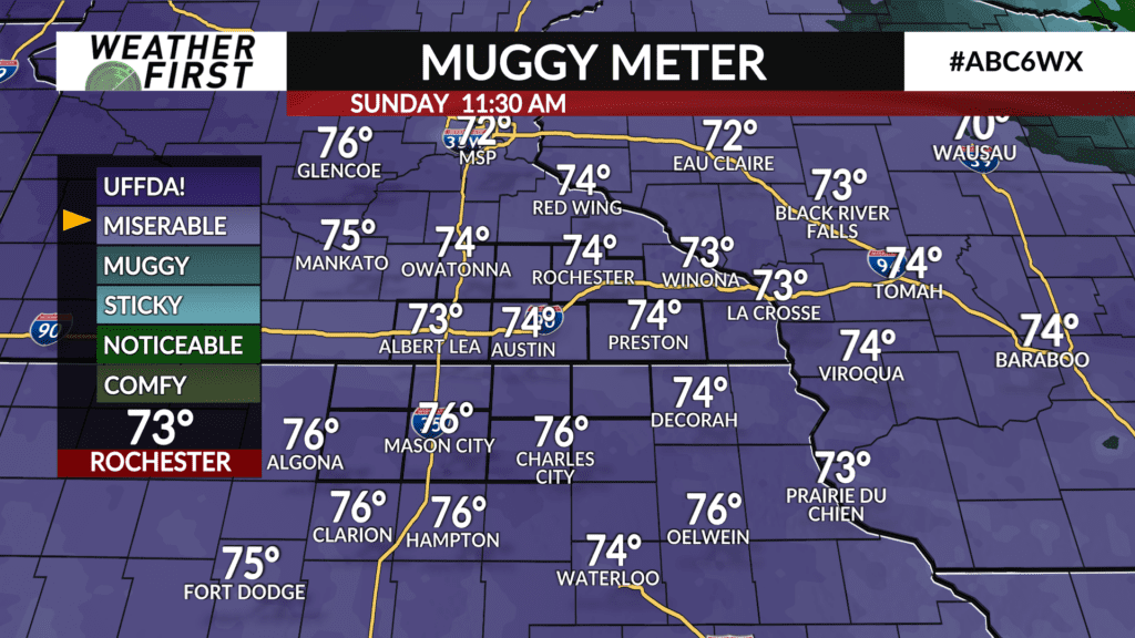
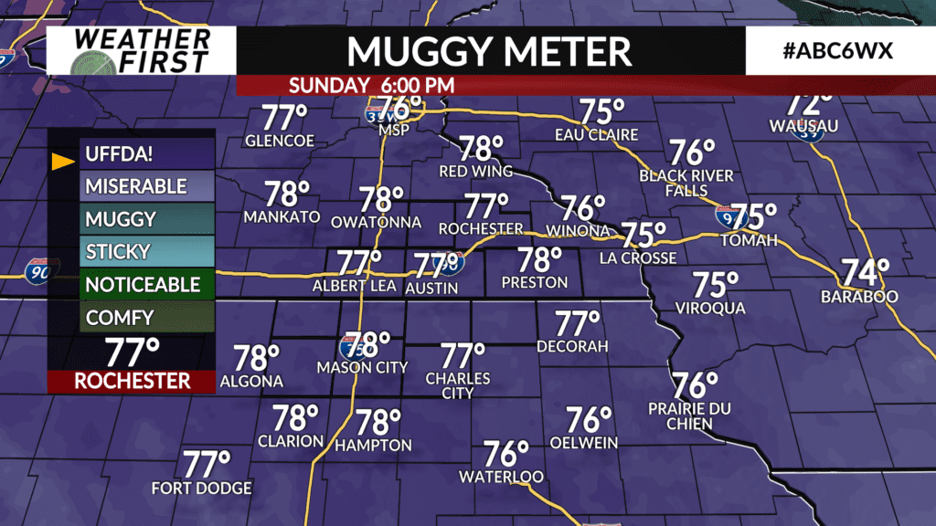
Tomorrow will be a thick one out there. Temperatures are forecast to reach into the upper 80F’s across our area, with dew points in the mid to upper 70F’s. This will push our feels like temperatures and/or heat index temperatures into the mid 90F’s.
Monday is going to be even more tropical and warm, with highs around 90F, and dew points in the upper 70F’s! This will push our feels like temperatures well above 100F Monday afternoon. Skies are expected to remain relatively sunny throughout the day, so being in the sun is only going to add to the oppressive feel.
A cold front tracks through Monday night, lowering our high temperatures a little on Tuesday. Highs are still expected to be in the mid 80F’s for most of the viewing area, with dew points around 70F. Heat index values will once again approach 90F.
Wednesday we cool down a bit more, with highs around 80F across the area, but those dew points will still be in the mid to upper 60F’s at the very least. With that said, heat index values may still be flirting with 90F.
Thursday’ temperatures will once again top off around 80F, with dew points in the upper 60F’s to around 70F before a cold front tracks across Minnesota Thursday afternoon and evening. Cooler, Canadian air rushes in behind the front just in time for the beginning of meteorological fall next weekend.